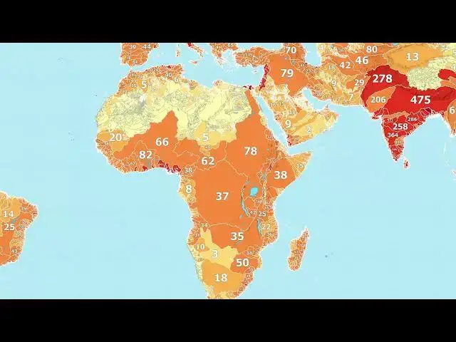

River Basins Reimagined: A Global Population Density Map
Feb 28, 2025

Explore a fascinating new perspective on global population distribution with this animated map! Using data from hydrosheds.org, we've visualized the world's major river basins based on their population density.
This revealing animation showcases:
- Which river basins have the highest concentration of people
- How population density varies across different watersheds globally
- The intricate relationship between water resources and human settlement patterns
From the densely packed river basins of Southeast Asia to the sparsely populated watersheds of the Arctic, this map offers a unique lens on global demographics and our connection to water resources.
For an in-depth analysis and additional insights, check out our detailed blog post:
https://vividmaps.com/river-basins-as-countries/
Interested in exploring more world maps? Check out these options on Amazon:
(Note: The following are affiliate links to Amazon)
National Geographic World Executive Map: https://amzn.to/4f69h3s
Antique World Map Poster: https://amzn.to/4f7Jsjr
Scratch-Off World Travel Map: https://amzn.to/48c0sTw
Don't forget to like, subscribe, and share your thoughts in the comments!
#RiverBasins #PopulationDensity #rivers #maps #geography
Show More Show Less