Best Geography, Map, and Travel Adult Coloring Books
Coloring isn’t just for youngsters. Some say adult coloring books help them not only encourage creativity but calm anxiety, and specialists admit there’s lots of evidence to support that opinion. Below is a list of the best geography and travel coloring books designed for adults.
The Natural Atlas: A Worldwide Adult Coloring Book
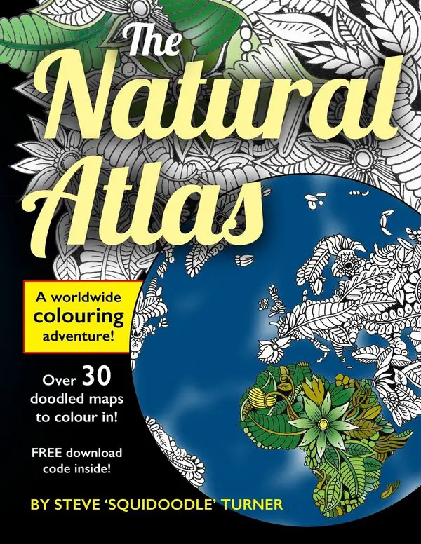
Color your way to rest and explore the world from the comfort of your apartment with The Natural Atlas. The single-sided printed atlas contains over 30 images to color.
The Natural Atlas is a high-quality coloring book consisting of 25 various country maps, 6 continents, 2 bonus pictures, and more. Every country’s pages also have its national flag and a compass. Try to find the national flower of every nation!
Moreover, you can download details for the world map illustration inside the book.
Pages: 78
Publisher: Steve Turner
List price: $8.99
Buy: Click To Buy On Amazon
Around the World Coloring Book

Ideal for apartment or classroom use, this entertaining and informative coloring book encourages youngsters to identify and find Argentina, France, India, Mexico, Nigeria, Saudi Arabia, Spain, and 23 other nations.
Each nation’s map includes names of significant cities and is followed by ready-to-color images of each country’s national flag, unique landmarks, and natural resources.
Fascinating facts and statistics highlight the unusual peculiarities of each nation.
Pages: 32
Publisher: Dover Publications
List price: $3.99
Buy: Click To Buy On Amazon
Travel Between the Lines Adult Coloring Book: Inspirational Coloring for Daydreamers and Globetrotters

The coloring book includes the line drawing illustrations from 29 countries. Each picture is unusual, with topics as varied as the nations: aerial, wide-angle images from Spain and Portugal; street views from Columbia and Bolivia; up-close vignettes from China, beautiful features of Versailles and famous landmarks, e.g., Berlin’s Brandenburg Gate.
The pictures are mixed level, suggesting easy, mediocre, and exciting images to color while daydreaming about far-off destinations.
Each image is paired with a short story or information, equating the photos to a memory or feeling from Geoff and Katie’s journeys and encouraging you to travel between the lines.
Pages: 108
Publisher: Wandertooth Media
List price: $10.95
Buy: Click To Buy On Amazon
Rand McNally Beautiful Cities Adult Coloring Book

Rand McNally’s travel specialists picked more than sixty of the world’s largest metropolises from Buenos Aires to Marrakech to highlight the Beautiful Cities collection.
The sophisticated, ready-to-color illustrations include:
- Lively street views.
- Capricious maps.
- Culture-inspired patterns.
- Architectural icons that will sustain reflective coloring on an artistic journey worldwide.
High-quality Rand McNally’s coloring is an excellent method to unleash creativity, decrease stress, and escape from the digital world.
Pages: 80
Publisher: Rand McNally
List price: $11.99
Buy: Click To Buy On Amazon
Geography Coloring Book

This unique, informative tool offers learners to the world’s countries and the United States’ states. Through lively participation, and coloring of the maps, users deeply comprehend the material and preserve that understanding.
Every part starts with a plate containing physical, political, and regional maps. World Thematic Maps consist of 11 global maps including climate, temperatures, precipitations, vegetation, populations, languages and racial distribution, land use, prevalent winds, and ocean currents.
According to continents, flags, and Review of Nations groups flags of the world, with the illustration of the flag placed close to the country of origin.
It is the choicest present for children of all ages and their parents who could benefit from a vivid “crash course” in geography and a delightful and educational guide to a more comprehensive comprehension of the world around them.
Pages: 208
Publisher: Pearson
List price: $19.20
Buy: Click To Buy On Amazon
City Maps: A coloring book for adults

Did you ever want to try coloring your own map? Nowadays, you can! With over forty bird’s-eye view maps to color from all the most significant urban areas in the world, you will get lots of cartographic training. These unique city maps highlight actual houses and road networks at scale. Close-up places such as Central Park in New York City, the Arc de Triomphe in Paris, the Lotus Temple in New Delhi, and the Grand Canal in Venice are included.
The coloring book comprises 94 pages with 44 maps, many with high levels of complexity.
Pages: 94
Publisher: PetersonGIS
List price: $9.49
Buy: Click To Buy On Amazon
Fantastic Cities: A Coloring Book of Amazing Places Real and Imagined

This unique coloring book highlights immersive aerial scenes of existing global cities besides the aesthetic illustrated. Artist Steve McDonald’s gorgeously rendered and precise linework gives bird’s-eye perspectives of visually capturing worldwide vicinities from New York City to London, Paris to Tokyo, and many more. The adult coloring book’s unusual large square format gives absorbingly complex sights to color. The crisp white pages are conducive to a range of creative applications, and a middle border keeps all the artwork entirely colorable.
Pages: 60
Publisher: Chronicle Books
List price: $10.39
Buy: Click To Buy On Amazon
Splendid Cities: Color Your Way to Calm

A coloring book that will relax and encourage you – all the while moving you to the world’s most fascinating cities.
Some real, others imagined, the marvelous cities in the world come alive under your hand. Open this coloring book and let yourself be drawn into a world journey dotted with floating kingdoms in the sky and mysterious cities and taking you from Moscow’s domes to the Eiffel Tower’s tip.
So take your time, relax, and let your imagination run free! Get out your markers or pens and discover the calming pleasure of coloring.
Pages: 96
Publisher: Little Brown
List price: $15.74
Buy: Click To Buy On Amazon
Adult Coloring Book: Around The World In 50 Pages

Journey with every stroke of your colored pencil or pen to these outstanding locations: Greece, London, Paris, Russia, Italy, and Russia. Color representative cityscapes such as New York Times Square, The Las Vegas Strip, Venice Canals, The Golden Gate, and Hong Kong Harbor.
As you’re coloring in every landmark, take notes of all the specific features the artist made sure to take, particularly in buildings like the Chrysler building in New York City, Saint Basil’s Cathedral in Moscow, London Bridge, and the Eiffel Tower, the Taj Mahal in the Indian city of Agra.
Once you finish a favorite coloring page, you can effortlessly tear out the page to frame, craft, or present to an admired one.
Pages: 54
Publisher: ColorIt
List price: $21.99
Buy: Click To Buy On Amazon
Adult Coloring Books: Topography Coloring for Grownups

Dive into your passion for topography with this incredible, stress-relieving coloring book! If you want to arrange an area’s natural and artificial physical peculiarities, you have chosen the right coloring book.
This book is stuffed with over twenty utterly lined designs varying from simple to complex.
Take a glass of wine and fellow fan of surface design and enjoy this topography coloring book!
Pages: 46
Publisher: CreateSpace Independent Publishing Platform
List price: $3.99
Buy: Click To Buy On Amazon
History: A Map Coloring Book

Youngsters can color their way through time with this new History of the World coloring book. These colorful and splendid maps feature everything from legendary battles to incredible inventions and unique architecture to world leaders.
Youngsters can color in the pictures and learn as they go from the bite-size historical facts following each image.
The last page of the book highlights a timeline of some of the critical bits of history.
Pages: 48
Publisher: Buster Books
List price: $29.83
Buy: Click To Buy On Amazon
World Regional Maps Coloring Book

This Coloring Book with blank outline maps is excellent for studying world regional geography, coloring, and education.
Every printable, outline, and a continent map is exhibited with a detailed version with state boundaries, country names, capitals, and major cities.
Learners can trace the map’s outlines, and study and highlight continents and features on the blank map.
Pages: 90
Publisher: CreateSpace Independent Publishing Platform
List price: $9.91
Buy: Click To Buy On Amazon
USA States Of America Amazing Coloring Book: histories and mains facts

This coloring book will find fascinating maps of all 50 U.S. states and the U.S. state symbols. The name of every U.S. state is in a large font size to be traced and colored. The maps of the U.S. states are set in alphabetic order to make it more comfortable to learn and remember. The U.S. Coloring Activity Book is an excellent present for any student or classroom education about the U.S. and fascinating data about every particular state. Get a copy for yourself, your family, or your student! It can be used as a teaching and training tool for all 50 United States. It is created to be an entertaining, educative activity book to encourage youngsters to understand the 50 United States of America.
Pages: 51
Publisher: Independently published
List price: $4.99
Buy: Click To Buy On Amazon
European Country Maps Coloring Book

The coloring atlas includes the United Kingdom, France, Italy, Sweden, Germany, Spain, and 45 more. Discover and color blank, outline, and comprehensive maps of Europe.
The blank outline maps are excellent for learning the geography and layout of every nation. Every country map is shown in two ways, a map of their administrative divisions or political boundaries, including capitals and many cities. Plus, a blank outline map of every nation. Many maps incorporate the neighboring boundary nations.
Ideal for coloring and learning. Students can trace the map’s outlines, and study and highlight nations and features on the blank maps. The coloring atlas can be photocopied for sharing with your family or students.
Pages: 105
Publisher: Independently published
List price: $9.95
Buy: Click To Buy On Amazon
The Great British Coloring Map: A Coloring Journey Around Britain

Color your way throughout Great Britain with this complete book in partnership with Ordnance Survey. Based on the Ordnance Survey’s detailed maps, the coloring pages investigate the towns, forests, coasts, and countryside of England, Scotland, and Wales.
The coloring atlas includes comprehensive maps of cities and other places of interest, such as Britain’s most recognizable traveler and historical sites, plus London’s striking gatefold.
Pages: 94
Publisher: PetersonGIS
List price: $24.95
Buy: Click To Buy On Amazon
World Map Coloring Book: Maps of the World Continents featuring Country Border, Capitals, Population figures, and Empty Maps

Learn while coloring blank, outlined maps of the globe and its continents. This coloring book includes blank outline continental maps with national borders, which are perfect for learning world geography. Each blank, outline, and printable continental map also arrives with a version depicting country and capital names, locations, and state capital names (for the United States and Australia).
For testing purposes, there is also a blank version and a version with only capitals. Large 8.5 x 11-inch paper allows you to add your details and drawings.
All maps within this book can be photocopied and used for educational purposes.
Pages: 102
Publisher: Independently published
List price: $8.99
Buy: Click To Buy On Amazon