Maps of the United States
The United States is a big country. At 9.8 million km² (3.8 million sq mi) it’s the world’s third or fourth largest depending on how you measure it, and it crosses six time zones. The territory took the better part of two centuries to fill out, starting from 13 colonies along the East Coast and eventually adding Alaska in 1867 and Hawaii in 1959. The maps below are some of the best currently available.
Table of Contents
U.S. Map Posters
Laminated World Map & US Map Poster Set (18″ x 29″) by Palace Learning
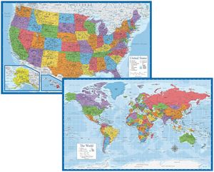
Two laminated posters in one package, a world map and a US map, each 18″ x 29″ (46 cm x 74 cm), made in the United States with 3 MIL double-sided lamination and waterproof sealed edges. Available in several color options including standard, green, light blue, black, and yellow.
Review: 4.8/5 (10,119 ratings)
Sheet Size: 18″ x 29″ (46 cm x 74 cm)
List Price: $12.97
Buy on Amazon
Laminated World Map & US Map Poster Pack (17″ x 22″) by Maps International
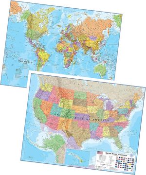
Every state and country is in a distinct color, with hill shading and time zones. The Maps International posters are 17″ x 22″ (43 cm x 56 cm) with write-on wipe-clean lamination. A dry-erase marker writes on them and wipes off cleanly. Ships in a tube.
Review: 4.8/5 (7,261 ratings)
Sheet Size: 17″ x 22″ (43 cm x 56 cm)
List Price: $19.99
Buy on Amazon
Momo & Nashi United States Map For Kids & World Maps For Kids 2pc Set (24″ x 16″)
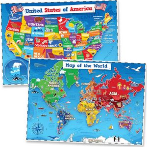
Waterproof plastic rather than paper, 24″ x 16″ (61 cm x 41 cm), illustrated with regional icons and landmarks for kids aged 4 to 8. No separate lamination needed. Dry-erase markers work on the surface.
Review: 4.8/5 (4,625 ratings)
Sheet Size: 24″ x 16″ (61 cm x 41 cm)
List Price: $12.72
Buy on Amazon
Maps International Classic USA Wall Map
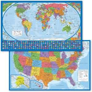
Most world maps use the Mercator projection, which shows Greenland as nearly the size of Africa. It isn’t, by a factor of about 14. This set uses the Equal Earth projection instead, developed by Bojan Šavrič, Tom Patterson, and Bernhard Jenny. Both posters are 18″ x 29″ (46 cm x 74 cm) with 3 MIL lamination.
Review: 4.8/5 (2,761 ratings)
Sheet Size: 18″ x 29″ (46 cm x 74 cm)
List Price: $9.97
Buy on Amazon
USA Map for Kids, LAMINATED, United States Wall Chart Map (18″ x 24″) by Palace Learning
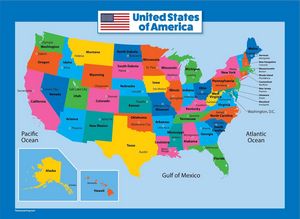
Laminated political map of the US, 18″ x 24″ (46 cm x 61 cm). Clear, large-font labeling for states and capitals. Fits a standard frame.
Review: 4.8/5 (1,845 ratings)
Sheet Size: 18″ x 24″ (46 cm x 61 cm)
List Price: $9.97
Buy on Amazon
United States Travel Maps and Atlases
National Parks Map Poster with USA Travel Destinations, Brown Edition by GeoJango
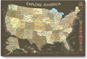
Made to order in Pleasanton, California by professional geographers, this covers all 63 national parks alongside over 700 National Park Service sites in total, including NASA Space Centers, state capitals, historic cities like Colonial Williamsburg, Mackinac Island, Tombstone, and Mount Vernon, the tallest peak in every state, US Interstates, and Route 66. Available in 24″ x 16″ (61 cm x 41 cm), 30″ x 20″ (76 cm x 51 cm), or 36″ x 24″ (91 cm x 61 cm).
Review: 4.7/5 (466 ratings)
Sheet Size: 30″ x 20″ (76 cm x 51 cm)
List Price: $47.00
Buy on Amazon
National Geographic Road Atlas 2027: Adventure Edition
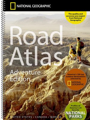
The number-one selling road atlas in the US. Road maps for all 50 states, Canada, Mexico, and Puerto Rico, with inset maps of major cities and metro areas. The Adventure Edition layer adds guidebook picks for 100 adventure destinations and dedicated sections on the 24 most-visited national parks. Tourism office contacts and a place-name index in the back. Spiral-bound with a tear-resistant Travel Tough cover.
Review: 4.7/5 (16,937 ratings)
Folded Size: 11″ x 15″ (28 cm x 38 cm)
List Price: $23.71
Buy on Amazon
Rand McNally 2027 Road Atlas
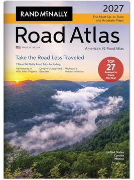
The only major road atlas that updates annually. The 2027 edition has 378 city inset maps on clean white backgrounds. The editorial section this year covers the FIFA World Cup across US host cities and the America250 celebrations marking 250 years of American independence. Made in the US.
Review: 4.7/5 (50 ratings)
Dimensions: 10 7/8″ x 15 3/8″ (27.6 cm x 39 cm)
List Price: $24.99
Buy on Amazon
National Geographic Complete National Parks of the United States, 3rd Edition
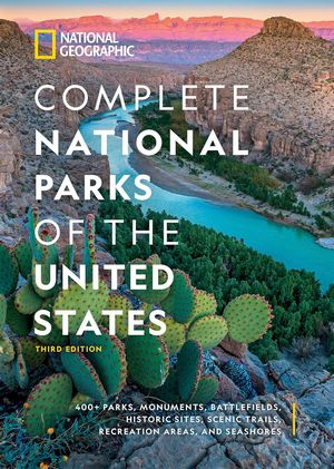
A 544-page reference covering more than 400 National Park Service properties, from parks and battlefields to seashores and scenic trails. Full-color photography, detailed maps, historical background, best-time-to-visit guidance, and top activities are included for each property.
Review: 4.7/5 (1,343 ratings)
Format: Hardcover, 544 pages
List Price: $22.00
Buy on Amazon
USA National Parks: Lands of Wonder by DK Travel
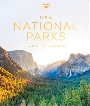
DK organized this one by year of designation, not geography, so it runs chronologically from Yellowstone in 1872 to New River Gorge in West Virginia in 2020. All 63 parks, each covered with maps, facts, activity ideas, photography, and ecology notes.
Review: 4.7/5 (1,115 ratings)
Format: Hardcover
List Price: $22.75
Buy on Amazon
US Scratch-Off Travel Maps
Metallic foil covers each state and national park on these maps. Scratch it off as you visit them. Most kits include both a US states map and a national parks poster.
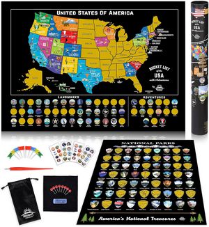
Scratch Off Map of United States + All 63 US National Parks (charcoal/silver) by Bright Standards
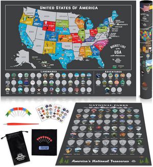
Charcoal and silver foil on 250gsm black paper. Includes a 17″ x 24″ (43 cm x 61 cm) US map covering 85 landmarks and all 63 national parks, a 12″ x 16″ (30 cm x 41 cm) national parks poster, flags, map pins, adventure stickers, scratch pen, cloth, and a storage pouch.
Review: 4.8/5 (138 ratings)
Sheet Size: 17″ x 24″ (43 cm x 61 cm) + 12″ x 16″ (30 cm x 41 cm)
List Price: $21.97
Buy on Amazon
Wooden National Park Map with Push Pin Travel Tracker (11″ x 19″) by LIVIN HARMONY
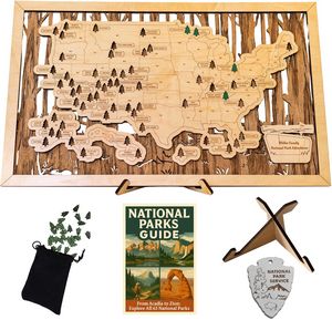
Solid wood, laser-engraved and assembled in an American workshop. Each of the 63 national parks is precision-cut into the board with its name and boundary. The push pins that mark your visits are shaped like trees. Comes ready to hang with pre-installed wall hardware, plus a tabletop stand for shelf display.
Review: 4.8/5 (137 ratings)
Sheet Size: 11″ x 19″ (28 cm x 48 cm)
List Price: $74.95
Buy on Amazon
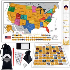
Scratch Off Map of USA + 63 National Parks Bundle (24″ x 17″, black/gold) by Bright Standards
Black and gold foil on a 24″ x 17″ (61 cm x 43 cm) landscape-format US map, plus a 12″ x 16″ (30 cm x 41 cm) national parks poster. Both sizes fit common frames. Comes in a gift tube with scratch pen and cloth.
Review: 4.7/5 (2,690 ratings)
Sheet Size: 24″ x 17″ (61 cm x 43 cm) + 12″ x 16″ (30 cm x 41 cm)
List Price: $21.97
Buy on Amazon
Large Scratch Off USA Map with All 63 National Parks, 50 Landmarks & State Flags (24″ x 17″) by TRIPA TRIPS
A 24″ x 17″ (61 cm x 43 cm) US map on premium glossy paper with 50 scratchable state flags, all 63 national parks, and 50 landmarks. The kit comes with two scratchers, a magnifier, a wiping cloth, 54 adventure stickers, and a storage pouch.
Review: 4.7/5 (1,130 ratings)
Sheet Size: 24″ x 17″ (61 cm x 43 cm)
List Price: $18.97
Buy on Amazon
Maps of the 50 US States
More detailed maps of each US state are available on Amazon by clicking on any state on the interactive map below.