The Best World Atlases in 2026
Yes, I know – your phone has Google Maps. And it’s probably faster than grabbing a book off the shelf. But physical atlases keep selling for a good reason.
When I’m working on ecological projects or making maps for my blog, I use digital tools constantly. They’re essential. But I still own several atlases, and I use them regularly. An atlas lets me see an entire region spread across two pages. I can mark things up, add notes, compare different areas side by side. Try doing that on a phone without losing your mind zooming in and out.
This year has some genuinely good new releases. Oxford just published their annual update with 2025 data. Several specialized atlases came out covering topics I didn’t know needed atlases (but they did). And the classics keep getting better with each edition. After comparing dozens of current titles, here’s what’s actually good.
General-Reference Atlases
If you’re going to own one atlas, it should probably be from this category.
Oxford Atlas of the World (32nd Edition)

Oxford updates this atlas every single year, which means it has the most current political boundaries, recent city growth, and up-to-date statistics available. The 32nd edition just came out in 2025, so everything reflects changes through this year.
The atlas opens with world statistics, then moves into a Gazetteer of Nations covering every country’s geography, politics, economy, and recent history. There’s a solid thematic section on climate change, migration, inequality, biodiversity, and global health – all topics where the data changes significantly year to year.
The maps themselves use clear scales and careful cartography. For researchers, educators, or anyone who needs accuracy, this is the one to get.
Review: 5/5
Publisher: Oxford University Press
Publication date: October 1, 2025
List Price: $67.84
Buy: Click To Buy On Amazon
National Geographic Atlas of the World (11th Edition)
National Geographic’s flagship atlas runs over 500 maps covering natural resources, economic trends, physical geography, and political boundaries. The 11th edition includes updated data on climate change and urbanization effects.
What sets this apart is the thematic sections at the beginning – twenty spreads covering tectonics, climate, world economy, and energy sources. There’s also an entire section on space with star charts, Moon and Mars maps, and visualizations of human space exploration.
It comes in a protective slipcase and uses high-quality paper and printing. This is the atlas you keep on a shelf and pull out when you want to really study something.
Review: 4.8/5
Publisher: National Geographic
Publication date: October 1, 2019
Edition: 11th
List Price: $154.82
Buy: Click To Buy On Amazon
National Geographic Family Reference Atlas (5th Edition)

If the flagship atlas above feels like too much, this family edition covers the same ground with about 650 photographs, maps, and graphics. Every country gets its own detailed map with context, flag, statistics, and environmental/population data.
The 5th edition works well for families because it balances accessibility with depth. Kids can understand it, but there’s enough information that adults won’t feel like they’re reading a children’s book. Special sections cover the ocean, solar system, and universe, plus contemporary topics like climate change, human migration, and digital connectivity.
Review: 4.7/5
Publication date: October 6, 2020
Edition: 5th
List Price: $60.58
Buy: Click To Buy On Amazon
Collins World Atlas (Complete Edition)

Fresh for 2026, this atlas reflects very recent changes including Kazakhstan’s capital city change, new flags for Kyrgyzstan and Honduras, and Croatia’s switch to the Euro. The Complete Edition lives up to its name with detailed regional and worldwide mapping.
It covers population, climate, natural disasters, and environmental issues with current data. Thousands of facts and statistics include continental and world ranking tables for context. At under $40, it’s well-priced for what you get.
Review: 4.7/5
Publisher: Collins Maps
Publication date: April 15, 2025
Edition: Complete Edition
List Price: $39.52
Buy: Click To Buy On Amazon
The Atlas of Microstates
I’m including this here because it’s genuinely interesting and just came out in March 2025. Microstates – sovereign countries with very small populations or land areas – make for better reading than you’d expect.
The atlas looks at places like Liechtenstein (entirely in the Alps, one of the world’s wealthiest countries per capita), the Cocos (Keeling) Islands (14 square kilometers, under 600 people), and historical oddities like Couto Misto, which had semi-independent status until Spain and Portugal partitioned it in 1864.
Beyond just describing these places, it examines questions about sovereignty, what makes microstates succeed or fail, and how size relates to political independence.
Review: 4.7/5
Publisher: Collins
Publication date: March 25, 2025
Edition: 1st
List Price: $25.49
Buy: Click To Buy On Amazon
Atlases of World History
History makes more sense when you can see it spatially.
Great Maps: The World’s Masterpieces Explored and Explained
This atlas takes a different approach – instead of mapping a topic, it’s about maps themselves. Fifty-five historical maps from Ptolemy’s world map through Hereford’s Mappa Mundi to Google Earth get analyzed in detail.
Each map comes with graphic close-ups showing details and profiles of the cartographers who made them. You learn why each map was commissioned, who it was for, and how it influenced navigation, propaganda, power, art, and politics.
Review: 4.8/5
Publisher: Firefly Books
Publication date: October 23, 2014
List Price: $29.48
Buy: Click To Buy On Amazon
History of the World Map by Map

This one works differently than most historical atlases. Instead of organizing everything chronologically with dense paragraphs, it uses 140+ maps as the main narrative device. You can follow early human migration out of Africa, see exactly how the Mongol Conquests spread across Asia, or understand why European colonial powers carved up Africa the way they did.
The second edition added sections on globalization and technology’s effects on human geography. Each map comes with timelines and info boxes that explain what was happening and why it mattered. It’s substantial without being overwhelming.
Review: 4.8/5
Publisher: DK
Publication date: September 5, 2023
Edition: 2nd
List Price: $39.63
Buy: Click To Buy On Amazon
World War I: The Definitive Visual History

Updated for 2024, this atlas covers WWI from Archduke Franz Ferdinand’s assassination through the Treaty of Versailles. Maps show major battles like the Somme with detailed descriptions and period photographs.
Eyewitness accounts add a personal element that makes the historical events feel more immediate. The visual approach works well for understanding how the war developed geographically.
Review: 4.8/5
Publisher: DK
Publication date: May 21, 2024
List Price: $29.65
Buy: Click To Buy On Amazon
World War II Map by Map
Maps created specifically for this atlas show WWII from the Axis powers’ rise through the atomic bombings. Each map includes enough detail to understand troop movements, supply lines, and strategic decisions on land, sea, and air.
The atlas includes archival maps from both Allied and Axis countries, which gives you different perspectives on the same events. Timelines provide context, and photographs highlight specific aspects like the Holocaust, Blitzkrieg tactics, and code-breaking operations. A team of historians led by Richard Overy put this together.
Review: 4.8/5
Publisher: DK
Publication date: September 3, 2019
List Price: $30.06
Buy: Click To Buy On Amazon
Atlas of World War II

National Geographic’s atlas combines vintage maps, newly created maps, rare photographs, and declassified documents. Rare maps include detailed Germany & Approaches maps Allied forces used, full-scale wartime world maps from President Roosevelt’s office, and Pacific theater maps B-17 pilots carried.
Satellite data shows terrain at a level of detail that wasn’t possible when these battles were fought. You can see the actual geography that shaped military decisions.
Review: 4.7/5
Publisher: National Geographic
Publication date: October 30, 2018
Edition: 3rd
List Price: $41.10
Buy: Click To Buy On Amazon
Travel Atlases
For planning trips or just daydreaming about where you’d like to go.

National Geographic Atlas of the National Parks
All 61 U.S. national parks get covered here with detailed maps, photographs, and historical context. Former ranger Jonathan Waterman wrote this, so the information on each park’s unique features – wildlife, natural landmarks, local history – comes from someone who actually worked in the parks.
Maps blend satellite imagery with clear cartographic details. You get both the big-picture context of where each park sits geographically and detailed enough maps to actually understand the park’s layout.
Review: 4.8/5
Publisher: National Geographic
Publication date: November 19, 2019
List Price: $37.16
Buy: Click To Buy On Amazon

Atlas Obscura (2nd Edition)
The second edition covers over 700 unusual locations worldwide – glowworm caves in New Zealand, a South African baobab tree so large it has a pub inside, M.C. Escher-inspired stepwells in India, Spain’s Baby-Jumping Festival.
Each entry includes maps and travel information. This isn’t a conventional travel atlas but rather a collection of places you probably wouldn’t find otherwise. The book works well for finding unexpected destinations.
Review: 4.8/5
Publication date: October 15, 2019
Edition: Second
List Price: $21.37
Buy: Click To Buy On Amazon
Atlas of Record-Breaking Adventures
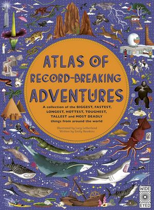
This atlas maps geographical extremes – tallest mountains, deepest oceans, largest caves, hottest places. Published in 2020 with detailed illustrations showing these record-breaking locations in context.
Good for kids and adults who like geographical trivia. The visual approach makes it easy to understand why these places are extreme.
Review: 4.8/5
Publisher: Wide Eyed Editions
Publication date: October 6, 2020
Edition: 1st
List Price: $25.08
Buy: Click To Buy On Amazon
Food and Drink Atlases
Geography and cuisine connect in ways people don’t always consider.
The World Atlas of Honey

C. Marina Marchese founded the American Honey Tasting Society and knows honey better than just about anyone. This atlas covers 80+ countries and their botanical nectar sources – showing how honey’s flavor comes from the specific plants bees visit in each region.
It traces honey production from ancient beekeeping to modern methods and includes the tasting and evaluation methods honey sommeliers use. Terroir affects honey the same way it affects wine or coffee.
Review: 4.9/5
Publisher: University of California Press
Publication Date: October 15, 2024
Edition: 1st
List Price: $21.38
Buy: Click To Buy On Amazon
The World Atlas of Wine (8th Edition)

Jancis Robinson and Hugh Johnson’s wine atlas has been the standard reference since 1971. The 8th edition runs 416 pages with 230 maps, including 22 new ones covering places like St. Helena in Napa Valley, Uruguay, and Lebanon.
Beyond just mapping wine regions, it addresses climate change impacts on viticulture and sustainability practices. Soil maps for Beaujolais and Marlborough show how geology affects wine character. The book works for both beginners trying to understand wine regions and professionals wanting detailed reference material.
Review: 4.9/5
Publisher: Mitchell Beazley
Publication date: October 1, 2019
Edition: 8th
List Price: $38.65
Buy: Click To Buy On Amazon
The World Atlas of Coffee (3rd Edition)

James Hoffmann (2007 World Barista Champion) completely updated this atlas for the 3rd edition released in November 2025. New chapters cover decaffeination and steep-and-release brewing methods. Additional origin countries include Australia, Japan, and Puerto Rico.
The atlas explains coffee from the ground up – why Chinese soil produces different coffee than Indian soil, how elevation and climate affect flavor, different processing methods, and roasting approaches. Country-by-country profiles identify what makes each region’s coffee distinctive.
Review: 4.8/5
Publisher: Mitchell Beazley
Publication date: November 4, 2025
Edition: 3rd
List Price: $30.87
Buy: Click To Buy On Amazon
The World Atlas of Whisky (3rd Edition)

Dave Broom profiles over 500 distilleries across Scotland, Japan, India, Taiwan, and other regions. The 3rd edition introduces Flavour Camp Charts that separate whiskies by flavor characteristics – fruity, smoky, etc.
Detailed distillery maps, tasting notes for limited malts like Karuizawa from Japan, and profiles of emerging craft producers in Australia and Germany. The atlas includes information on sustainable practices in Scotch production.
Review: 4.7/5
Publisher: Dave Broom
Publication date: November 26, 2024
Edition: 3rd
List Price: $33.54
Buy: Click To Buy On Amazon
National Geographic Atlas of Beer

Beer-geographers Nancy Hoalst-Pullen and Mark Patterson map breweries worldwide with over 200 color photos and 100+ maps. Tips for ordering beer in 14 languages, profiles of breweries in Poland and Iceland, and coverage of trends like kombucha-beer hybrids.
Review: 4.7/5
Publisher: National Geographic
Publication date: September 19, 2017
Edition: 1st
List Price: $47.09
Buy: Click To Buy On Amazon
The World Atlas of Tea

Just released in March 2025, this atlas charts tea-producing nations from China’s Yunnan Province to Kenya’s Nandi Hills. Maps show how terroir impacts teas like Darjeeling and Pu-erh.
Brewing guides for matcha and herbal infusions, information on Sri Lankan and Japanese sustainability practices, and the cultural history of tea across civilizations. Maps show production seasons and local specialties. Profiles of organic estates highlight ethical production.
Review: 4.6/5
Publisher: Firefly Books
Publication Date: March 4, 2025
Edition: 1st
List Price: $22.60
Buy: Click To Buy On Amazon
Nature Atlases
For anyone interested in the natural world and animals.
Lonely Planet Kids Atlas of Dogs

Continent maps show where 150 dog breeds originated. Each breed gets a profile with size, coat, and personality information. You learn about breeds like the Greenland Dog (bred for sledding in Arctic conditions) and the Basenji from Africa (which yodels instead of barking).
Good for dog-loving kids and adults who want to understand breed origins and characteristics.
Review: 4.8/5
Publisher: Lonely Planet
Publication date: October 18, 2022
Edition: 1st
List Price: $14.99
Buy: Click To Buy On Amazon
Lonely Planet Kids Atlas of Horses and Ponies
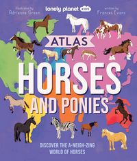
Released in October 2025, this atlas covers over 100 horse and pony breeds from South America’s Peruvian Paso to Asia’s Orlov Trotter to Europe’s Swedish Warmblood.
Themed sections cover horse senses, care, foals, donkeys and mules, working horses, mythical horses, horse sports, wild horses, war horses, and record-breaking horses. Each breed profile includes origin, physical characteristics, and personality information.
Review: 4.7/5
Publisher: Lonely Planet
Publication date: October 21, 2025
Edition: 1st
List Price: $18.75
Buy: Click To Buy On Amazon
Lonely Planet Kids Atlas of Cats

One hundred cat breeds from around the world including domestic breeds like the Ragamuffin and Sphynx plus wild cats. Continent maps show origins, profiles give personality traits and unique adaptations.
Special sections on courageous cats, cat shows, kittens, cats in ancient Egypt, oriental cats, natural instincts, wild cats, cat culture, and record-breaking cats.
Review: 4.7/5
Publisher: Lonely Planet
Publication date: August 6, 2024
Edition: 1st
List Price: $18.75
Buy: Click To Buy On Amazon
The Animal Atlas
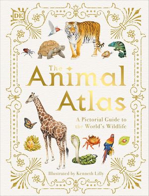
Animals from every continent with maps showing species distribution. Covers mammals, birds, reptiles, amphibians, and insects. The 2020 edition includes updated data on animal populations and habitats.
Hand-drawn illustrations show details of fur, feathers, and scales. Conservation information explains threats to different species.
Review: 4.7/5
Publisher: DK
Publication date: May 19, 2020
Edition: 1st
List Price: $16.12
Buy: Click To Buy On Amazon
Children’s Atlases
For getting kids interested in geography.
Children’s Illustrated Atlas (Revised Edition)
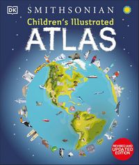
Over 50 maps designed for ages 7-9, each with country information, cultural details, and wildlife. The atlas teaches map-reading skills – how to use a key, compass, and scale. Includes a world map poster and political maps for each continent.
Review: 4.8/5
Publisher: DK Children
Publication date: April 18, 2023
Edition: 2nd
List Price: $18.15
Buy: Click To Buy On Amazon
My First Big World Atlas

Lap-sized board book for young children teaching basics like the 5 oceans and largest continents. Seek and Find activities on each page keep young kids engaged. Good for introducing geographic concepts to toddlers and preschoolers.
Review: 4.8/5
Publisher: Little Hippo Books
Publication Date: August 24, 2020
Edition: 1st
List Price: $12.99
Buy: Click To Buy On Amazon
The Atlas Obscura Explorer’s Guide for the World’s Most Adventurous Kid

A New York Times bestseller covering 100 unusual places worldwide – Mexico’s Cave of Crystals, Vietnam’s largest cave, Zambia’s 355-foot waterfall, Antarctica’s Blood Falls. Written for ages 8-12.
Places connect in chains, encouraging kids to see geographic relationships. Illustrations by Joy Ang.
Review: 4.8/5
Publisher: Workman Publishing Company
Publication date: July 19, 2022
Edition: 1st
List Price: $20
Buy: Click To Buy On Amazon
Where on Earth?

More than 60 3D maps covering topics from the animal kingdom to earthquakes. The 2021 edition includes content on pandemics, climate change, the internet, world populations, poverty, and current technology. Ages 8-12.
Review: 4.7/5
Publisher: DK
Publication date: September 21, 2021
Edition: 1st
List Price: $12.68
Buy: Click To Buy On Amazon
National Geographic Student Atlas: 6th Edition

For middle and high school students. The 6th edition (2022) includes new thematic maps for every continent, updated infographics, and current statistics. Covers climate change, urbanization, biodiversity, and other contemporary topics. Works well for classroom use, homework, or college prep.
Review: 4.9/5
Publisher: National Geographic
Edition: 6th
Publication date: July 5, 2022
List Price: $18.59
Buy: Click To Buy On Amazon
National Geographic Kids Beginner’s World Atlas (5th Edition)
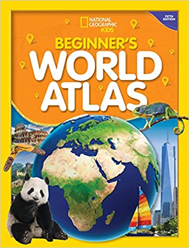
For ages 7-10. Large, colorful maps with updated facts about land, people, and animals. Teaches map reading with explanations of keys, glossary, and metric conversions. Good introduction to world geography for elementary school students.
Review: 5.0/5
Publisher: National Geographic
Edition: 5th
Publication date: July 5, 2022
List Price: $11.51
Buy: Click To Buy On Amazon
Space Atlases
For looking beyond Earth.
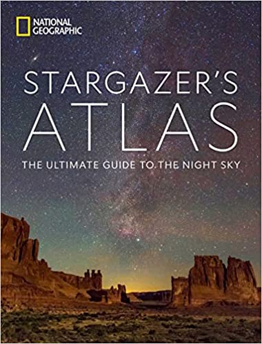
National Geographic Stargazer’s Atlas: The Ultimate Guide to the Night Sky
Over 350 photographs plus 200 maps and graphics covering astronomy and celestial observation. Eight sky maps show stars from Northern and Southern Hemispheres. Information on all 88 constellations including mythology, identification tips, and details on stars and galaxies within them.
Historic observatories and modern dark-sky preserves mapped worldwide. Detailed maps of all 8 planets, dwarf planets Ceres and Pluto, and 13 moons. Expert advice on locating stars and constellations.
Review: 4.8/5
Publisher: National Geographic
Publication date: October 25, 2022
Edition: 1st
List Price: $36.70
Buy: Click To Buy On Amazon
Space Atlas (Second Edition)

Updated maps, photographs, and illustrations charting the solar system and beyond. The second edition includes a special section by astronaut Buzz Aldrin on Earth’s moon and its role in space exploration.
Science writer James Trefil covers each planet, important moons, asteroids, and other solar system objects. Explanations of the Milky Way and other galaxies with clear descriptions of astrophysics basics including dark matter and gravitational waves.
Review: 4.8/5
Publisher: National Geographic
Publication date: October 23, 2018
Edition: 2nd
List Price: $42.14
Buy: Click To Buy On Amazon
Universe (Third Edition)
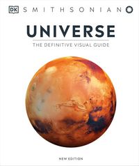
Covers stars, planets, black holes, nebulae, and other astronomical phenomena. Opens with astronomy history and fundamental concepts using 3D artworks. Tours the Solar System, Milky Way, and distant galaxies.
Comprehensive star atlas with entries on all 88 constellations and monthly sky guides showing night sky views throughout the year from both Northern and Southern Hemispheres.
Review: 4.8/5
Publisher: DK
Publication date: September 8, 2020
Edition: 3rd
List Price: $23.31
Buy: Click To Buy On Amazon
Which One Should You Get?
If you need a solid general reference, get the Oxford. They update it every year, so the borders and statistics stay current. It costs more than some others, but the annual updates justify the price if you actually use it. National Geographic’s flagship costs even more but covers more ground – 500+ maps including space, which Oxford doesn’t do as thoroughly.
Got kids? The National Geographic Family Reference Atlas works for everyone in the house without being too simple or too complex. For really young kids – like preschool through early elementary – start with My First Big World Atlas or the Beginner’s version. They’re designed for those ages.
The historical ones depend on what you’re interested in. I like World War II Map by Map because the maps actually explain why battles happened where they did. Same with History of the World Map by Map – you see migration patterns and territorial changes instead of just reading about them.
The specialized atlases surprised me most this year. The coffee one explains terroir as well as any wine book. The honey atlas taught me things I didn’t know about how location affects flavor. If you’re into any of these topics – wine, coffee, whisky, tea, honey – the atlases go deeper than you’d expect.
Whatever you buy, you’re getting something your phone won’t do – the ability to see big areas all at once and actually understand how places relate to each other spatially.
Also, check out: The Best World Map Posters