Collisions in New York City
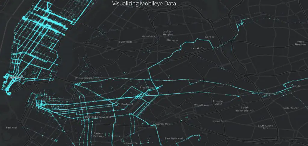
By combining best in class computer vision from Mobileye, with best in class analytics and mapping from Esri, cities are now able to see their hidden pedestrian risk areas and make their city safer for all.
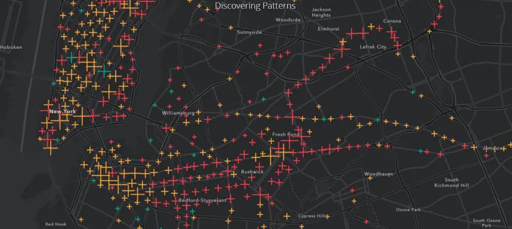
Collision warning location
The most common time of day that near-collisions occurred
Red – Most collisions in these areas occur in the morning where people are commuting to work from residential areas.
Yellow – The afternoon near-collisions tend to cluster around business districts.
Green – And there are very few evening clusters, yet they still represent hundreds of collision warnings.
Related post:
– New York City cycling incident map
… NYC maps

