Norway is a narrow country on the map, but it stretches much farther than most people imagine.
If you lay it across Europe, it reaches from Ireland almost all the way down to North Africa.
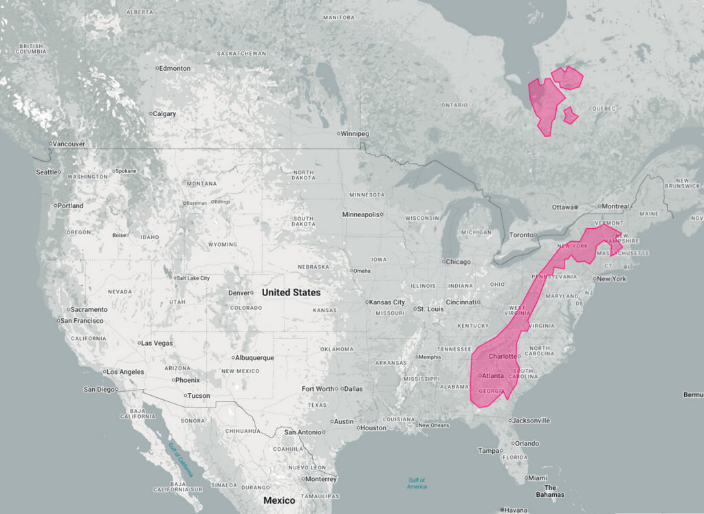
On the U.S. map, the same outline runs from Vermont to Georgia. That’s a serious distance.
Measured straight from Lindesnes in the south to Nordkapp in the north, the length is about 1,750 km (1,090 miles). Follow the roads and ferries, and it turns into roughly 2,300 km (1,430 miles). Driving it usually means close to 30 hours on the move.
Most people are settled in the south and around Oslo. The north has fewer towns and long empty stretches in between. Because of that, Norway relies on many regional airports – flying is often the only realistic way to cover the distance.
The climate also shifts a lot. In the south, winters are fairly mild thanks to Atlantic currents. Head north, and you’re inside the Arctic Circle, where the year brings long dark winters and bright summer nights. That range in daylight and weather makes building and maintaining roads, power lines, and other services more complicated.
Norway isn’t the only country with this shape. Chile runs even longer – more than 4,200 km (2,600 miles) along South America. Like Norway, it deals with the challenge of distance, climate contrasts, and the cost of linking far-apart regions.