The 1957 Times Atlas Map: A Strategic View of Cold War Alliances
This 1957 Times Atlas map centers on the Atlantic Ocean to highlight NATO countries, revealing Cold War alliances through unconventional projection and strategic coloring.
Read More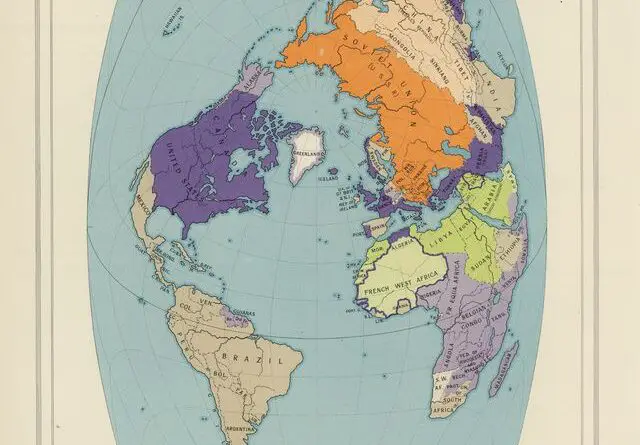
This 1957 Times Atlas map centers on the Atlantic Ocean to highlight NATO countries, revealing Cold War alliances through unconventional projection and strategic coloring.
Read More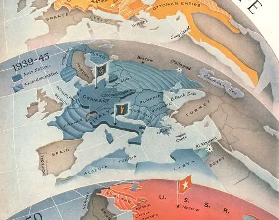
Discover how Europe’s power dynamics shifted through three major conflicts in this rare Time Magazine propaganda map series from WWI to the Cold War.
Read More
Soviet views of Europe and Asia, captured in maps from Moscow and Irkutsk, reveal Cold War strategies and ambitions. See the story behind these historic maps.
Read More
Did Stalin really plan to conquer the world? A 1952 magazine map claimed to reveal his Cold War strategy. Explore the history, the defector’s claims, and why the map still sparks debate today.
Read More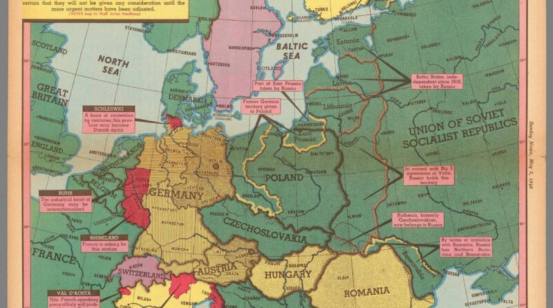
This 1946 map shows how unstable Europe still was a year after WWII ended—with shifting borders, Soviet control, and regions waiting for decisions.
Read MoreFrom 1938 to 1948, the Eastern Bloc area witnessed significant border changes, largely driven by the complex geopolitical dynamics of World War II and the immediate aftermath. The Eastern Bloc, comprising countries in Eastern and Central Europe, was under the influence of the Soviet Union during this period.
Read More