Historical Maps

Historical maps showing territorial changes of countries and historical events of the past.
Historical MapsLanguages

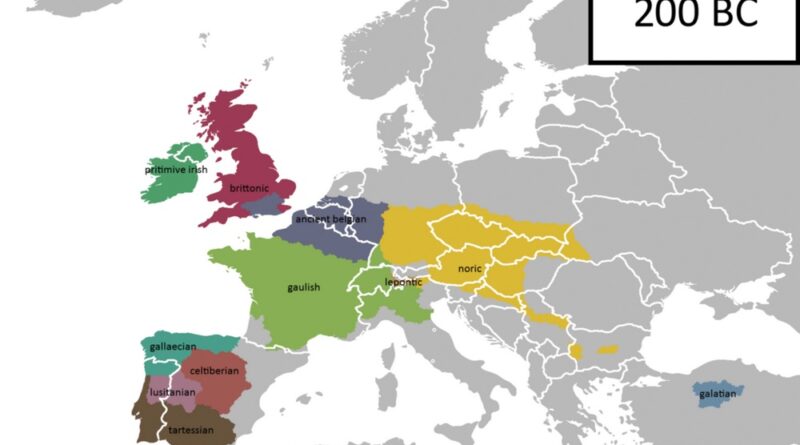
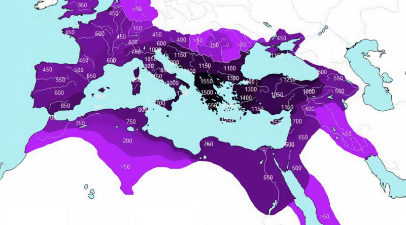
The Rise and Fall of Celtic Languages

Welsh, Irish, and Scottish Gaelic occupy a narrow strip of the Atlantic coast today. Most people think of them as small, peripheral languages that have always been there at the edge of Europe, hanging on by a thread. But two thousand years ago Celtic was one of the most geographically widespread language groups in the world, running from Portugal to the Black Sea and beyond.

Read more: The Rise and Fall of Celtic Languages
Historical Maps

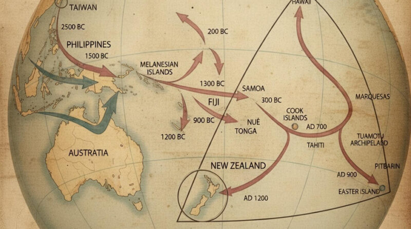
From Taiwan to New Zealand: 4,000 Years of Pacific Migration

People who left Taiwan before 3000 BC eventually reached New Zealand by 1200 AD—a 4,000-year migration across scattered Pacific islands. This map traces the routes and dates of each leg of the journey, from the Philippines (2500 BC) through the Cook Islands (800 BC) to the final settlements in Hawaii, Easter Island, and New Zealand.

Read more: From Taiwan to New Zealand: 4,000 Years of Pacific Migration
Historical Maps

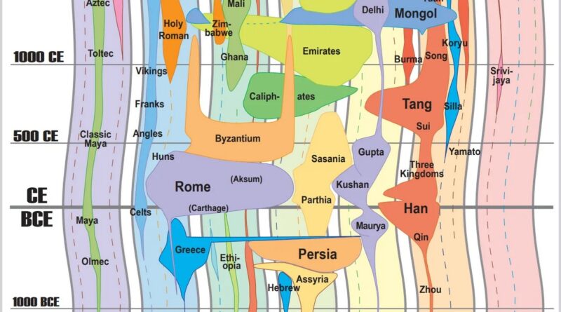
Mapping 9,000 Years: How the World GeoHistogram Shows Every Major Empire on One Timeline

Some maps try to do the impossible. The World GeoHistogram squeezes 9,000 years of civilization onto a single poster—compare Ancient Rome with the Mongol Empire, see when Alexander conquered Persia, figure out which civilizations actually existed at the same time. It’s ambitious, messy, and genuinely useful for understanding historical connections.

Read more: Mapping 9,000 Years: How the World GeoHistogram Shows Every Major Empire on One Timeline
Historical Maps

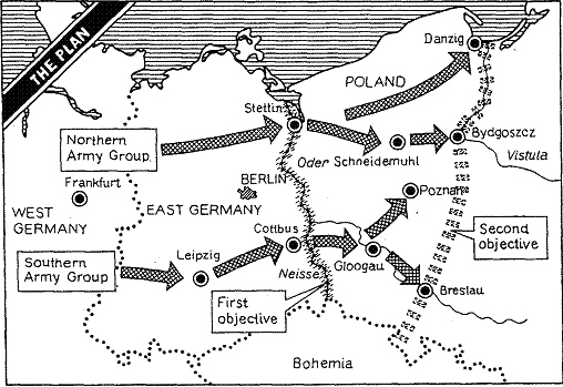
Operation Unthinkable: Churchill’s Secret Plan to Start World War III in 1945

Just weeks after victory in Europe, Winston Churchill commissioned a secret military plan so audacious it earned the codename “Unthinkable.” The proposal called for Western forces to launch a surprise attack against their Soviet allies on July 1, 1945. What drove Churchill to contemplate such a drastic action, and why was the plan ultimately shelved?

Read more: Operation Unthinkable: Churchill’s Secret Plan to Start World War III in 1945
Historical MapsMaps of World Religions

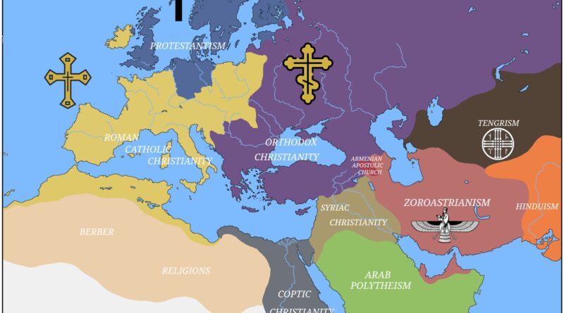
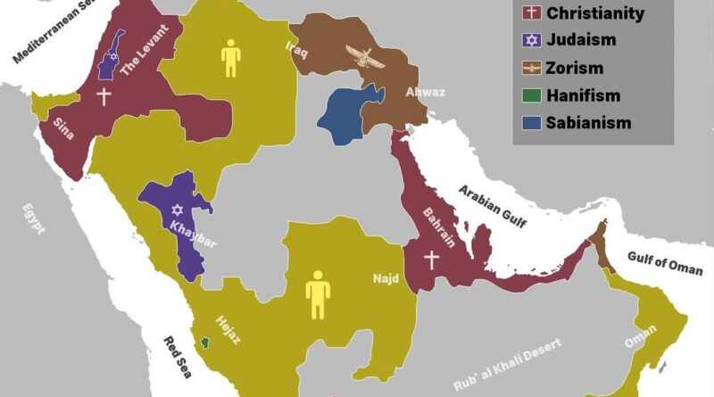
Religions in the Arabian Peninsula around the 5th century

In the early 5th century, different beliefs shared the Arabian Peninsula. Jewish and Christian families lived in busy caravan towns, while many desert tribes still honored local gods or searched for a single creator.
Zoroastrian customs from Persia reached Arabia’s northeast, blending with local traditions. A few generations later, Islam appeared and began to reshape life across the peninsula.

Read more: Religions in the Arabian Peninsula around the 5th century
Historical Maps

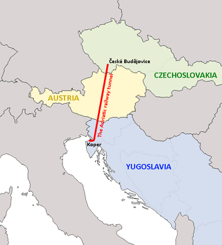
The Adriatic Tunnel: When Czechoslovakia Dreamed of Boring Through Austria

Countries without coastlines get the short end of the stick. Switzerland figured out how to make it work, but they’re special. Most landlocked nations spend half their time begging neighbors to let goods pass through. Czechoslovakia was fed up with this by the 1970s, leading to one of the most audacious infrastructure dreams of the Cold War era.

Read more: The Adriatic Tunnel: When Czechoslovakia Dreamed of Boring Through Austria