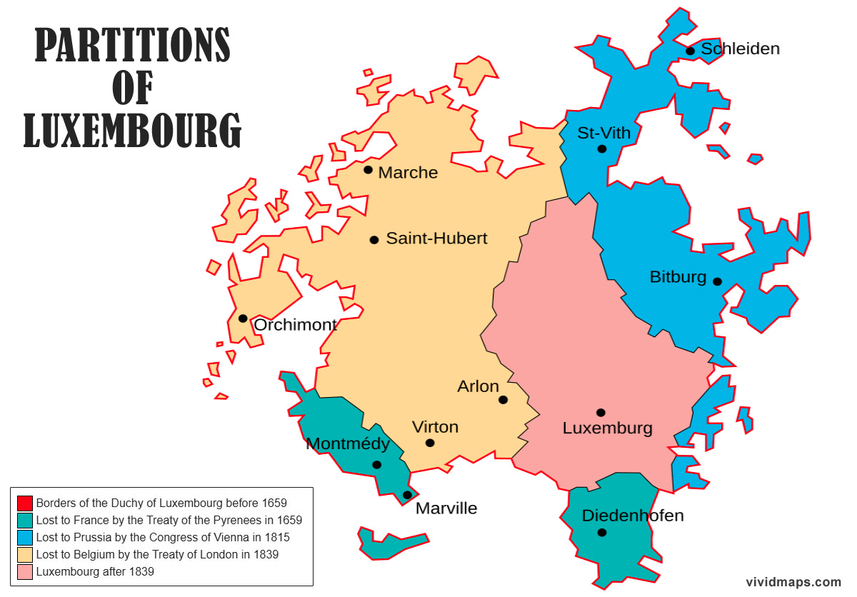
Luxembourg used to be much bigger. The original duchy covered10,700 km² (4,132 mi²) before its neighbors started taking chunks of it.
Three different partitions between 1659 and 1839 reduced Luxembourg to today’s 2,586 km² (998 mi²). That means Luxembourg lost 8,114 km² – about 76% of what it once had.
1659 – France takes the first piece
Luxembourg belonged to Spain back then. France and Spain were fighting over territory in the Low Countries. When they signed the Treaty of the Pyrenees to end the war, France kept three Luxembourg fortresses it had captured: Stenay, Thionville, and Montmédy, plus the land around them.
Lost: 1,060 km² (409 mi²)
1815 – Prussia grabs some land
Napoleon had conquered Luxembourg and made it part of France. After Napoleon lost, the Congress of Vienna gave Luxembourg to the Dutch as a grand duchy. But Prussia demanded the Bitburg fortress area to defend Germany’s western border. The Dutch agreed to give it up.
Lost: 2,280 km² (880 mi²)
1839 – Belgium takes half
Luxembourg was still ruled by the Dutch king when Belgium revolted in 1830. Most of Luxembourg sided with Belgium and joined the rebellion. Only Luxembourg City stayed under Dutch control. The Treaty of London in 1839 officially split Luxembourg – Belgium got the western half, the Dutch kept the eastern part.
Lost: 4,730 km² (1,827 mi²)
This Belgian piece had 175,000 people living in it – half of Luxembourg’s population back then. It became Belgium’s Luxembourg province and it’s still Belgium’s biggest province.


")

