All bike Paths in the Netherlands Mapped
The Netherlands is among the most bike-friendly countries globally, with 36 percent of Dutch people listing the bicycle as their most systematic way of getting around on an ordinary day instead of the auto (45 percent) and public transportation (11 percent). Cycling has a share of 27 percent of all urban and rural journeys nationwide. In municipalities, this is even higher, such as Amsterdam, which has 38 percent, and Zwolle 46 percent. The Netherlands is a densely settled and extraordinarily flat nation, which means that travel distances tend to be short, even between towns. This high commonness of bike trips is encouraged by impressive cycling infrastructure.
Cycling became popular in the Netherlands in the 1880s (a little later than in the U.S. and U.K.). But by the 1890s, the Dutch were already creating paths specialized for cyclists. In 1911, the Dutch-owned more bikes per capita than any other nation in Europe. The usage of bikes persisted in growing, and in 1940 there were about 4 million bicycles in a population of 8 million.
Nowadays, in total, the Netherlands has 22.9 million bikes for a country of just over 17.44 million people, which indicates there are 1.3 bicycles per capita, the highest worldwide.

An increasing number of paths connect the Netherlands’ cities, towns, and villages. Some of these bicycle roads are part of the Dutch National Cycle Network, a network of bicycle tourism paths that reach all country’s remote places.
The cycle network’s total length is above 35,000 kilometers (21,748 miles), equivalent to a quarter of the Netherlands’ entire 140,000 km (86,992) road network. The simple map below shows only dedicated bicycle paths, not roads with a cycle lane.
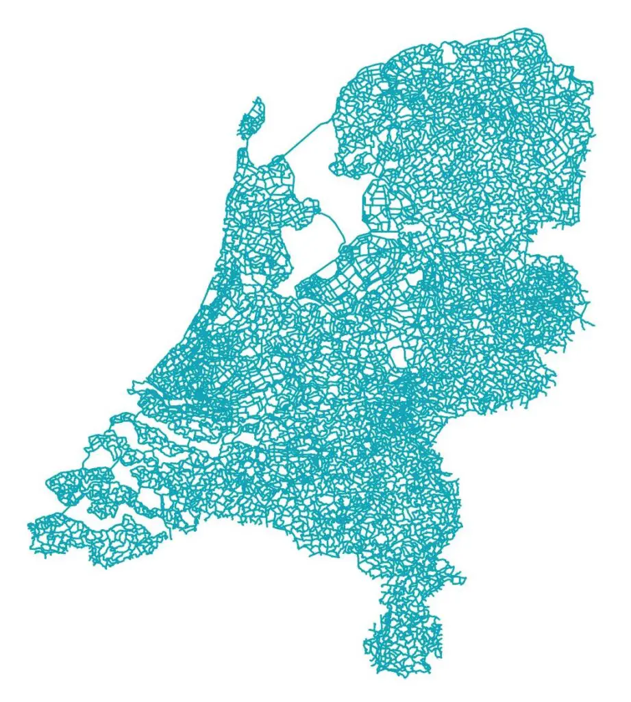
On other roads and streets, bicycles and cars share the same road space, but roads with a low-speed limitation are usually.
An average cyclist can naturally expect to cover between 15 and 18 kilometers (~ 10 miles), on average, in an hour by bicycle throughout most areas of the country.
Print cycling maps are widely available in the country and come in different forms:
- Route maps (a national map that shows route information rather than general topography are usually used for vacations and are sold at most tourist stores).
- National maps cover the entire nation, with markings and symbols about the cycleways of the Netherlands. Most national bicycle maps include the LF routes or long-distance cycle routes and the other ways of the numbered-node cycle network. These maps are used for cycling in unfamiliar settlements and cross-country use.
- Online or in downloadable apps (OpenStreetMap, etc.).
If you plan a cycling holiday or multi-day cycle trips, the best thing is to follow the LF routes.
The Most Beautiful Cycle Paths in the Netherlands:






Hi. Great video! What are you some of your recommendations for segments of paths that aren’t not by roads? I would love to know where that treed canal path is. Thanks so much.