The 1920 Plan of The Central European Union
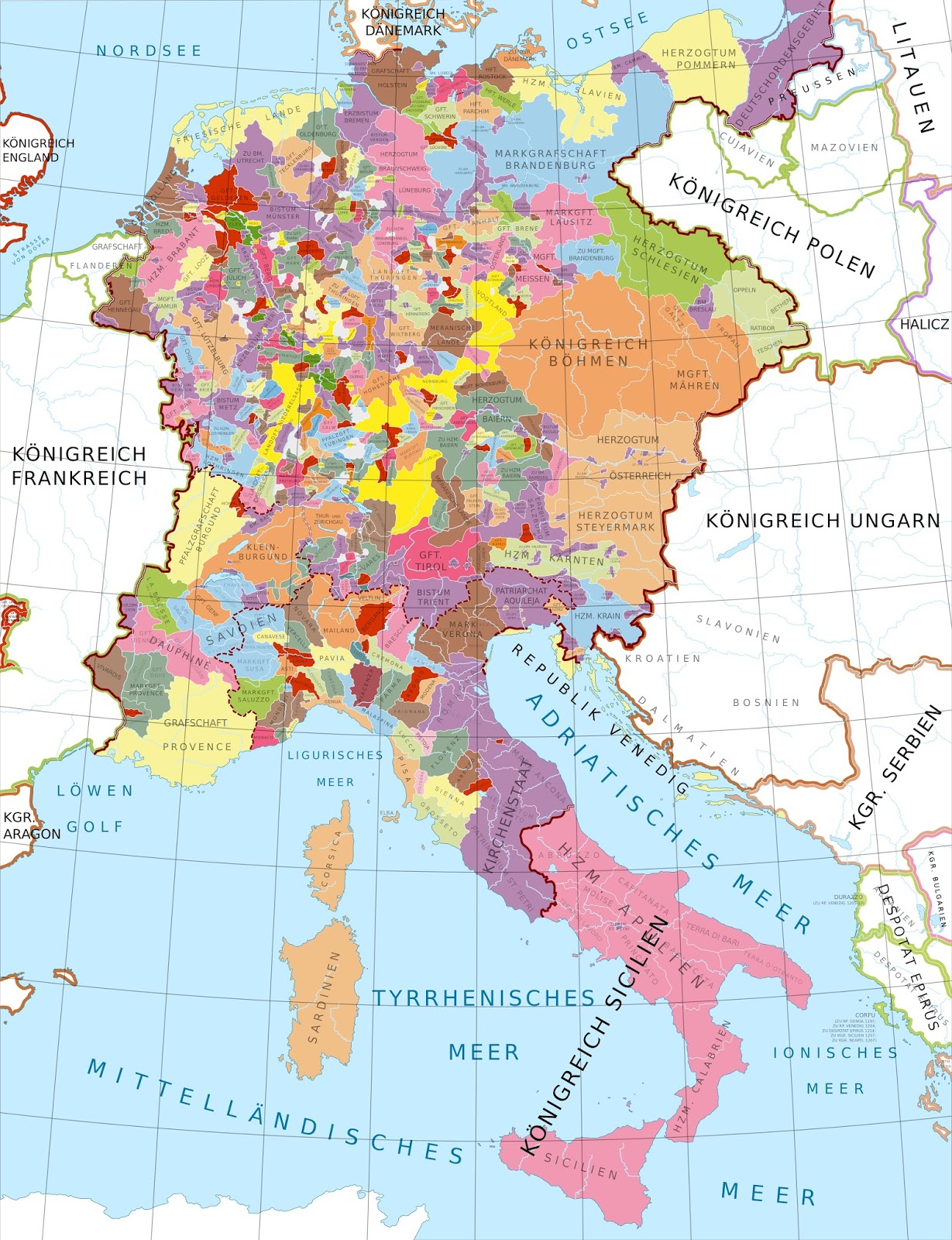
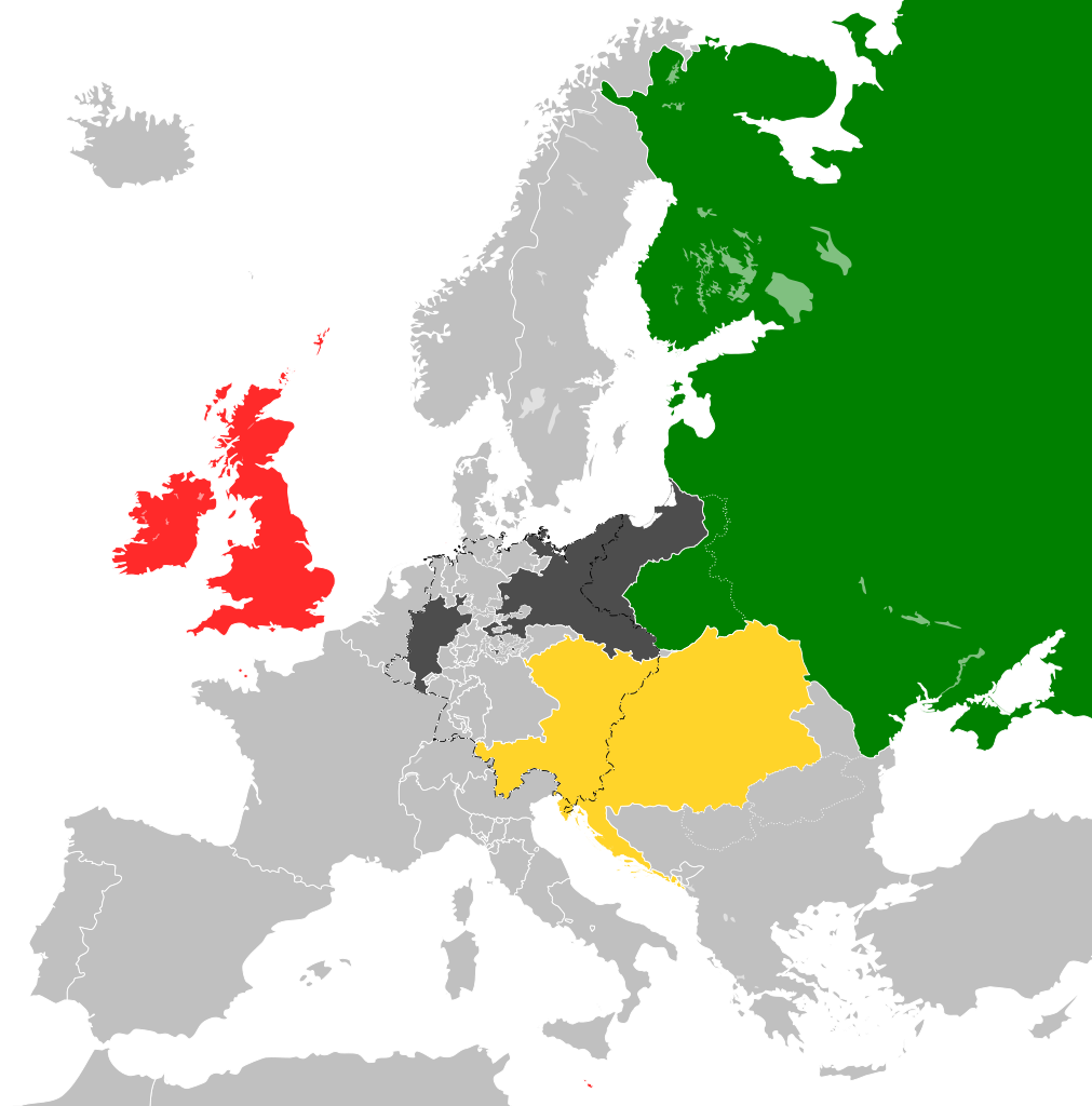
Throughout history, there have been several attempts to create a union of countries in Europe, often with the goal of promoting peace, stability, and cooperation on the continent. Notable attempts include the Holy Roman Empire, established in the Middle Ages, and the Napoleonic Confederation of the Rhine in the early 19th century. However, the most significant modern effort is the European Union (EU), founded in the aftermath of World War II. But before the European Union came into being, there were several other unusual ideas about creating a union of countries on the European continent.
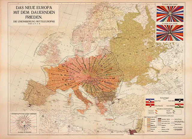
Below is a remarkable, mysterious, and exceedingly uncommon map depicting an intricate utopian blueprint for a prototype European Union following World War I. This map is attributed to “P.A.M.,” an elusive individual, likely enclosed separately within a 24-page pamphlet (not included here) that provides an extensive and detailed description of his visionary proposal.

The pamphlet titled “Die Unionisierung Mitteleuropas : Ein Wegweiser zum Dauerfrieden” (“The Central European Union: A Guide to Lasting Peace“) opens by questioning the Treaty of Versailles, which imposed humiliating and devastating terms on post-war Germany. It asks, “Can anyone genuinely believe that the outcomes of the peace talks thus far have guaranteed everlasting peace? Can anyone genuinely believe that the desire for revenge among different nations has been appeased by the terms of the current peace negotiations?”
The author then convinced readers that in his project, the national states are indeed torn apart, but they are, as it were, brought under one roof by creating sub-regions in which all nations would be fused over time. He stated that a new human nature would emerge from all the good and noble sides of every existing nation, and racial hatred would no longer prevail as before. Instead, he said that the love of the people would prevail, bestowing happiness and blessings on all those who were counted as a unitary nation.
As depicted on the map, the future Central European Union was envisioned to consist of 24 “cantons,” each taking on a unique long, narrow, wedge-like shape and bearing the name of its respective capital city. The unusual wedge shape was chosen with the intention of creating the most accommodating and equitable portion of Central Europe, aiming to resolve and put to rest long-standing disputes among European peoples permanently. These wedges were designed to converge at St. Stephen’s Cathedral in Vienna, which was renamed “Sankt Stephan” and designated as the Union’s capital. The rationale for selecting Vienna as the capital is not provided in detail, other than the author’s personal view that it could serve as a large, well-designed, and spacious garden city.
Notably, the cantons were deliberately designed to cross-cultural, ethnic, and traditional state boundaries, reflecting the author’s vision of fostering unity and cooperation across these lines.
Throughout the Union, only four Nations are recognized: Romans, Germans, Slavs and Magyars. Each of these Nations, with the exception of the latter, is divided into different peoples, all belonging to the same tribe of the Nation. The Romans are found in France, Italy, Rumania—Germans in Prussia, Bavaria, Holland, Saxony, Austria, the Tyrol, etc.—The Slavs in Poland, Czechoslovakia, Moravia, Ruthenia, Croatia, Serbia, etc.
P.A.M.
The map distinguishes the four Nations with distinct colors, and each Canton encompasses individuals from at least two of these Nations. For instance, the Canton of Brussels is home to residents from Roman, German, and Slavic backgrounds.
Within the pamphlet, numerous details are presented regarding various aspects of the envisioned Union. The President of the new European Union is slated to hold a three-year term, with a rotational system among the four Nations for this position. Suffrage is intended to be extended to individuals aged 20 and older, though interestingly, married women are excluded from this right.
Esperanto is proposed as the official language, and the pamphlet outlines the joint ownership of overseas colonies, with a separate map depicting significant portions of Africa as Union colonies. Additional particulars encompass the design of the Union’s flag, with both its front and back sides featured in the upper right section of the map.
It is apparent that the author and mapmaker harbored some degree of apprehension regarding the reception of their work.
To many a reader this work may appear as the result of over-excited imagination; someday, though late, the knowledge of truth will gain the upper hand, and perhaps many things which have been stimulated by me here will be realized. This would be the most beautiful reward of my quite selfless, long, and elaborate intellectual work.
P.A.M.
Opting to temporarily conceal his identity, he appended a note at the conclusion of his guide:
I have informed a Notary of my name, profession and role as author and editor of this work of peace, and it will be announced only when the four principal Nations in the Union have expressed their judgment publicly.
P.A.M.
The title page of the brochure indicates that the author published it, listing Otto Maas’ Sons (“Druck von Otto Maas’ Söhne”) as the publisher. There is a suggestion that P.A.M. may have been none other than P.A. Maas, the son of Otto Maas.


