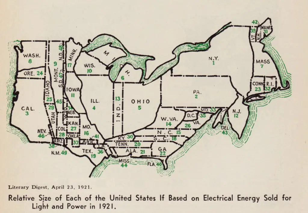
Map showing the relative size of each of the United States if based on Electrical energy sold for light and power (1921)
“Relative size of each of the United States if based on electrical energy sold for light and power in 1921 (Literary Digest, April 23, 1921)”
Arkansas barely had electricity in 1921. Arkansas’s first electric utility was founded in 1913, but service was confined to a few towns. Most of the state didn’t have electricity until after the Rural Electrification Act was passed as part of the New Deal in 1935. Iowa, by contrast, started rural electrification in 1916. When the hydroelectric plant on the Mississippi at Keokuk, IA was built in 1910 it was the largest power plant in the world.
Related post:
– United States Old Maps


