Egypt is the most populous country in the Arab world and the third-most populous on the African continent, after Ethiopia and Nigeria. As of 2024, Egypt’s population stands at around 107 million people (2024e). What’s striking about Egypt’s population is how unevenly it’s spread out. About 95% of Egyptianslive along the banks of the Nile River, the Nile Delta north of Cairo, and the Suez Canal, even though these areas account for less than 5% of Egypt’s total land area.
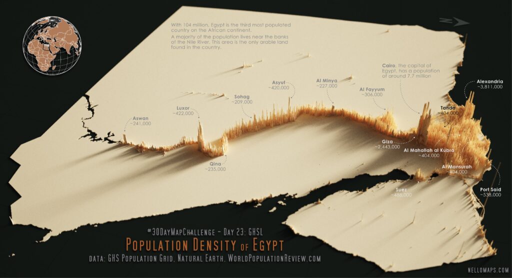
Population density of Egypt
The concentration of Egypt’s population in such a small area makes it one of the most densely populated regions in the world. The areas along the Nile and in the Nile Delta have an average population density of over 3,820 people per square mile (1,540 per km²), compared to Egypt’s overall average of 181 people per square mile (70 per km²).
This map gives a clear picture of how the population clusters tightly around the Nile and the delta, with the vast majority of Egypt’s land — including the Sahara Desert — remaining almost uninhabited.
The Nile River: Egypt’s Lifeline
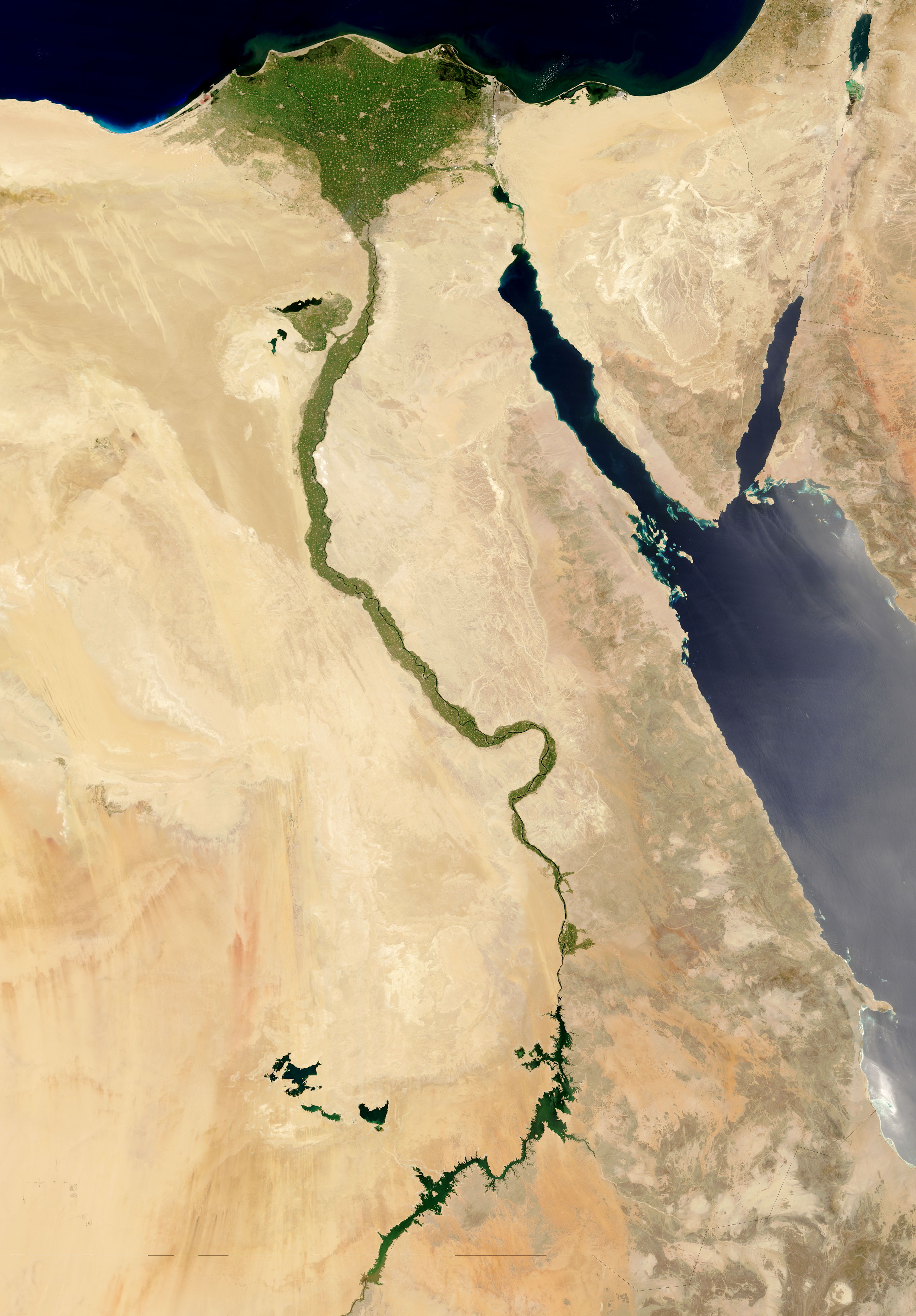
The Nile River plays a defining role in Egypt’s population distribution. Flowing for 4,258 miles (6,853 kilometers) through 11 countries, the Nile is often regarded as the longest river in the world. The river provides water for drinking and agriculture, and its annual floods have fertilized the surrounding desert soils for thousands of years, supporting civilization since ancient times.
NASA
This satellite image from NASA beautifully illustrates how the Nile appears like a green ribbon cutting through the otherwise barren desert.
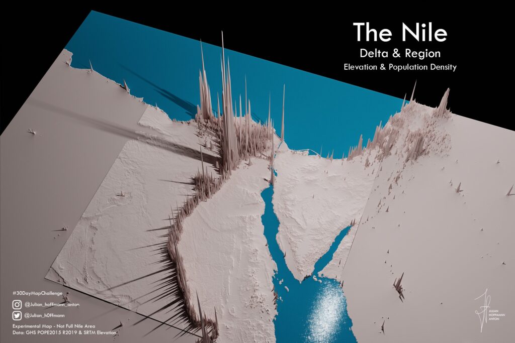
A 3D Perspective of Egypt’s Population
Julian Hoffmann and Nelson Schäfer created fascinating 3D maps that visually emphasize the population’s concentration along the Nile. The vertical spikes reflect the dramatic density differences between the Nile Valley and the surrounding desert.
These 3D maps highlight how nearly all of Egypt’s population is crammed into narrow corridors along the river, while the vast desert areas remain empty.
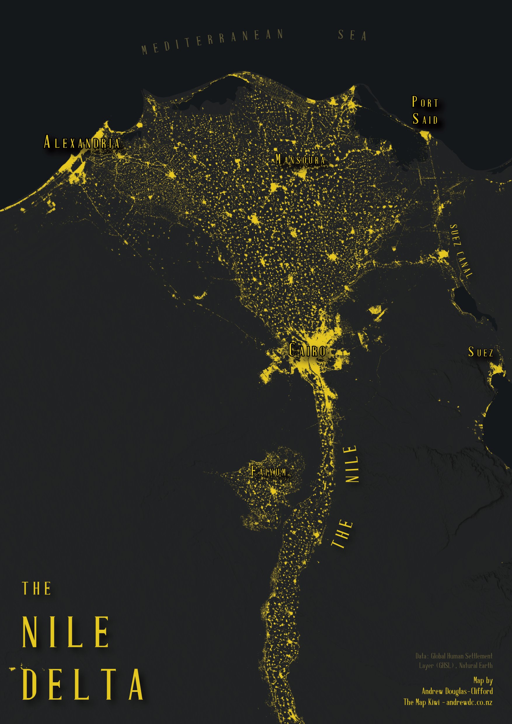
Settlements and Roads in Egypt
Egypt’s cities and towns have formed along the Nile’s banks, where access to water and fertile land allows for sustainable living. Andrew Douglas-Clifford created a detailed map showing the settlement patterns in Egypt, reinforcing how vital the Nile is to human habitation.
Map of the Settlements of Egypt
Notice how settlements hug the Nile and the delta, with almost no significant population centers in the desert.
Egypt’s road network also reflects this pattern. Most major highways and transportation routes follow the Nile’s path, linking the country’s key urban centers.
Map of the Roads of Egypt
The road map shows how infrastructure is tightly connected to the river, underscoring the Nile’s role as the backbone of Egypt’s society and economy.
Why the Nile Matters
Egypt’s population density is one of the most extreme examples of how natural resources shape human settlement. Without the Nile, life in Egypt as we know it would not exist. The combination of fertile soil, access to water, and a long history of human adaptation has made the Nile Valley the heart of Egypt’s civilization for millennia.


This was helpful af!
Beautiful maps
Incredibly useful for my geography internal!