Solar and wind power potential of the U.S.
Renewables generated roughly 26% of America’s electricity last year! Wind and solar? They finally overtook coal, something that seemed unlikely even five years ago.
All that renewable power comes from specific regions, not the country as a whole. Some states are absolutely loaded with sun and wind. Others barely have enough to make projects worthwhile.
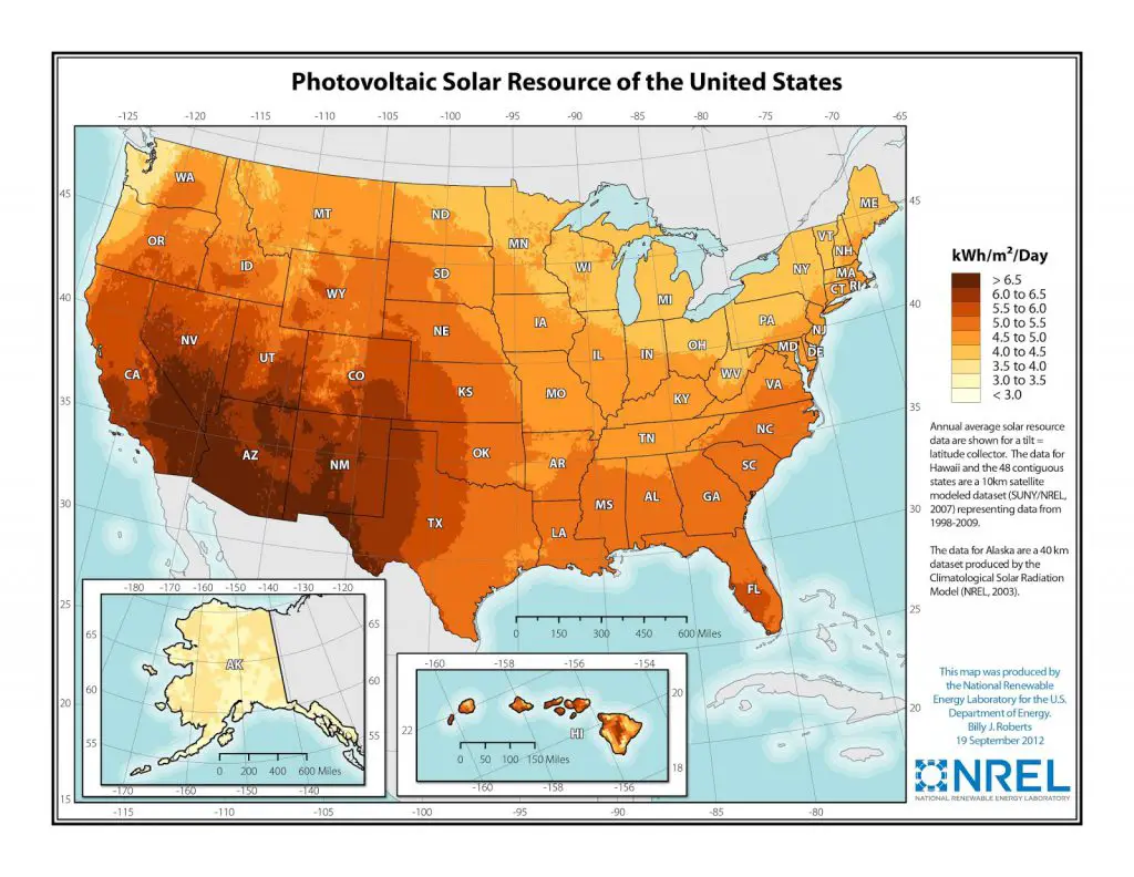
Southeastern California gets bombarded. Southern Nevada too. Arizona’s southern regions, plus scattered areas in New Mexico and Texas. Those zones pull in 6.5+ kilowatt-hours per square meter daily. Head north to cloudier states and you’re looking at 3, maybe 4 kWh/m²/day tops.
Largest Solar Projects in the U.S.
| Project Name | Location | Capacity |
|---|---|---|
| Edwards & Sanborn Solar + Storage | Kern County, California | 875 MW |
| Copper Mountain Solar Facility | Boulder City, Nevada | 802 MW |
| Gemini Solar and Storage | Clark County, Nevada | 690 MW |
| Frye Solar | Kress, Texas | 637 MW |
| California Valley Solar Ranch | San Luis Obispo County, California | 580 MW |
Edwards & Sanborn pairs 875 megawatts of generation with 3,300 megawatt-hours of batteries. That battery bank is the largest one connected to solar anywhere in the U.S. Part of the site leases land from Edwards Air Force Base. The Defense Department hasn’t done a bigger renewable deal with private industry.
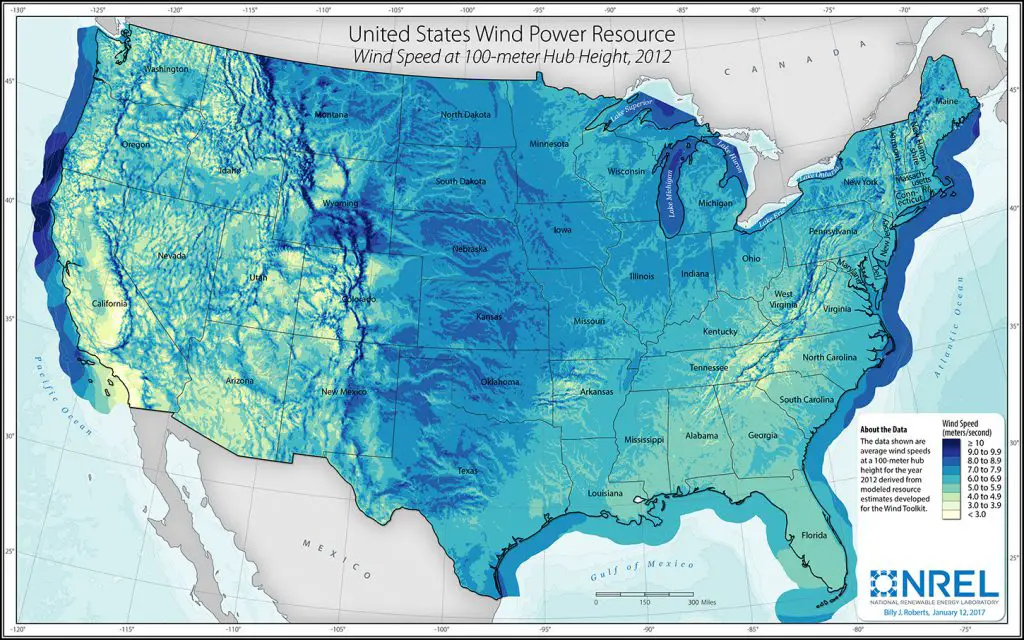
Wind runs on completely different geography. Strong, consistent speeds above 10 meters per second cluster along northern California’s coast. The Great Lakes see similar numbers. So does the eastern spine of the Rockies and scattered Atlantic offshore zones. Water creates temperature gradients that drive steady winds. Mountains channel and accelerate airflow through passes.
Largest Wind Projects in the U.S.
| Project Name | Location | Capacity |
|---|---|---|
| SunZia Wind | Lincoln, Torrance, and San Miguel Counties, New Mexico | 3,500 MW |
| Alta Wind Energy Center | Kern County, California | 1,548 MW |
| Western Spirit Wind | Central New Mexico | 1,050 MW |
| Great Prairie Wind | Hansford County, Texas | 1,027 MW |
| Traverse Wind Energy Center | Blaine County, Oklahoma | 999 MW |
SunZia Wind in central New Mexico will be the largest wind farm in the Western Hemisphere when it comes online in 2026. The project includes over 900 turbines spread across Lincoln, Torrance, and San Miguel Counties. Pattern Energy broke ground on the $11 billion project, which pairs the wind farm with a 550-mile transmission line to carry power to Arizona and California.
Solar capacity additions beat natural gas in 2025. Wind now supplies over 10% of total U.S. generation.

