The Simpsons first aired in 1989, and it is now in its 37th season. It’s easily one of the longest-running TV shows ever. The story follows the Simpson family: Homer, his patient wife Marge, and their children—troublemaker Bart, smart Lisa, and little Maggie—as they navigate everyday chaos in the unusual town of Springfield.
Nobody really knows where Springfield’s located. The show dodges naming a state on purpose, and the folks behind it seem to love tossing in red herrings. You might spot snowy peaks one week, a coastline the next, or even some sandy dunes thrown in for good measure. Heck, with actual towns named Springfield in something like 35 states, it kinda feels like it could be your own backyard, which is why it hits home for a lot of us.
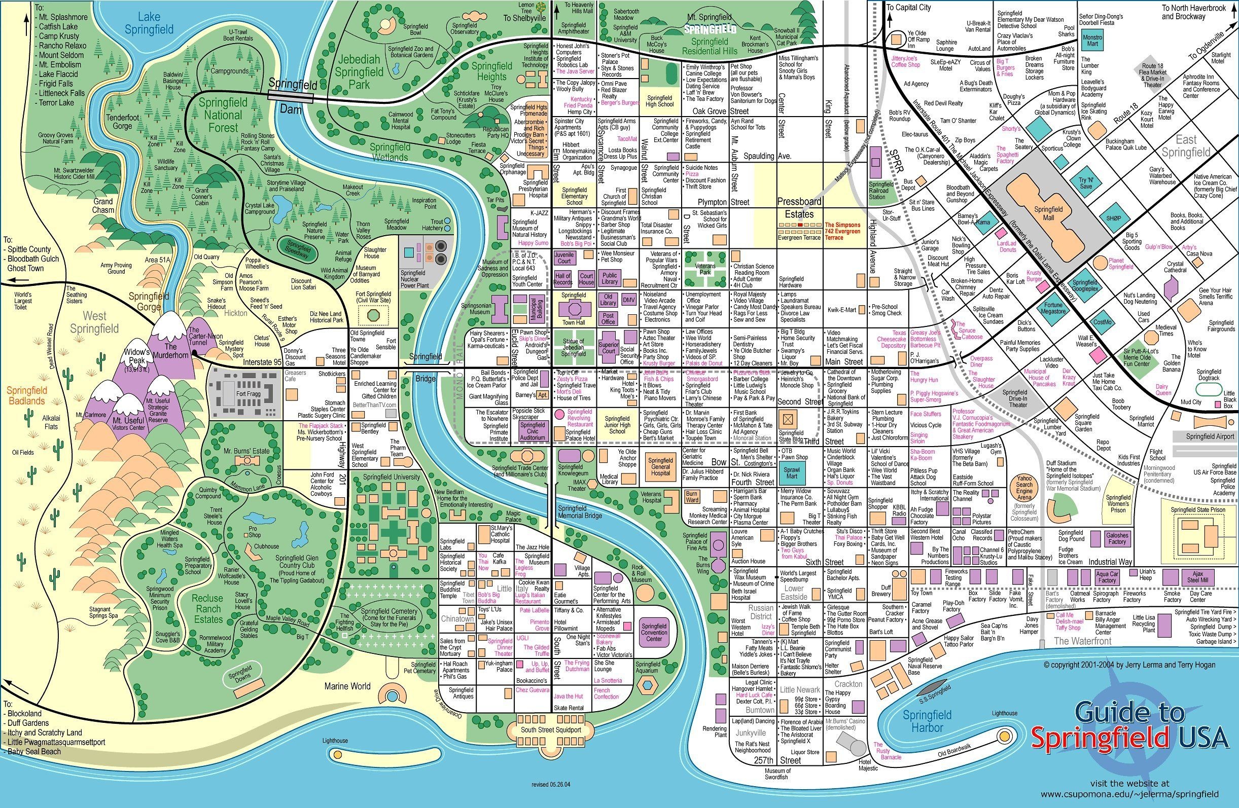
Take a look at this map—it’s got all the fan-favorite hangouts: the family’s digs at 742 Evergreen Terrace, Springfield Elementary (Bart’s playground for pranks, Lisa’s spot to shine), that sketchy nuclear plant where Homer clocks in, Moe’s dingy bar for his beer fixes, and Apu’s trusty Kwik-E-Mart. Can’t leave out the tire dump that’s eternally on fire, the Android’s Dungeon for all things comics, or the slew of other places that crop up episode after episode.
If you try to map it all out logically, though, good luck—the geography’s all over the place. Homer might drive to work in one scene but stroll there in another. The school’s blocks away sometimes, miles the next. Streets shift around depending on the plot, because the writers prioritize funny stories over perfect consistency.
Over the years, fans have sketched up tons of different Springfield maps. Some cram in every obscure location from the series, while others focus on the essentials. There isn’t an “official” version out there because the show plays fast and loose with the layout, but that’s part of the charm—enthusiasts just keep churning out their takes on it.
If you haven’t already seen The Simpsons, they’re all easily available on Amazon: