Have you ever noticed how different cities feel when you’re navigating them? There’s a reason why you can drive through Salt Lake City without getting lost, while Boston’s streets might leave you scratching your head. The way streets are oriented in American cities isn’t random – it’s a product of history, geography, and human decisions that shaped our urban landscapes.
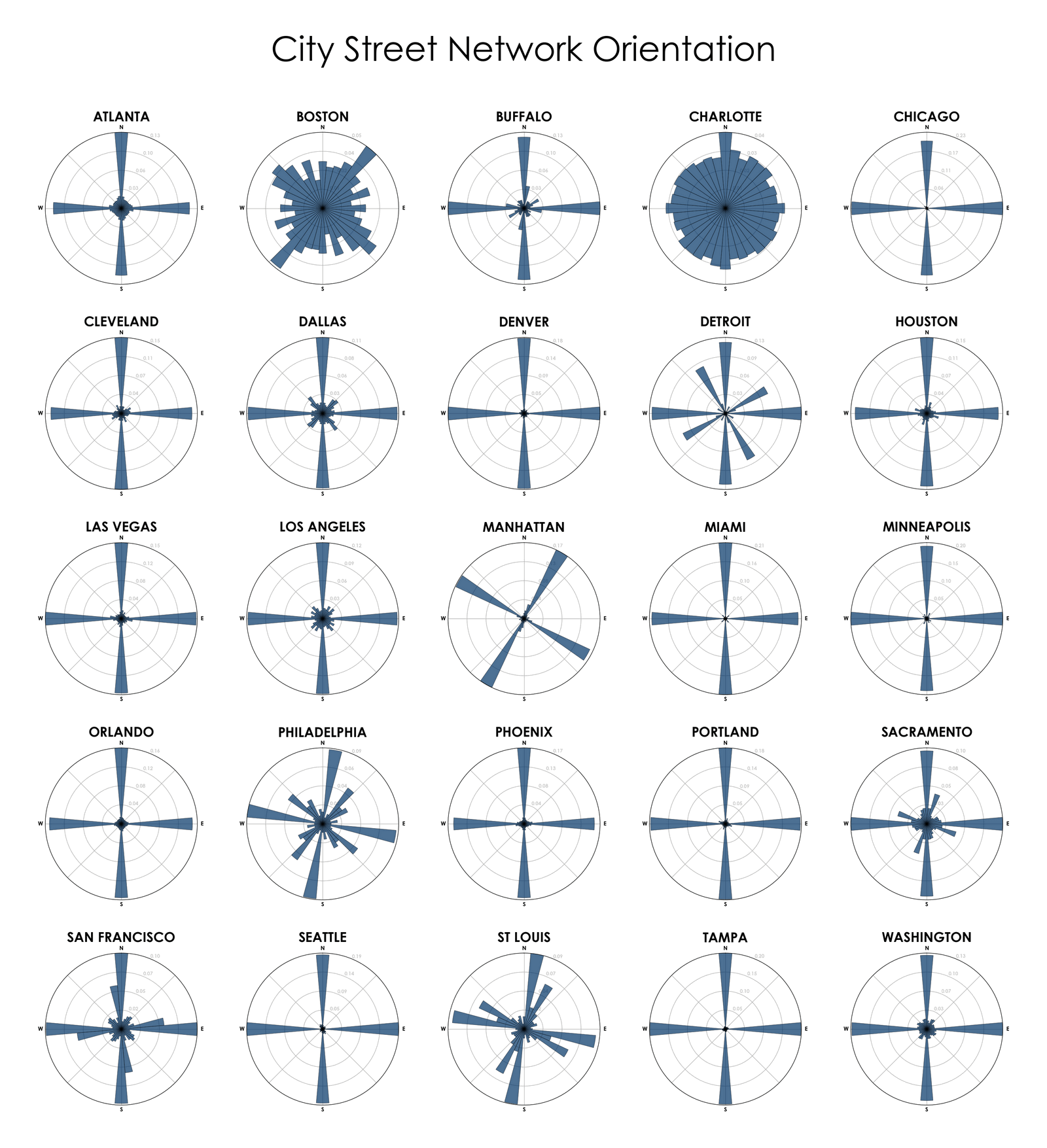
Reading the Rose Diagrams
Each sector in the rose diagrams below corresponds to a street orientation. The length of each sector indicates the number or frequency of streets pointing in that particular direction. These beautiful visualizations, created by Geoff Boeing, reveal the hidden patterns of our cities’ street networks:
What’s fascinating is how these patterns emerged. Manhattan’s famously rigid grid system, for example, was established by the Commissioners’ Plan of 1811. The plan aimed to create an orderly system for selling and developing land – arguably the most ambitious urban planning initiative in New York’s history.
A Tale of Two Cities: Order vs. Organic Growth
Looking at these visualizations, you’ll notice two distinct patterns:
The Planned Cities: Places like Chicago, Philadelphia, and Denver show strong directional preferences, typically aligned with cardinal directions. These cities were largely planned and built during the 19th century when the grid system was seen as the epitome of modern urban planning.
The Historic Evolution: Cities like Boston and Pittsburgh show more scattered orientations. Boston’s seemingly chaotic layout follows old cow paths and colonial-era trails, while Pittsburgh’s street pattern was shaped by its challenging topography and three converging rivers.
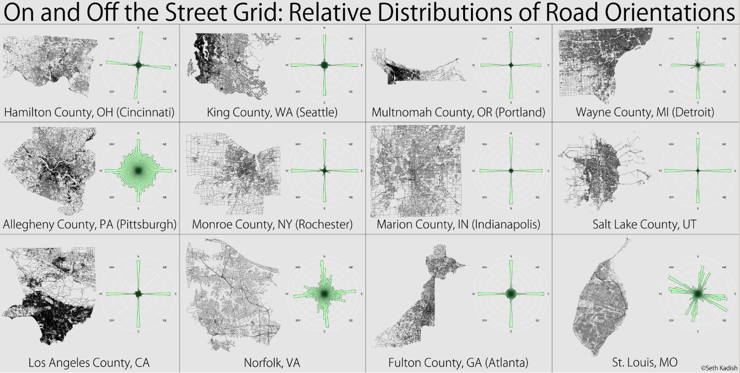
Visualization below created by vizual-statistix shows county-level patterns.
Did you know that Thomas Jefferson himself influenced America’s obsession with the grid system? His Land Ordinance of 1785 established the practice of dividing land into square-mile sections, which later influenced many cities’ layouts.
Modern Implications
These street orientations affect more than just navigation. Studies have shown they impact:
Solar access and energy efficiency
Wind patterns and urban heat islands
Traffic flow and congestion
Walking and cycling behavior
A study published in the journal “Environment and Planning B: Urban Analytics and City Science” found that grid-like street patterns generally provide more direct routes and better connectivity. The researchers analyzed 100 urban areas worldwide and found that grids typically reduce average trip lengths by 10-30% compared to less regular street layouts, though this benefit can vary significantly based on factors like topography and development density.
Explore Your Own City
Want to see how your city’s streets are oriented? Check out the interactive map below:
Related Products
If you’re interested in urban planning and city design, check out these fascinating resources available on Amazon:
The Power Broker – The classic story of how one man transformed New York’s urban landscape