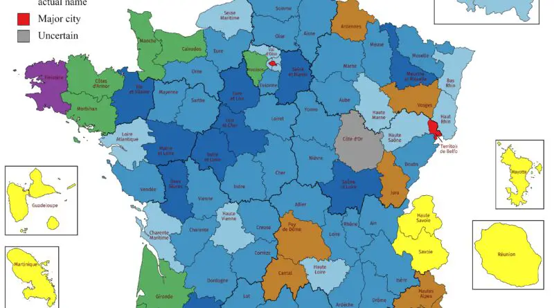
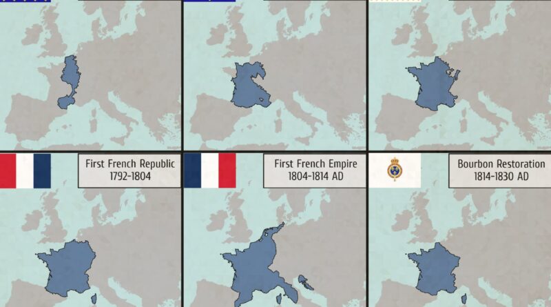
France

Political maps

Departments of France Mapped

There are 101 departments in mainland France. These departments are administrative divisions that serve as the primary subdivisions of the country. Each department is assigned a number and a name. Additionally, there are five overseas departments (French Guiana, Guadeloupe, Martinique, Mayotte, and Réunion) and one overseas collectivity (French Polynesia), making a total of 107 departments and collectivities in France.

Read More
Historical Maps

France in 1030 mapped

The Kingdom of France was ruled by the Capetian dynasty, which began in the late 10th century. In 1030, Robert II, also known as Robert the Pious, was the reigning king. The Capetian kings faced difficulties in asserting their control over the numerous feudal territories and maintaining a centralized administration. The economy of the Kingdom of France in 1030 was predominantly agrarian.

Read More
Historical Maps

Evolution of France’s Borders Mapped

France’s borders remain a testament to its rich and complex history, reflecting the interplay of conquest, diplomacy, and geopolitics over the centuries. From the medieval domains of the Capetian kings to the modern-day republic, the evolution of France’s borders is a fascinating journey through time, shaped by the ambitions and aspirations of its rulers and people.

Read More