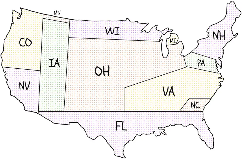
Because of the way the primary system works in the United States, presidential candidates spend an unbalanced amount of time in “battleground states” like Florida, Iowa, Michigan, North Carolina, Pennsylvania, Ohio, Virginia, Wisconsin, and less time where most of the U.S. population lives (New York, California, etc.)
NationalPopularVote.com has created a map that displays where the presidential candidates did campaign events in 2016.
In 2016, practically all campaign events (94 percent) were in the 12 U.S. states where Trump’s support was within 43 and 51 percent. 2/3 of the events were in just six states (Ohio, Florida, Virginia, North Carolina, Pennsylvania, Michigan).
In 2012, all campaign events were concentrated in the 12 U.S. states where Romney’s support was within 45 and 51 percent. 2/3 of the events were in four states (Ohio, Florida, Virginia, Iowa). 38 U.S. states were ignored, including 12 of the 13 smallest states and virtually all agricultural, Northeastern, Southern, and Western states.
A similar map pattern prevailed in 2000, 2004, 2008 and is assumed in 2020.


")


