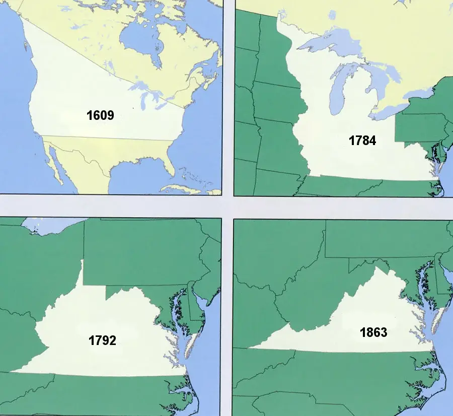
Virginia’s territorial claims have evolved significantly over the years, shaping the state’s geographic boundaries and influencing its historical narrative. The origins of Virginia’s territorial claims can be traced back to the early 17th century, when English settlers, led by the Virginia Company, established the Jamestown colony in 1607. The original charter granted by King James I defined Virginia’s boundaries as stretching from the Atlantic Ocean to the Pacific Ocean.
As the colony expanded westward, disputes over territory arose with neighboring colonies, particularly Maryland and North Carolina. The ambiguity of the initial charters and the lack of precise geographical knowledge led to overlapping claims and conflicts. Virginia’s expansionist ambitions were tempered by subsequent charters that adjusted its boundaries, and negotiations or conflicts often determined the final demarcation of its territory.
During the colonial period, Virginia’s claims extended into the Ohio Valley and the Appalachian Mountains. However, the French and Indian War (1754-1763) altered the territorial dynamics, with the Treaty of Paris in 1763 ceding some western lands to the British. Virginia’s western boundary was further defined by the Proclamation of 1763, restricting westward settlement beyond the Appalachian Mountains.
The American Revolution brought about a reevaluation of territorial claims, and in 1781, Virginia ceded its northwestern territory to the United States government, contributing to the formation of the Northwest Territory. Subsequent events, such as the creation of Kentucky as a separate state in 1792, further shaped Virginia’s borders.
Throughout the 19th century, Virginia’s territorial claims remained stable, but the Civil War had a profound impact. The formation of West Virginia as a separate state in 1863, aligned with the Union during the war, led to a significant alteration of Virginia’s western boundary.
The map below shows Virginia’s territorial claims over the years.
In the 20th century, Virginia’s territorial claims were unaffected by major changes, and its current borders were established. The state’s geographic configuration has since played a crucial role in its cultural, political, and economic development, reflecting the complex historical processes that defined Virginia’s territorial evolution.
If you’d like to learn more about the history of Virginia, please read: