
Map of Alabama With Counties, Cities and Rivers
Alabama has a peculiar shape for a state that wants to be a seaport. It reaches north into the Appalachian foothills, spreads across a belt of chalky prairie, and then squeezes down to the Gulf of Mexico through a narrow southwestern gap that Florida almost closes off.
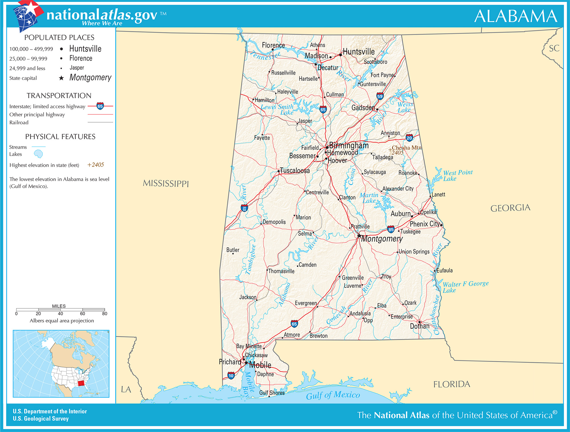
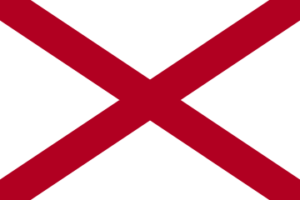
Alabama is a state in the southeastern United States covering 52,420 square miles (135,767 km2). It has 67 counties, borders Tennessee, Georgia, Florida and Mississippi, and holds a 53 mile (85 km) Gulf of Mexico coastline. Montgomery is the capital, Huntsville is the largest city by the 2020 Census, and Cheaha Mountain at 2,407 feet (734 m) is the highest point.
What are the basic facts about Alabama?
| Fact | Value |
|---|---|
| Capital | Montgomery |
| Admitted to the Union | December 14, 1819 (22nd state) |
| Total area | 52,420 sq mi (135,767 km2), 30th largest state |
| Land area | 50,645 sq mi (131,171 km2) |
| Water area | 1,775 sq mi (4,597 km2) |
| Highest point | Cheaha Mountain, 2,407 ft (734 m) |
| Lowest point | Gulf of Mexico, sea level |
| Counties | 67 |
| Population, 2020 Census | 5,024,279 |
| Median household income, 2020 to 2024 | $63,999 |
Which states border Alabama?
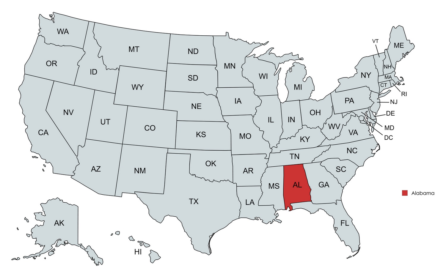
Four states touch Alabama. Tennessee lies to the north, Georgia to the east, Florida to the south and Mississippi to the west.
The Florida panhandle blocks most of the southern edge, so Alabama reaches salt water only in its southwestern corner around Mobile Bay. Britannica puts the general coastline at 53 miles (85 km) and the average elevation of the whole state at about 500 feet (150 m).
What does the terrain of Alabama look like?
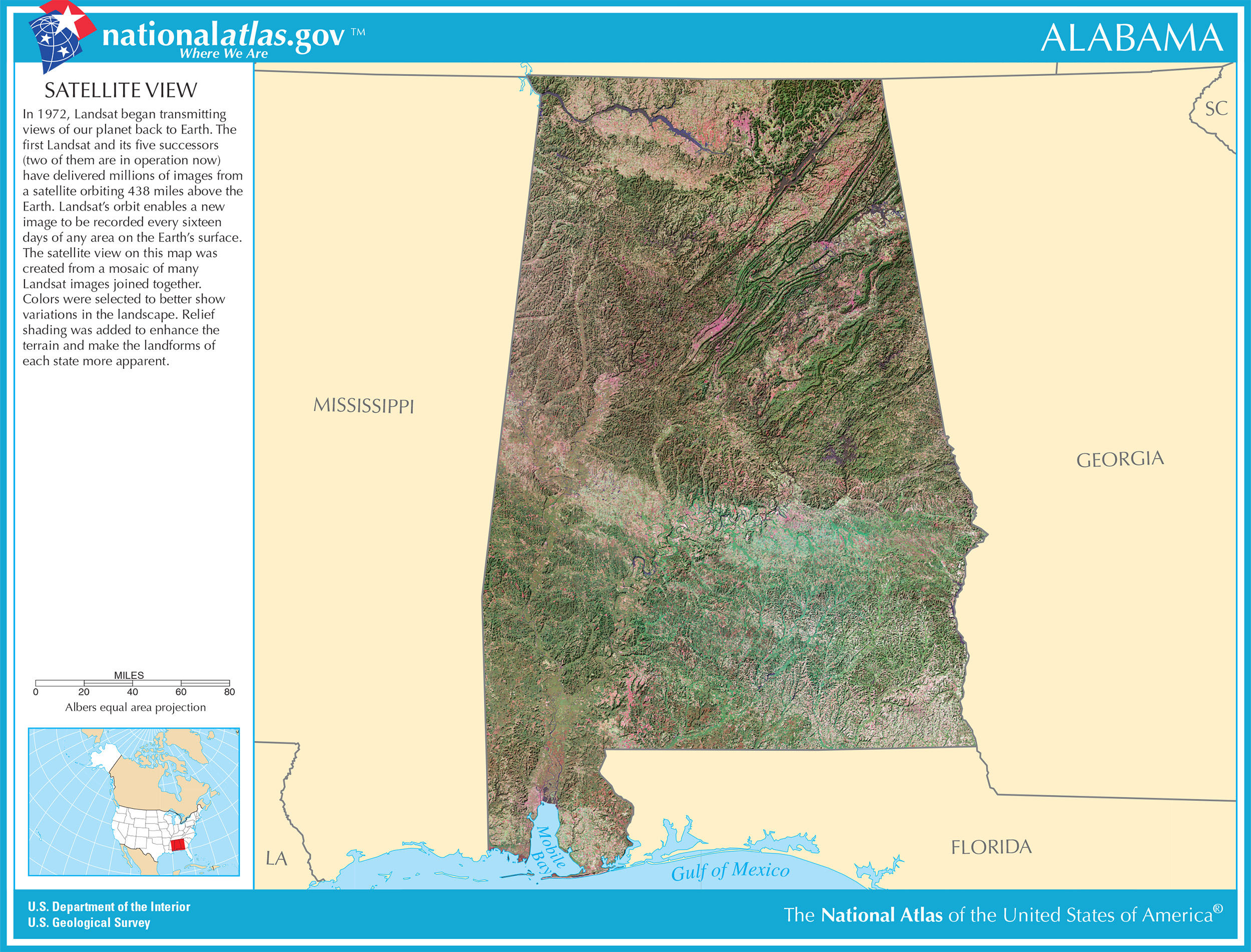
The state tilts from northeast to southwest. The Appalachian foothills fill the north, and the highest ground, Cheaha Mountain, stands in the northeast.
South of the Fall Line the land flattens into the East Gulf Coastal Plain. The Encyclopedia of Alabama places that boundary in a sweeping curve from Phenix City to the Mississippi border west of Florence. Along the coast, elevation drops below 50 feet (15 m).
Inside the plain lies the Black Prairie, about 145 miles (233 km) long and 18 miles (29 km) wide at its broadest. Selma, Demopolis and Montgomery all stand on it, and its limestone and marl soils shaped the cotton economy that built the early state.
Near Wetumpka there is a meteorite crater more than 5 miles (8 km) across, dated to roughly 85 million years ago.
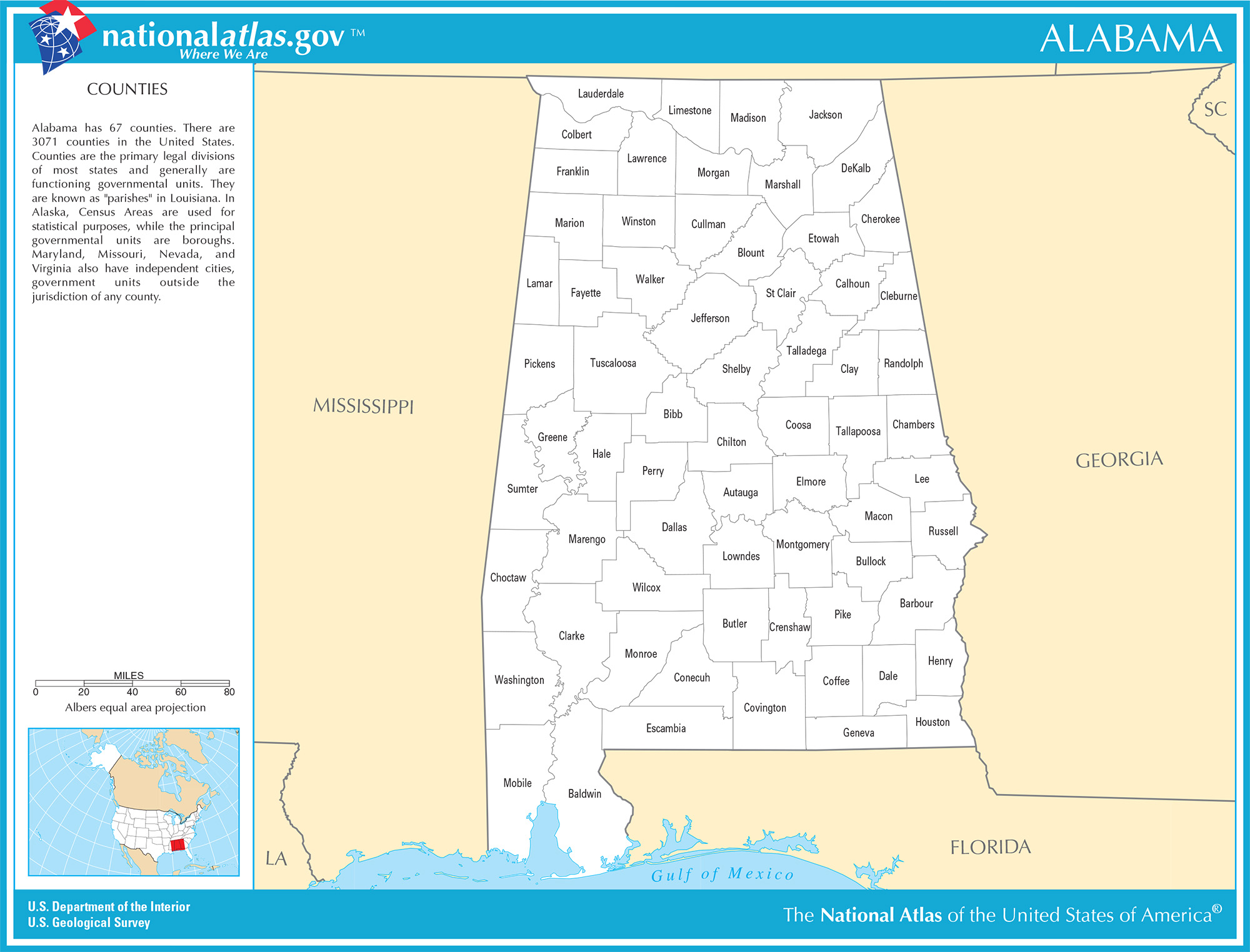
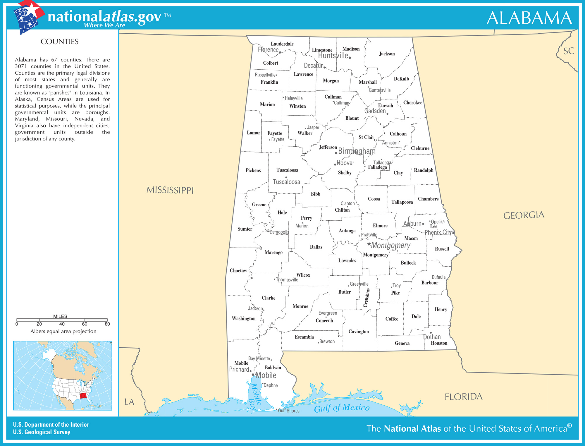
How many counties does Alabama have?
Sixty-seven. They differ a lot in size. Baldwin County on the Gulf has about 1,590 sq mi (4,118 km2) of land, nearly three times the roughly 535 sq mi (1,386 km2) of Etowah County, the smallest.
Population is even more uneven.
| County | 2020 Census population |
|---|---|
| Jefferson (Birmingham) | 674,721 |
| Mobile | 414,809 |
| Madison (Huntsville) | 388,153 |
| Baldwin | 231,767 |
| Montgomery | 228,954 |
Jefferson County alone holds 13.4% of the state’s residents.
What are the biggest cities in Alabama?
Huntsville moved ahead of Birmingham in the 2020 Census. Montgomery, the capital, finished a few dozen residents behind Birmingham.
| Rank | City | 2020 Census population |
|---|---|---|
| 1 | Huntsville | 215,006 |
| 2 | Birmingham | 200,733 |
| 3 | Montgomery | 200,603 |
| 4 | Mobile | 187,041 |
| 5 | Tuscaloosa | 99,600 |
| 6 | Hoover | 92,606 |
| 7 | Auburn | 76,143 |
| 8 | Dothan | 71,072 |
| 9 | Decatur | 57,938 |
| 10 | Madison | 56,933 |
How many people live in Alabama and where?
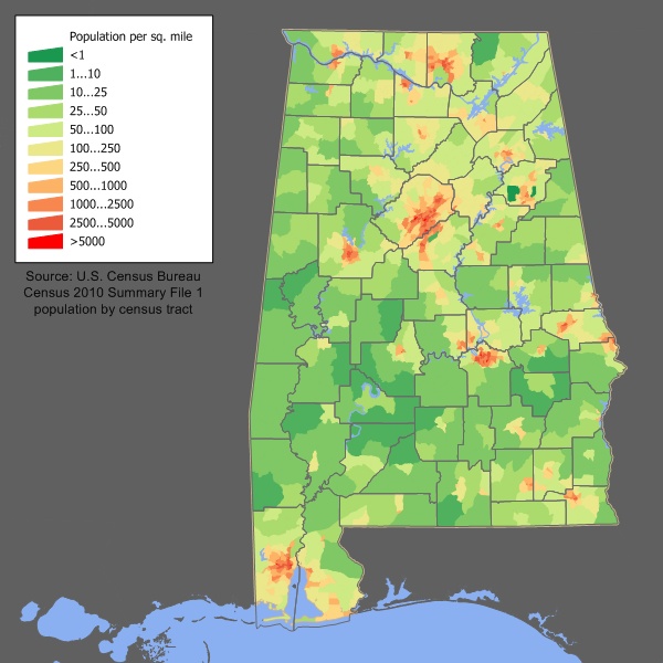
Alabama had 5,024,279 residents in the 2020 Census. That works out to about 99 people per sq mi (38 per km2) of land. The Census Bureau’s latest estimate in QuickFacts is 5,193,088 (2025), roughly 3.4% above the 2020 count.
People cluster along a line from Huntsville through Birmingham and Montgomery to Mobile, which is also the route the interstates follow.
What are the main rivers and lakes in Alabama?
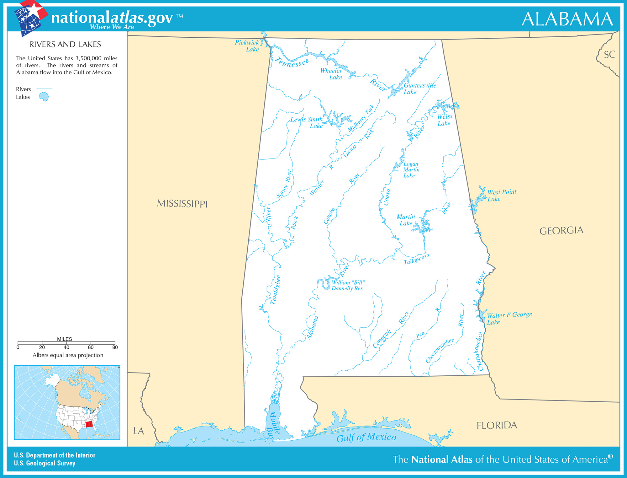
Alabama has about 132,000 miles (212,000 km) of rivers and streams. Most of the state below the Tennessee River drains into Mobile Bay through the Mobile River basin.
| Feature | Size |
|---|---|
| Alabama River | about 318 mi (512 km) |
| Cahaba River | about 194 mi (312 km) |
| Tennessee River | 652 mi (1,049 km) in total, crossing northern Alabama |
| Lake Guntersville | about 108 sq mi (280 km2), 69,100 acres |
The Tennessee River’s 652 miles are the length of the whole river, and only a loop across the north lies inside the state. The Alabama River, formed where the Coosa and Tallapoosa meet, is the longest river that flows mostly within Alabama. Lake Guntersville is a reservoir on the Tennessee River, built by the Tennessee Valley Authority, so even the biggest lake on the map is a man-made one.
Where the Alabama and Tombigbee rivers meet above Mobile Bay, they form the Mobile-Tensaw Delta, one of the largest river deltas in the country.
How much rain does Alabama get?
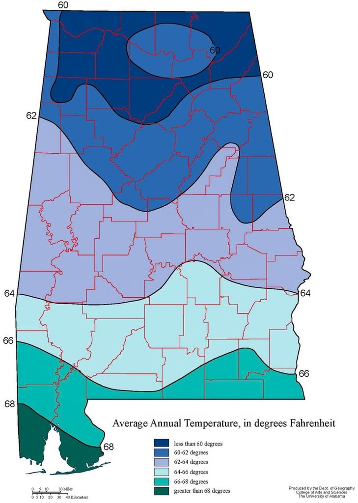
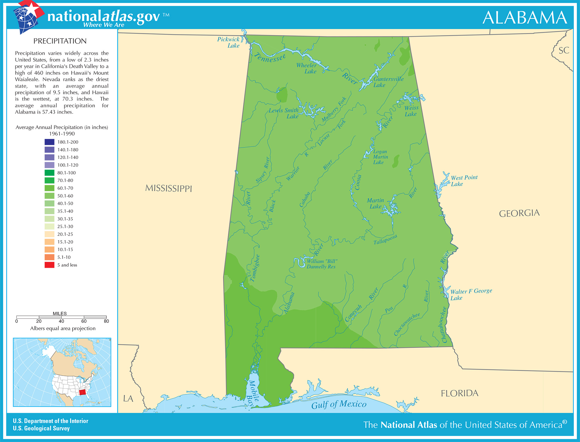
A lot. The state’s 1991 to 2020 average is 56.88 inches (1,445 mm) a year, according to the Alabama state climatologist at UAH. The climate is humid subtropical, which is Cfa on the Köppen scale.
Which highways cross Alabama?
Alabama has eleven Interstates. Those are I-10, I-20, I-22, I-59, I-65, I-85, I-165, I-359, I-459, I-565 and I-759.
I-65 is the longest at about 366 miles (589 km) and links Mobile, Montgomery, Birmingham and Huntsville. I-359 in Tuscaloosa is the shortest at about 2.3 miles (3.7 km).
Tolls are rare. The Foley Beach Express, the last toll road to the Gulf beaches, became free in May 2024 after the state bought it. Drivers continue to pay on the Montgomery Expressway and the Emerald Mountain Expressway near Wetumpka.
What taxes do Alabama residents pay?
| Tax | Rate |
|---|---|
| State income tax | 2% to 5% |
| State sales tax | 4% |
| Average combined sales tax (state and local) | 9.46% |
| Effective property tax rate | about 0.37% |