This post may contain affiliate links. As an Amazon Associate, we earn from qualifying purchases.
The Atchafalaya River is where the Mississippi River wants to flow. The first map up there is an elevation map, which shows just how the Atchafalaya River is a far superior waterway, since it’s deeper and more direct. People have been doing seriously extensive work for a long time to make sure the Mississippi continues flowing to New Orleans.
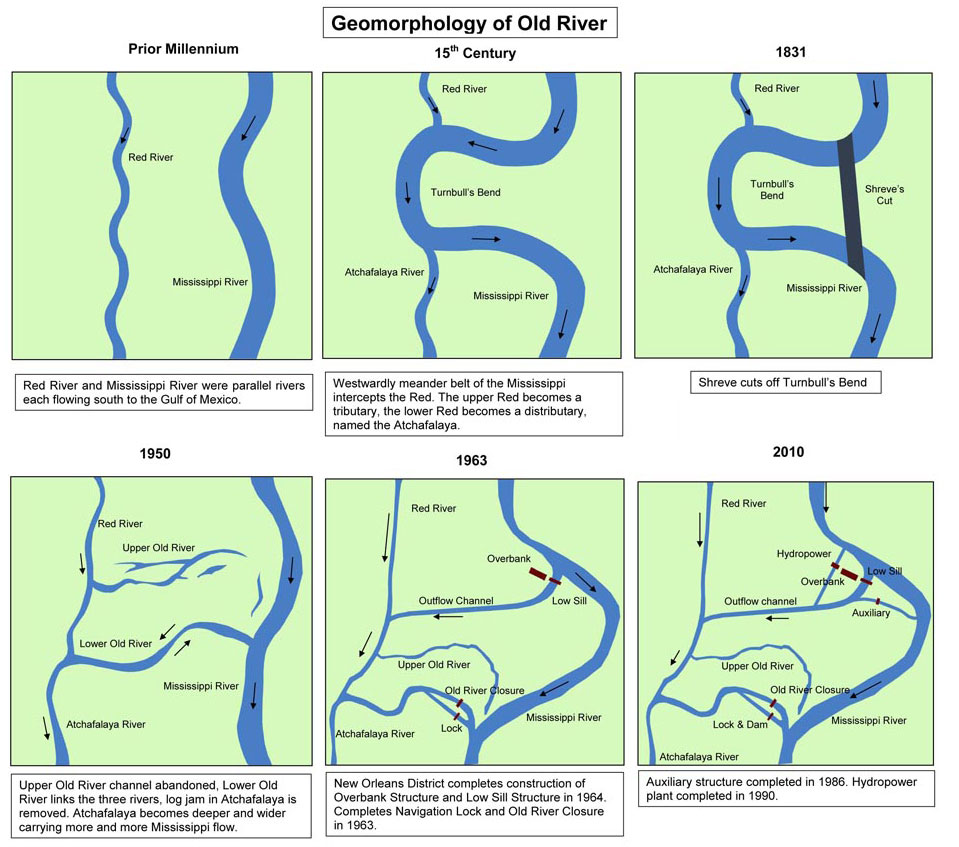
Prior Millennium
Red River and Mississippi River were parallel rivers each flowing south to the Gulf of Mexico.
15th Century
Westwardly meander belt of the Mississippi intercepts the Red. The upper Red becomes a tributary, the lower Red becomes a distributary, named the Atchafalaya.
1831
Shreve cuts off Turnbull’s Bend.
1950
Upper Old River channel abandoned, Lower Old River links the three rivers, log jam in Atchafalaya is removed. Atchafalaya becomes deeper and wider carrying more and more Mississippi flow.
1963
New Orleans District completes construction of Overbank Structure and Low Sill Structure in 1964 Completes Navigation Lock and Old River Closure in 1963.
2010
Auxiliary structure completed in 1986. Hydropower plant completed in 1990.