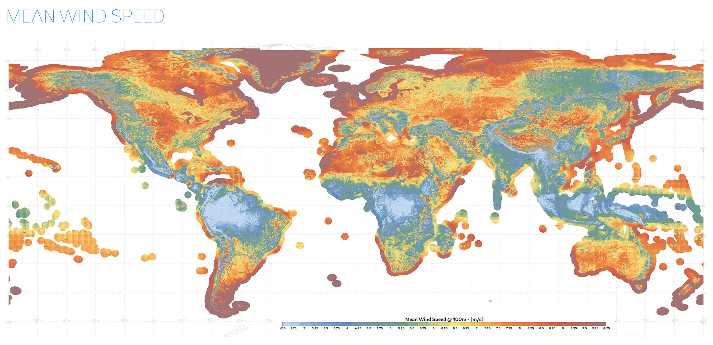
Where does wind blow hardest on our planet? And where does it barely register at all? The Global Wind Atlas maps wind power density globally.
The Technical University of Denmark and World Bank Group compiled this using weather data from 1998 to 2017, broken down to 250-meter resolution. Beyond the renewable energy applications, the maps show atmospheric circulation in action across the globe.
You can explore the interactive version for any location. One note: the modeling sometimes reads high on steep mountain ridges because airflow gets more complicated in rugged terrain.
Commonwealth Bay in Antarctica holds the title of the windiest place on Earth, as reported by Guinness World Records and National Geographic Atlas. Winds there average 50 mph (80 km/h) all year, and gusts often reach over 150 mph (240 km/h).
The interior of Antarctica is a huge ice plateau. Because cold air is heavier, it moves downhill toward the coast and gains speed as it goes. The shape of the bay funnels this wind through a narrow gap, which makes the weather even harsher.
Douglas Mawson’s expedition spent 1911-1914 at Cape Denison. On March 24, 1912, they measured 109 mph (176 km/h) winds with gusts they estimated over 168 mph (270 km/h). Three years in that.
The single strongest gust ever recorded was 253 mph (408 km/h) on Barrow Island, Australia during Cyclone Olivia in 1996.
The Amazon basin near the Brazil-Colombia border at 68° west and 0° latitude is different. Average wind speed is 1.55 m/s (3.5 mph or 5.6 km/h). Commonwealth Bay is 45 times windier than that Amazon spot.
This spot is in the Intertropical Convergence Zone. Trade winds from both hemispheres meet here, but instead of blowing sideways, the air goes up. Surface winds stay weak. Sailors called similar ocean areas “the doldrums” because ships would sit there for weeks with no wind to move them.
Gabon, Congo, DR Congo, Sumatra, Indonesia, and Malaysia have the same conditions. All equatorial forests where air rises more than it blows horizontally.
Catalina Foothills, Arizona averages 1.1 mph (1.77 km/h) annually—the least windy US city.