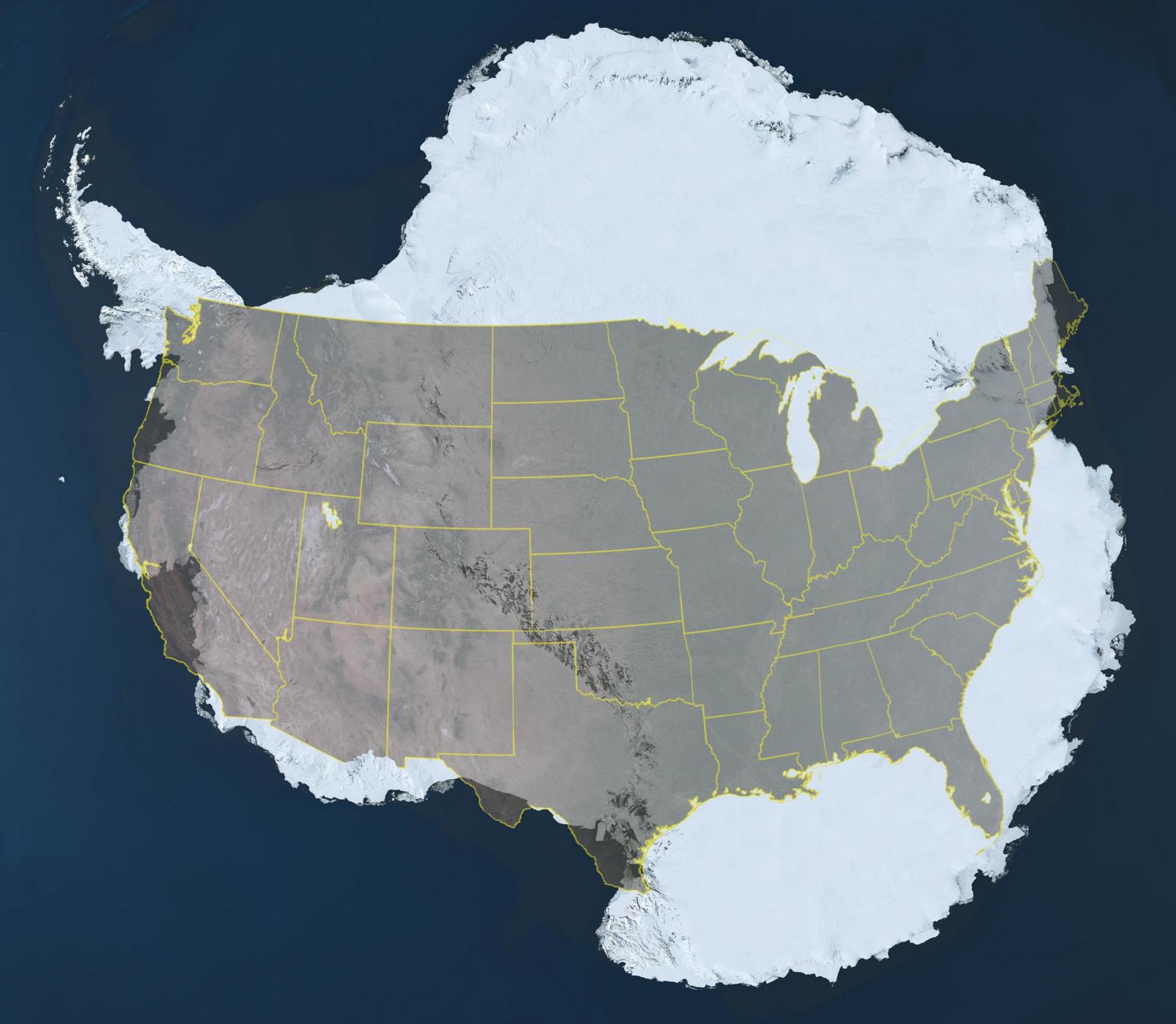
Antarctica covers around 14.2 million square kilometres (5.5M sq mi), roughly one and a half times the size of the United States. The coldest continent on Earth, the driest, the windiest, and the highest. It is also the only one that legally belongs to nobody.
Antarctica and the United States size comparison. Source: NASA.
The Antarctic Treaty, signed in 1959 and in force since 1961, froze all territorial claims and banned military activity across the continent. More than 50 countries have ratified it. A separate environmental protocol, signed in 1991, specifically prohibits mining and resource extraction. That protocol can be reviewed after 2048. The outcome of that review is far from settled.
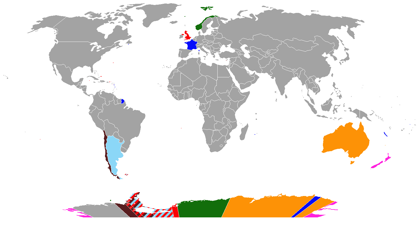
Map of territorial interests in Antarctica
Before the treaty froze their claims, Argentina, Australia, Chile, France, New Zealand, Norway, and the United Kingdom each asserted sovereignty over sectors of the continent. Australia’s sector is the largest, covering roughly 42% of the total landmass. Marie Byrd Land in West Antarctica has never been claimed by any country. These claims remain on paper, inactive but not withdrawn.
Map of antarctic territorial claims
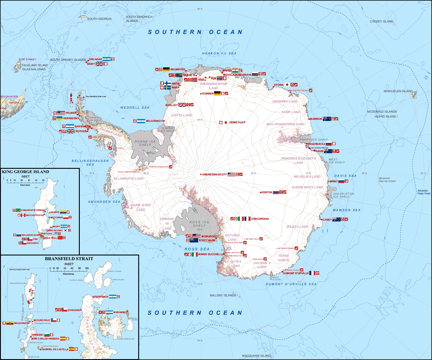
Today about 70 stations from around 30 nations operate across Antarctica. The nations holding territorial claims have generally kept their stations within their own sectors. The United States, Russia, and China have not. They have built stations wherever the science requires, regardless of whose claimed territory the land falls under.
Research stations have the highest summer population. Below is the Antarctic population of research stations, as listed in the Antarctic Atlas.
The summer population across all stations reaches around 4,000. In winter it falls to roughly 1,000. At least 11 people have been born on the continent. The first was Emilio Marcos Palma, an Argentine, on 7 January 1978.
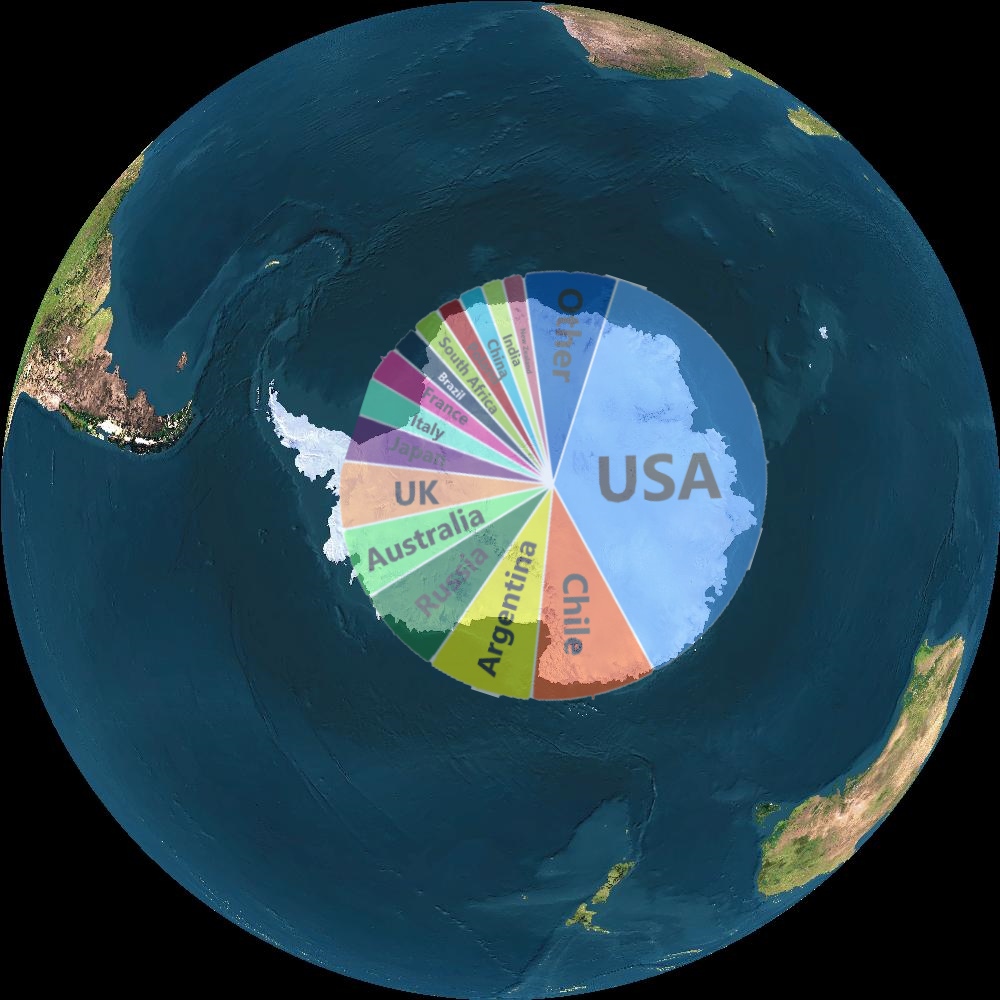
If the 2048 review opened the question of ownership, several models have been proposed for how Antarctica might be divided. One approach splits it among the nations with the most active research presence.
Antarctica is divided correspondingly between countries with the most researchers
Another assigns each country the geographically nearest sector of the continent, based on which nation or territory lies closest to each point in Antarctica.
Antarctica is split into areas depending on which nation (or dependency) is nearest to any given location
A third is the Frontage Theory, developed by Brazilian geographer Therezinha de Castro. It assigns each point in Antarctica to the first country encountered when moving directly north from it along a line of longitude. Under her model, countries with a broader longitudinal span in the southern hemisphere receive larger Antarctic claims.
Map of claims to Antarctica if the “Frontage Theory” were universally implemented
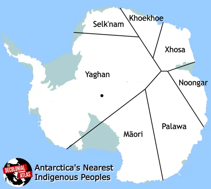
The Decolonial Atlas takes a different approach entirely, assigning sectors to the nearest indigenous peoples rather than to governments. The Yaghan and Selk’nam of South America. The Māori of New Zealand. The Palawa of Tasmania. The Noongar of southwestern Australia. The Xhosa and Khoekhoe of southern Africa. None of them were called to the original negotiating table.
Map of Antarctica’s nearest aboriginal peoples
The stakes behind all of this are considerable. Some estimates put Antarctica’s potential oil reserves at around 200 billion barrels. Climate projections suggest parts of West Antarctica may eventually develop conditions resembling sub-polar regions further north, making the continent’s northernmost areas potentially suitable for limited human activity. Antarctica’s only two native flowering plants, Antarctic hair grass and Antarctic pearlwort, are already spreading further south as temperatures rise.
The Antarctic Treaty has held for more than 60 years. The 2048 review will be its first serious test.








no commenting I HATE COMMENTING
me too >:(