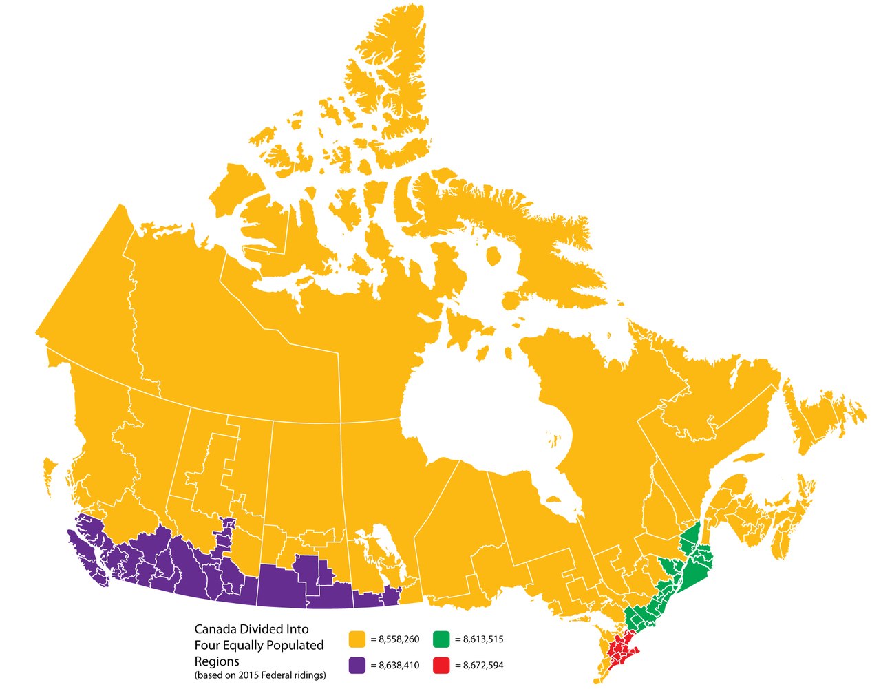
Canada Divided Into Four Equally Populated Regions
Canada covers almost 10 million square kilometres (around 3.85 million square miles) — more land than any country except Russia. You might expect people to be spread across that whole space, but Canada’s about 41.7 million residents (2025) mostly live in a thin band just above the U.S. border. That’s where the big cities are, where winters are shorter and where the main transport links run. North of that belt the land stretches for thousands of kilometres, but the towns are small and far apart.
This comes through clearly in a map by political scientist Ian Bremmer. He drew four regions, each holding roughly the same number of people (about 8.6 million). One region covers nearly the entire North and Prairie provinces; another fits into a small area of southern Ontario. Seeing the country carved up that way makes the population imbalance impossible to miss.
Here are the ten largest cities in Canada (2021 Census) with their provinces:
| Rank | City | Province | Population |
|---|---|---|---|
| 1 | Toronto | Ontario | 2,794,356 |
| 2 | Montréal | Quebec | 1,762,949 |
| 3 | Calgary | Alberta | 1,306,784 |
| 4 | Ottawa | Ontario | 1,017,449 |
| 5 | Edmonton | Alberta | 1,010,899 |
| 6 | Winnipeg | Manitoba | 749,607 |
| 7 | Mississauga | Ontario | 717,961 |
| 8 | Vancouver | British Columbia | 662,248 |
| 9 | Brampton | Ontario | 656,480 |
| 10 | Hamilton | Ontario | 569,353 |
All of these cities sit well down in that southern belt. Some neighbourhoods in Windsor, Ontario or parts of British Columbia actually lie south of areas of Minnesota, North Dakota and other northern U.S. states. Because of that, winters there can feel milder than many Americans might expect.


