Iran’s Climate Map
When people think of Iran, they might imagine desert heat and endless arid plains. But that’s only part of the picture. Iran’s climate is surprisingly diverse, shaped by high mountains, inland plateaus, forested coastlines, and vast deserts. It’s a country where you can ski in the Alborz Mountains in the morning and catch a warm breeze on the Persian Gulf by evening.
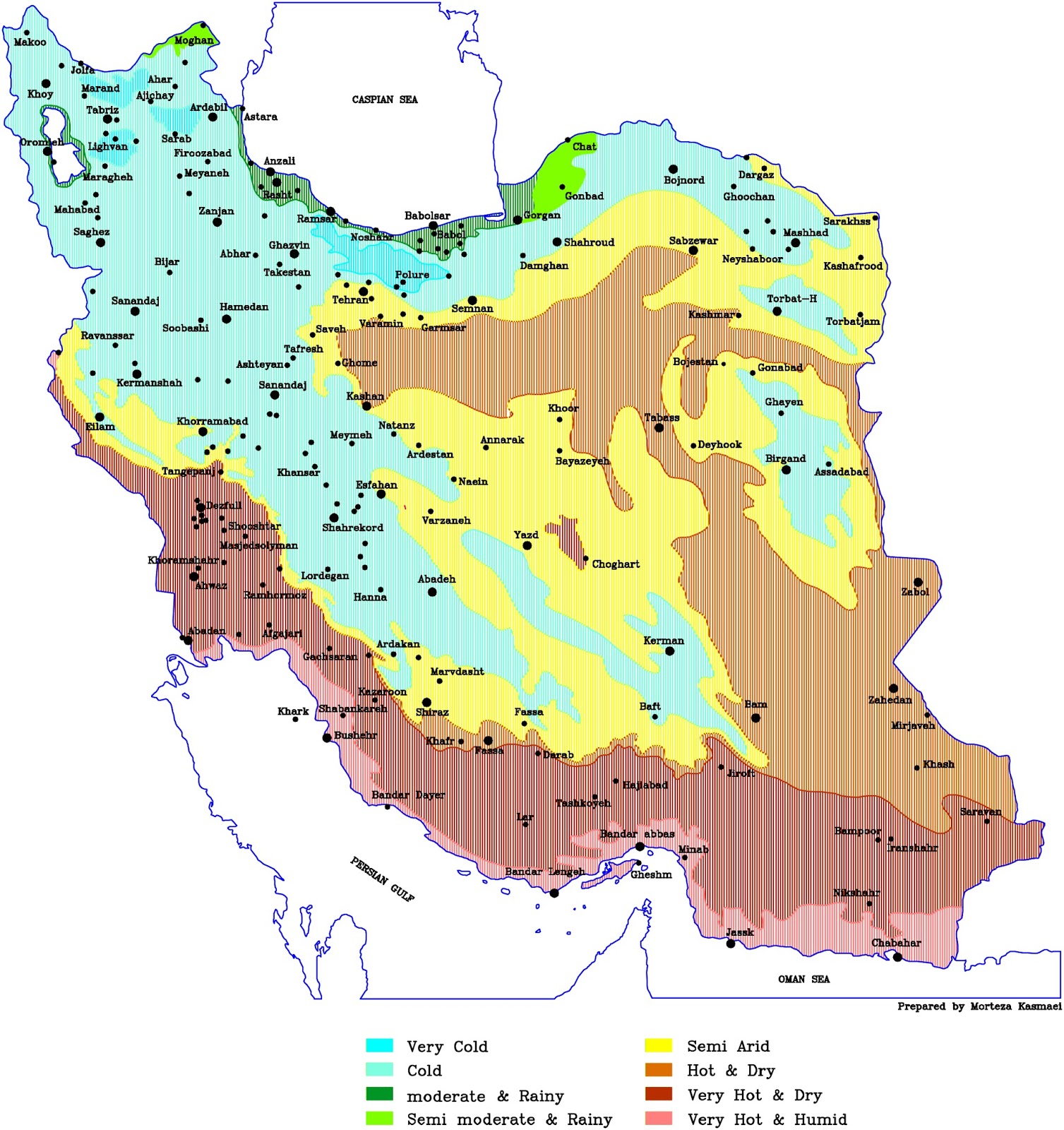
A look at the map created by Morteza Kamrani shows just how varied the country’s climate zones really are. From “Very Cold” to “Very Hot & Humid,” nearly every major climate type found in the Northern Hemisphere shows up within Iran’s borders.
A Land of Elevation and Extremes
Iran’s topography has a huge influence on its climate. The towering Zagros and Alborz mountains act as natural barriers, trapping moisture in some regions while shielding others from rain. The high plateau that covers much of the interior sees cold winters and scorching summers—what you’d expect from an area with little water and lots of sun.
In contrast, the Caspian coast in the north, particularly provinces like Gilan and Mazandaran, receives a lot of rainfall and stays relatively humid and mild. That green strip along the sea stands out on the map as “Moderate & Rainy,” fed by moist air funneled in from the sea and trapped by the Alborz range.
The North: Cool and Wet
Cities like Rasht and Lahijan sit in Iran’s rainiest region. Known for its rice paddies and tea fields, this zone has a temperate climate, something like the Black Sea coast of Turkey or even parts of northern Italy. Here, fog, mossy rooftops, and thick forests are common—a different world from the sunbaked deserts of the south.
The West and Northwest: Cold Mountains
Moving west and northwest, into areas around Kurdistan, Kermanshah, and Tabriz, things get much colder, especially in winter. The high elevation and mountainous landscape mean heavy snowfall, icy roads, and long winters. You’ll notice “Cold” and “Very Cold” zones marked on the map across these provinces.
Central Plateau: Dry and Drastic
Most of Iran’s interior—including cities like Yazd, Kerman, and Esfahan—falls into the “Hot & Dry” or “Very Hot & Dry” categories. These areas experience massive temperature swings between day and night. Summer days often climb above 40°C (104°F), while winter nights can dip below freezing.
Water is scarce here, and agriculture relies on ancient systems like qanats—underground aqueducts first developed over 2,500 years ago. These dry zones are the reason why Persian architecture includes so many clever solutions: thick mud walls for insulation, tall windcatchers (badgirs) for cooling, and shaded courtyards for comfort.
The South: Scorching and Humid
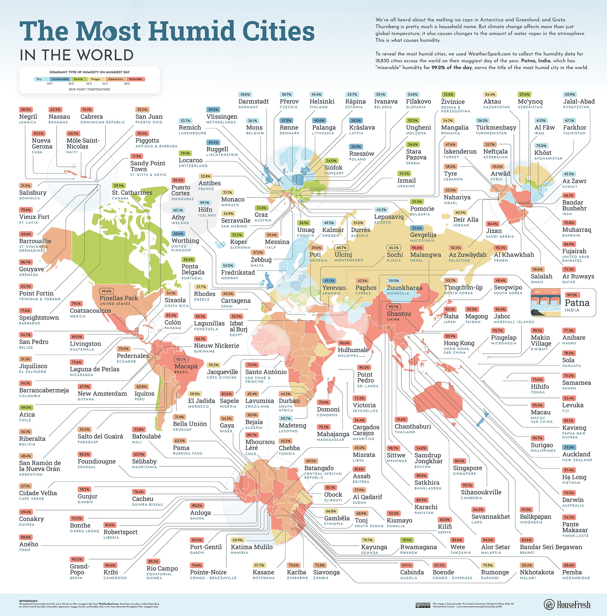
Then there’s the Persian Gulf and the Oman Sea coastline. Provinces like Hormozgan, Bushehr, and Sistan and Baluchestan experience some of the most extreme heat and humidity in the world. On the map, this region appears as “Very Hot & Humid.” Cities like Bandar Abbas regularly top 45°C (113°F) in summer, and the humidity can make it feel even more intense.
It’s no wonder that life in this region follows the rhythm of heat: shops close during the hottest hours, people rest indoors, and streets only come alive after sunset.
Iran’s climate varies widely, and so does life across its regions. These weather differences shape where people settle, what they farm, and how they adapt their homes and daily routines.

