Hawaii sits farther from other landmasses than almost any island group on Earth — volcanic peaks that Polynesians found by sailing outrigger canoes across thousands of kilometers of open ocean centuries ago. Most maps squeeze the archipelago into a tidy rectangle, but the actual layout sprawls much wider. Tally up every minor rock and individual islet and you get about 137 named islands, islets and atolls. The combined land area comes to roughly 16,635 km² (6,423 mi²), or about 28,314 km² (10,932 mi²) when you include inland waters.
The chain formed as the Pacific Plate crept northwest over a hotspot locked in place deep in the mantle. Magma pushed up and piled into volcanoes. The Big Island erupts regularly and adds new coastline in the southeast. Old volcanic stumps sit hundreds of kilometers northwest, worn down by wind and waves over millions of years. Each island marks where the plate was when magma broke through.
Polynesian navigators crossed thousands of kilometers of open water to settle these islands sometime in the early first millennium CE. They developed an island culture that unified into a kingdom. The US annexed Hawaii in 1898. On August 21, 1959, it joined as the 50th state. The 2020 census counted1,455,271 residents, most of them on Oʻahu.
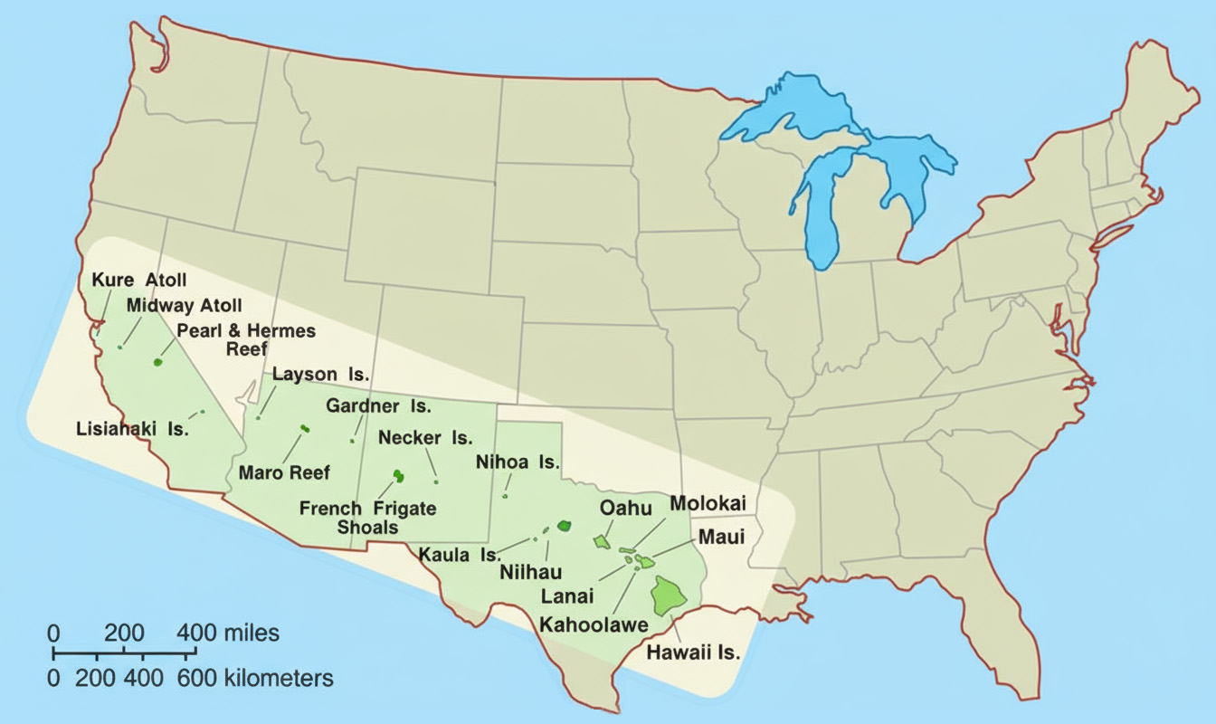
Kure Atoll to the Big Island spans about 2,450 km (1,520 mi) — roughly the distance you’d cover driving from New York to Denver. Tiny atolls and bare rock pinnacles are sprinkled across the northwestern section. Nobody lives on most of them. Some are just pinnacles sticking out of the water. But they anchor Hawaii’s maritime boundaries and extend the state far beyond the main islands.
Trade winds blowing across thousands of kilometers of ocean keep coastal areas at 23–29 °C (73–84 °F) throughout the year. Rain is different. Windward slopes catch clouds coming off the Pacific and stay wet. Drive to the leeward side and you hit a rain shadow — dry, sunny, sometimes sparse vegetation. You can cross from rainforest to near-desert in half an hour on some islands.
The table below shows named features across the archipelago.
Island
Area (km²)
Area (mi²)
Inhabited Places
Hawai‘i (Big Island)
10,432
4,028
Hilo, Kailua-Kona, Waimea, Pāhoa, Volcano
Maui
1,883
727
Kahului, Wailuku, Lahaina, Kīhei, Hāna
O‘ahu
1,545
597
Honolulu, Kailua, Kaneohe, Wahiawa
Kaua‘i
1,430
552
Līhu‘e, Kapa‘a, Hanalei, Waimea
Moloka‘i
673
260
Kaunakakai, Maunaloa
Lāna‘i
364
141
Lāna‘i City
Ni‘ihau
180
70
Pu‘uwai
Kaho‘olawe
117
45
Uninhabited (former military site)
Pearl and Hermes Atoll
80 (lagoon area)
31
Uninhabited
Kure Atoll
10 (lagoon area)
4
Green Island (wildlife refuge station)
Midway Atoll
6.2
2.4
Sand Island settlement (U.S. Fish and Wildlife staff)