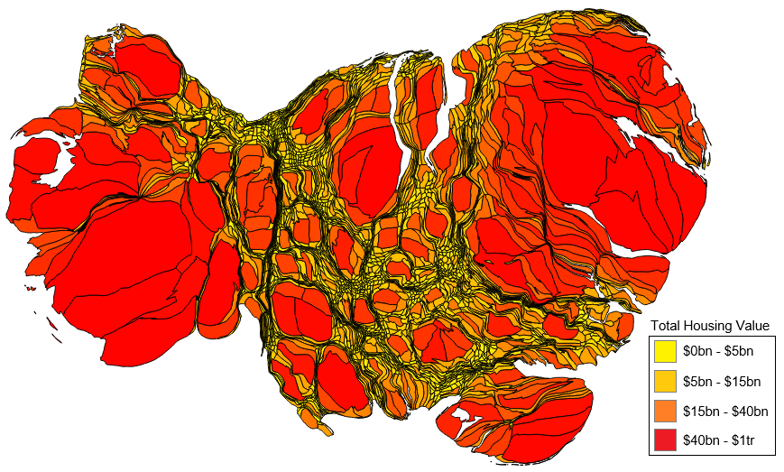
Exactly — that’s the point of the cartogram. It resizes areas based on total property value instead of land area. Even though rural regions make up the vast majority of the country’s physical land, they represent a much smaller share of overall property value. Cities and metro areas balloon in size because that’s where the highest concentrations of valuable real estate are (dense housing, commercial property, high prices). The huge rural ’empty’ spaces shrink dramatically, which really highlights how unevenly wealth in real estate is distributed across the US.
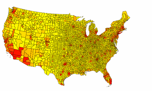


It looks like it’s just popular cities. Anyway, pretty cool.
Exactly — that’s the point of the cartogram. It resizes areas based on total property value instead of land area. Even though rural regions make up the vast majority of the country’s physical land, they represent a much smaller share of overall property value. Cities and metro areas balloon in size because that’s where the highest concentrations of valuable real estate are (dense housing, commercial property, high prices). The huge rural ’empty’ spaces shrink dramatically, which really highlights how unevenly wealth in real estate is distributed across the US.