Soil Map
Alfisols form in semiarid to humid areas, typically under a hardwood forest cover. They have a clay-enriched subsoil and relatively
Read more: Soil Map
Maps depicting environmental degradation across planet.
Alfisols form in semiarid to humid areas, typically under a hardwood forest cover. They have a clay-enriched subsoil and relatively
Read more: Soil MapWincenty Okołowicz was a Polish geographer and climatologist. He is best known as the author of the World’s climatic zones
Read more: Climates classification by Wincenty OkołowiczPredicted extinction risks by regions. Predicted extinction risks from climate change differ by region. The highest risks characterized South America,
Read more: Global warming could drive 1 in 6 of Earth’s species to extinctionPlastic debris has now become the most serious problem affecting the marine environment, not only for coastal areas of developing
Read more: Concentrations of plastic debris in surface waters of the global oceanInformation from the GOCE gravity satellite that ran out of fuel and fell to the earth two years ago, is
Read more: Geothermal energy sites around the world26% of the world’s mammals are threatened. The map above shows the 4 countries with over 90 threatened mammal species
Read more: Most threatened mammals in the worldСarbon dioxide levels differ in the northern and southern hemispheres and distinct swings in global CO2 concentrations as the growth
Read more: A Year In The Life of Earth’s CO2Fine-scale patterns of terrestrial diversity. (A) The numbers of threatened mammal species and (B) those with ranges smaller than the
Read more: Map of threatened mammals and amphibiansThe average rainfall for the continent is about 670 mm per year but the spatial and temporal distribution is very
Read more: Renewable water resources in AfricaThe Rainforest Alliance’s work is driven by the principle that the health of the land is inextricably linked to the
Read more: The Rainforest Alliance’s global reach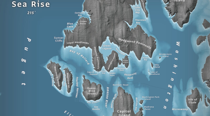
What happens to Seattle when 66 meters of water flood Puget Sound? Jeffrey Linn used LiDAR elevation data to map the city as an archipelago, where Capitol Hill becomes “Capitol Island” and the Space Needle turns into the “Sea Needle.” He created two versions with different cartographic styles.
Read more: Islands of Seattle