Information from the GOCE gravity satellite that ran out of fuel and fell to the earth two years ago, is now being used by scientists from ESA and the International Renewable Energy Agency (IRENA) to create maps of geothermal energy around the world. The data shows well-known geothermal hot spots as well as some that were unknown before now.
“These maps can help make a strong business case for geothermal development where none existed before,” said Henning Wuester, Director of IRENA’s Knowledge, Policy and Finance Centre. “In doing so, the tool provides a shortcut for lengthy and costly explorations and unlocks the potential of geothermal energy as a reliable and clean contribution to the world’s energy mix.”
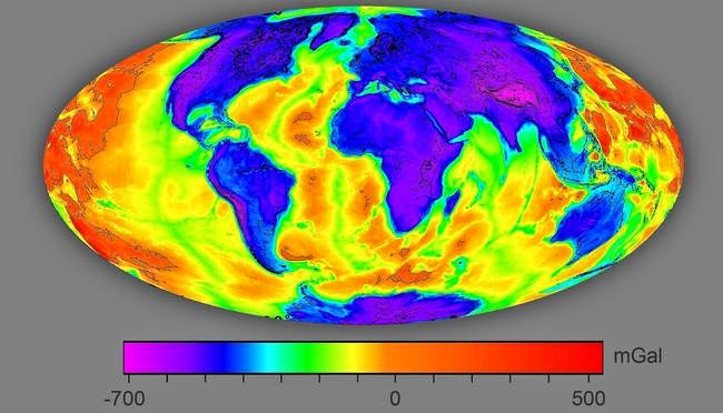
The gravity anomalies that were mapped were ‘free air’ and ‘Bouguer.’ The free air map provides information on geological structures while the Bouguer map uses the GOCE data along with global topography to show differences in crustal thickness around the world. When you combine both sets, you get a clear picture of where geothermal reservoirs exist.
Once scientists use the map to pinpoint good locations for energy harvesting, they will still have to perform surveys and measurements to figure out where best to extract the energy, but the maps get us one step closer to that energy than we were before and all that’s required is looking at a map.
The satellite’s data will also be used by scientists to study ocean circulation, sea level, ice changes and the earth’s interior, all valuable information for monitoring climate change.