Amsterdam’s map showing valuation of property
This map shows the ranges of neighbourhood street quotes in Amsterdam. The neighbourhood street quote is used to calculate the
Read MoreThis map shows the ranges of neighbourhood street quotes in Amsterdam. The neighbourhood street quote is used to calculate the
Read MoreRed diamonds represent a low School Proficiency Index while green diamonds represent high. Diamond sizes signify Median Home Value for
Read MoreIn recent years, an increasing number of terrorist attacks have shocked communities around the world. Many of the gravest attacks
Read More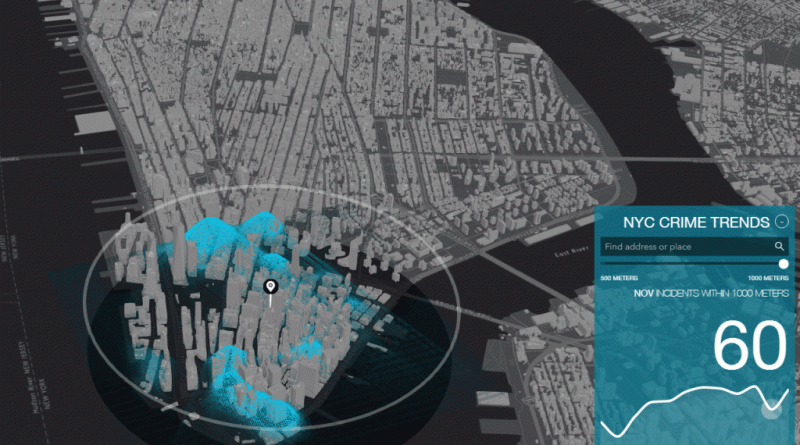
Via coolmaps.esri.com Related posts: – New York City felonies map – New York City crime rank – Death map New York – The gangs
Read MoreThe best buildings marked in purple. Via amsterdam.nl
Read MoreA Zip Code’s score is a number between 0 and 99, which represents the average of its percentile rank amongst
Read MoreHigh School Graduation % in the United States in 2015.
Read More