Chernobyl disaster mapped
The Chernobyl catastrophe took place on 26 April 1986 at the Nuclear Power Plant, near the town of Pripyat in the USSR. It is considered the worst nuclear disaster in history. The accident response and decontamination cost about 18 billion rubles or approximately US$68 billion in 2019 (corrected for inflation).
The core melted down, and two detonations broke up the reactor core and crushed the reactor construction. Open-air reactor core fire distributed substantial aerial radioactive pollution for about 9 days that precipitated onto parts of the Soviet Union and Europe, before subsequently ending on 4 May 1986. About 70 percent of fallout landed in Belarus, 16 kilometers or 9.9 miles away. The fire issued about the same volume of contamination as the initial detonation. About 68 thousand people were departed from Exclusion Zone and the town of Pripyat encompassing an area of roughly 2.6 thousand sq km (1 thousand sq mi).
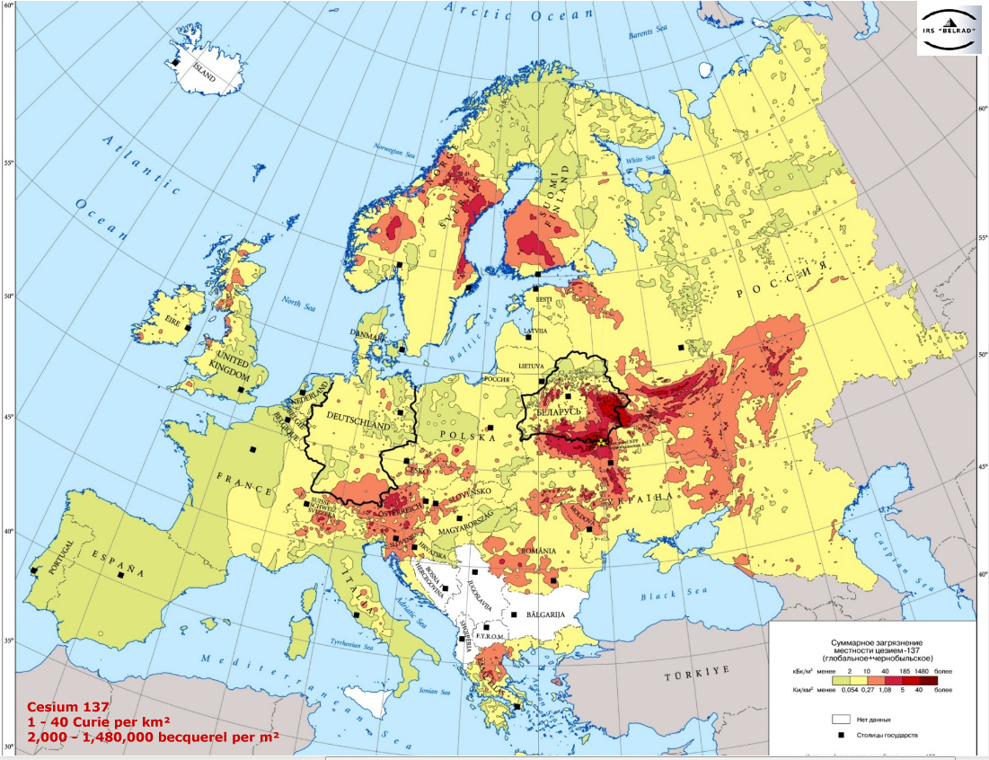
The map below, created by Reddit user Stoplizardtrump3, shows how a cloud of radiation engulfed Europe during the 1986 Chernobyl disaster.

Below is the Russian map that shows radioactive fallout from Chernobyl disaster (Curie/km2).


