What Did Europe’s Map Look Like in the 1500s?
Looking at historical maps of Europe from the 1500s reveals a continent vastly different from what we know today. While modern viewers might try to find familiar country shapes and borders, the reality was far more complex and intriguing.

A Patchwork of Powers
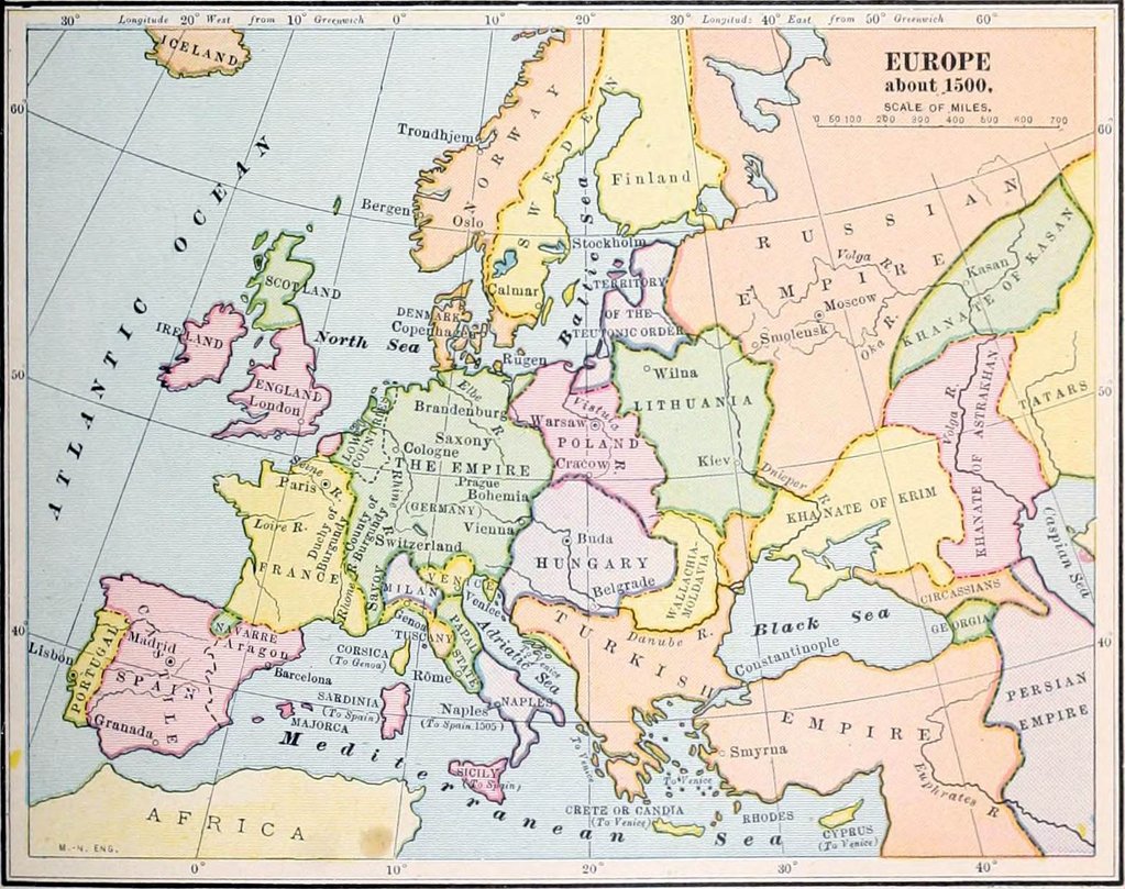
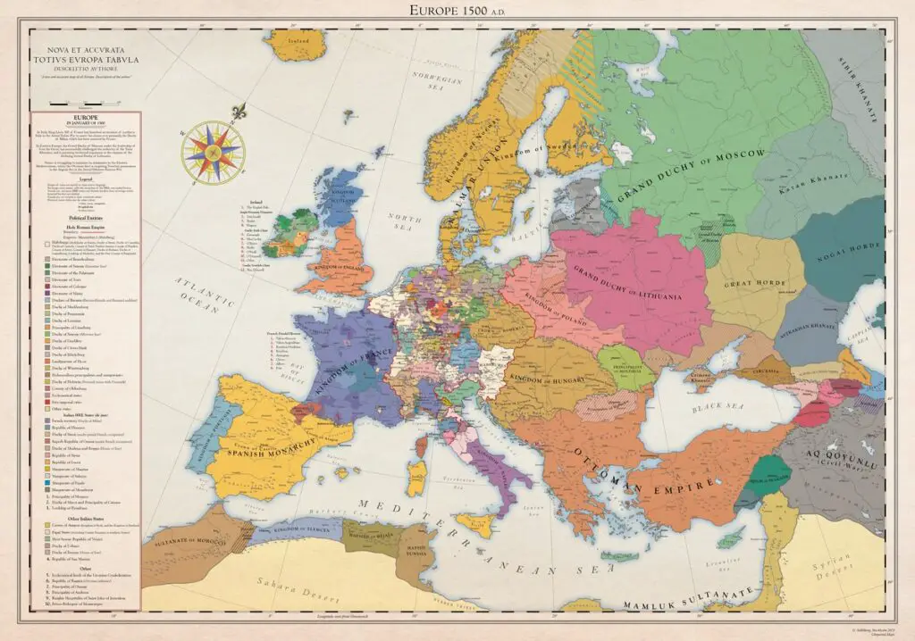
The Europe of 1500 wasn’t organized into neat nation-states as we know them today. Instead, it was a dynamic mix of kingdoms, duchies, city-states, and empires, each with its own unique story:
- The Italian Peninsula was home to powerful city-states like Venice, Florence, and Milan, each controlling vast trade networks and wielding significant cultural influence
- In Central Europe, the Holy Roman Empire operated as a complex federation of semi-independent states
- The Atlantic coast saw the rise of consolidated kingdoms like Portugal and Spain, which would soon dominate global exploration
Here is a detailed map of Europe created by G. Stahlberg.

The Rise of Great Dynasties
The 1500s witnessed dramatic shifts in power that would reshape Europe’s political landscape. The Habsburg dynasty achieved perhaps the most remarkable expansion in European history:
- In 1519, they unified the Spanish kingdoms, the Netherlands, Flanders, and Austria under one rule
- By 1526, they added Bohemia, Hungary, and Silesia to their territories
- This created an empire where, famously, “the sun never set”
According to recent research from the University of Oxford’s Medieval Studies Department, this Habsburg expansion represented the largest peaceful transfer of power in medieval European history
The Ottoman Challenge
While Western Europe dealt with Habsburg dominance, the East faced the rising Ottoman Empire. Under Sultans Selim I and Suleiman I (known as “the Magnificent”), Ottoman influence expanded dramatically:
- They conquered Syria, Palestine, and Egypt
- They took control of most of Hungary and Wallachia
- Their presence forever changed the religious and cultural makeup of southeastern Europe
Daily Life and Governance
Despite these grand political movements, daily life in 16th-century Europe remained largely local. Recent archaeological findings suggest that:
- Most people rarely traveled more than 20 miles from their birthplace
- Multiple languages and dialects could exist within a single “country”
- Local customs and laws often held more practical importance than royal decrees
Historical maps of this period help us understand these complex political and social relationships. For those interested in decorative historical maps of Europe, here are some high-quality reproductions available on Amazon:
- Antique Map of 16th Century Europe – Beautiful reproduction on aged parchment
- Vintage Map of Europe – Elegantly detailed reproduction with historical borders and decorative elements
- Detailed Holy Roman Empire Map – Focuses on Central European territories
Learning from the Past
Understanding Europe’s map in the 1500s helps us appreciate how modern nations emerged from this complex political landscape. While borders have shifted and empires have fallen, many of the cultural and linguistic regions visible on 16th-century maps continue to influence European politics and society today.


