Bird’s-Eye Map of Greater New York (1897)
")
“First Bird’s-Eye Map of Greater New York”. From photographs taken in the Sunday World’s Sudio Balloon, April 29, 1897.
Issued as a four-fold spread in a late 19th-century newspaper, this large print was meant to be framed “for future reference”, as it shows the landmarks, points of interest, neighborhoods and more. At its top states, “Greater New York Photographed From The Sunday World’s Balloon, One Thousand Feet Above The Ground – The Picture Shows How America’s Largest City Looks From The Clouds – Note All The Points Of Interest.”
Spanning from the northern tip of Manhattan and Westchester, down to Ellis and Staten Island, it stretches out across Long Island out to Far Rockaway and Hollis. Throughout are small vignettes of scenes of life, from boat building to fishing, or even U.S. Troops.
This is our first encounter with this early “air age” type view that actually was referencing physical vantage from above, not a conceptualized imagination of the area. While balloon views can be found centuries prior, this view might include the highest elevation and perspective on the metropolis.
Bird’s-Eye Map of New York City was published in 1870.
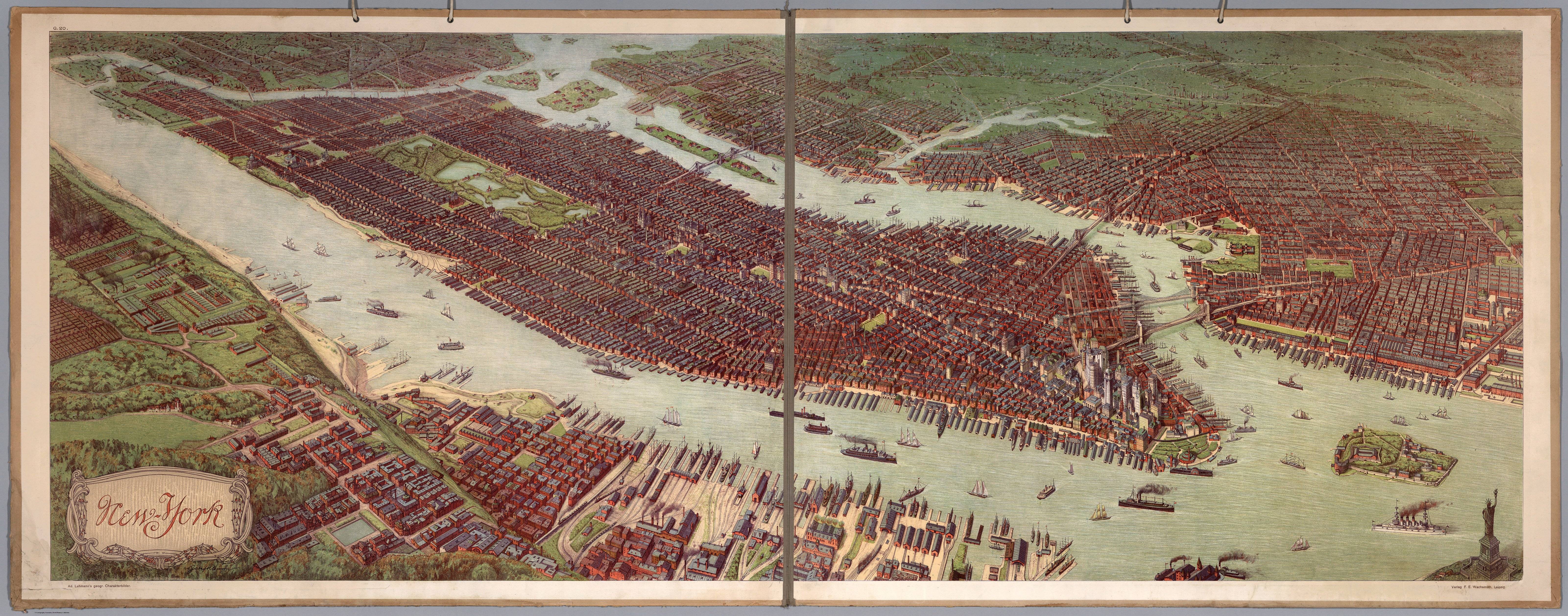
Bird’s Eye View of Manhattan (1908)
Related posts:
– Urban Scratchoff
– Interactive map of New York City in year 1609
– Map of Manhattan by Joan Vinckeboons (1639)
– Map of Manhattan (1865)
– Bird’s-eye-view of the Manhattan, published by Currier & Ives (1870)
– A map of the wondrous isle of Manhattan (1926)


")

