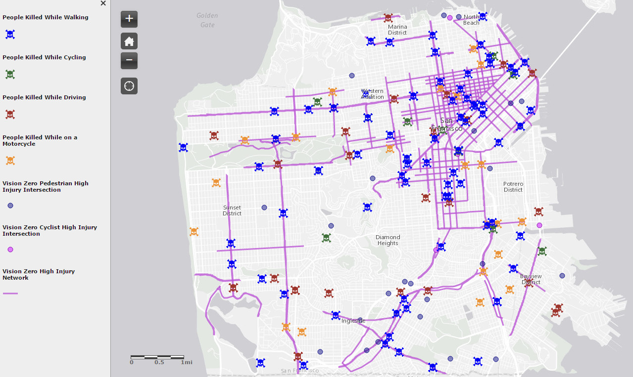
High Injury Network San Francisco Map
The high-injury corridor analysis was conducted by SFDPH in collaboration with SFMTA on behalf of the Citywide Vision Zero Task Force in Fall 2014, utilizing the most recent injury data available through 2012. The Vision Zero High Network was created by assigning intersection-level injury counts to street segments and then using spatial mapping tools to identify corridor-level patterns of injuries. A high-injury network San Francisco Map was first developed for people walking, biking, and finally, a complete Vision Zero network for all modes, including people driving and riding motorcycles.

By adopting Vision Zero as a policy in 2014, the City and County of San Francisco are committed to building better and safer streets, educating the public on traffic safety, enforcing traffic laws, and prioritizing resources to implement effective initiatives that save lives. Through this work, we will create a culture whereby city residents, workers, and visitors prioritize traffic safety and ensure that when people make mistakes while using our streets the result is not serious injuries or death.
This map tracks 57 projects that have been selected as representative of the range of projects and programs that support the advancement of Vision Zero. This is merely a set of projects and programs, it is part of a multi-year effort with an even larger number of efforts that will be implemented to achieve Vision Zero.

Related posts:
– San Francisco violent crimes, hot spot analysis (2003 – 2015)


