Interactive Pangea map with international borders
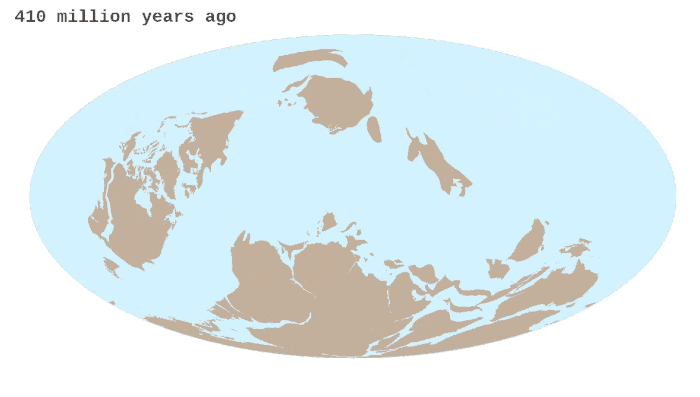
Pangea was a supercontinent that existed during the late Paleozoic and early Mesozoic eras. It assembled from earlier continental units approximately 335 million years ago, fully assembled about 270 million years ago, and it began to break apart about 175 million years ago. In contrast to the present Earth and its distribution of continental mass, much of Pangea was in the southern hemisphere and surrounded by a super ocean, Panthalassa. Pangea was the most recent supercontinent to have existed and the first to be reconstructed by geologists.
The term “Pangaea” was coined by the German meteorologist and geophysicist Alfred Wegener, who proposed the theory of continental drift. The name “Pangaea” is derived from the Greek words “pan” meaning “all” or “entire,” and “gaea” meaning “Earth.”
The formation of Pangaea had a significant impact on Earth’s climate. The supercontinent’s vast size and its position near the equator led to extreme climatic conditions. The interior of Pangaea was hot and arid, while the coastal regions experienced intense monsoons and lush vegetation.
Geologists and paleontologists have reconstructed the approximate positions of the continents during the time of Pangaea by studying rock formations, fossils, and magnetic data. These reconstructions help us understand Earth’s ancient geography and the evolution of life.
As the continents came together, various species of plants and animals were brought into contact for the first time, leading to significant faunal exchange. This resulted in the mixing and diversification of species, contributing to the evolution of new ecosystems.
The formation of Pangaea coincided with several mass extinction events. The most notable was the Permian-Triassic extinction, also known as the Great Dying, which occurred about 252 million years ago and resulted in the loss of approximately 96% of marine species and 70% of terrestrial vertebrate species.
Pangaea started to break apart around 200 million years ago, leading to the formation of the modern continents. The breakup resulted in the opening of the Atlantic Ocean and the separation of the landmasses that we recognize today.
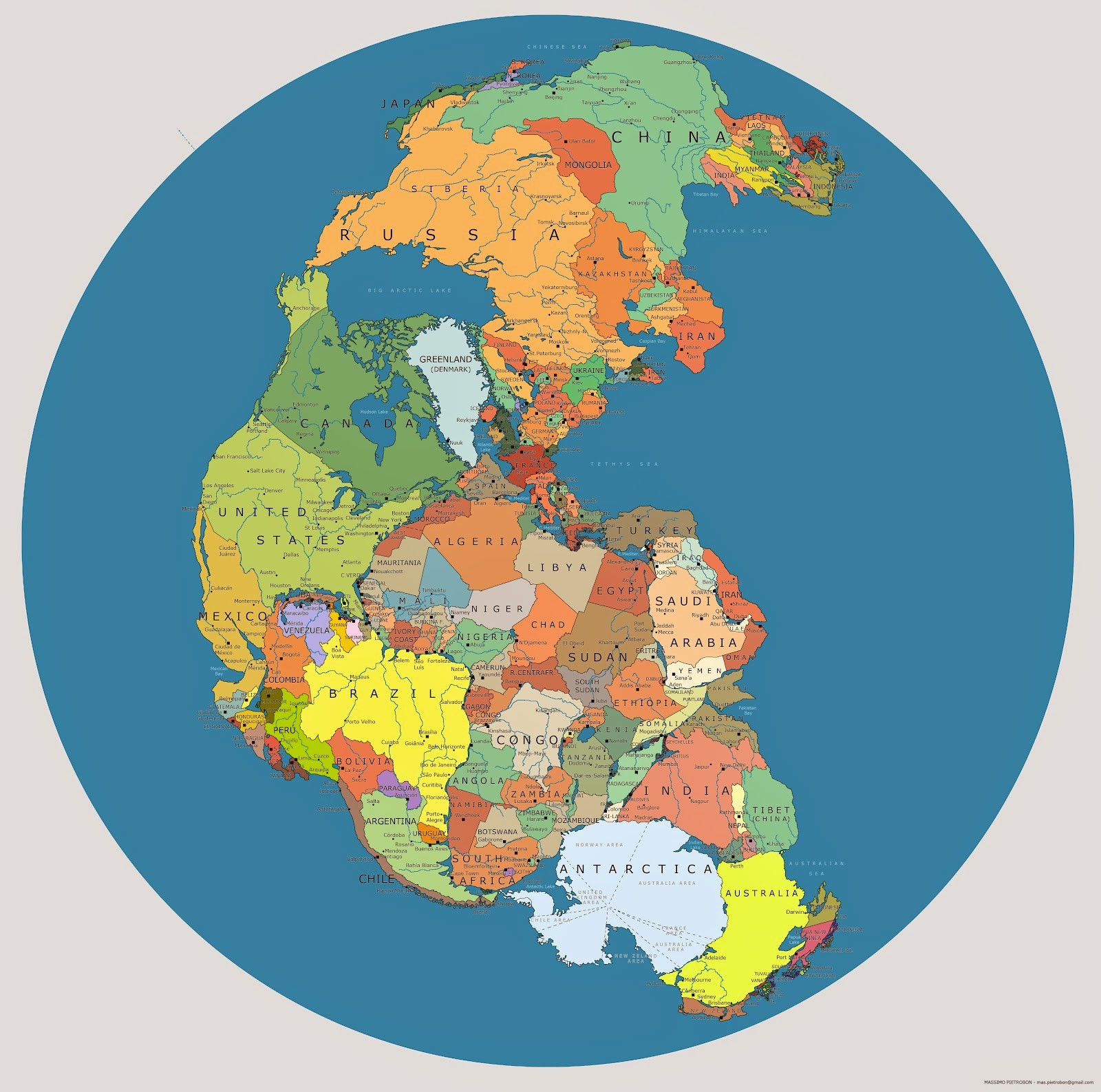
It is interesting to know what the political map of the world would look like if Pangea had not broken up into several continents.

Below is an interactive globe of Pangea with current international borders created by Vibor Cipan.
Here is a more detailed globe of Pangea with current international borders.
Pangaea was not the first or only supercontinent in Earth’s history. It was part of a cycle of supercontinent formation and breakup known as the Wilson Cycle. Over millions of years, supercontinents form, break apart, and then reform in a continuous process. The animated below shows the breakup of Pangea.
Scientists predict that in the future, a new supercontinent called Pangea Ultima may form. This hypothetical supercontinent could take shape over the next 250 million years as the continents continue to drift. However, the exact configuration of Pangea Ultima is uncertain.
Looking for more unusual maps? Then have a look at the following:


hamboger