Seattle developed on terrain the Vashon Glacier carved 13,500 years ago. The ice left behind a series of hills separated by valleys and lower ground. Capitol Hill peaks at 158 meters (520 feet)—the city’s highest point. Queen Anne reaches 139 meters (456 feet). Downtown averages 53 meters (175 feet). The waterfront sits at sea level.
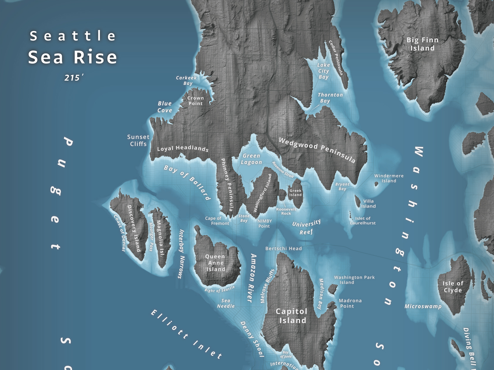
In January 2014, Jeffrey Linn, who works as a campus planner at the University of Washington, posted his first “Islands of Seattle” map on the university’s website. The map was created using available LiDAR data to show what 66 meters (215 feet) of sea level rise would do to the city—roughly the amount expected if all ice sheets melted. He was inspired by blogger Burrito Justice, who created a similar map for San Francisco.
Seattle’s hills survive as islands. Capitol Hill becomes “Capitol Island.” Queen Anne becomes a separate island. The Space Needle, sitting at lower elevation, goes underwater—Linn renamed it the “Sea Needle.” Green Lake becomes “Green Lagoon.”
Linn later created an updated version with different cartographic styling and color schemes. Lake Washington and Puget Sound merge into one body of water. The Lake Washington Ship Canal, currently a narrow waterway, becomes part of a wider strait.
Not all of Seattle’s famous seven hills will survive rising water levels. Denny Hill, which was partially removed during regrading projects in the early 1900s, now stands at just 44 meters (143 feet)—well below the projected waterline. First Hill, at 112 meters (367 feet), will become an island. Beacon Hill, at 111 meters (364 feet), will be surrounded by water.