New Spain at Its Height in 1810
Have you ever thought about how the Americas‘ borders might look nothing like they do if history took a slight turn? In 1810, without the changes coming, the US could have stopped cold at the Mississippi, with spots like California and Texas still under Mexican oversight, and Central America staying bundled together. This map of New Spain catches that moment, when Spain’s hold was massive but about to crack.
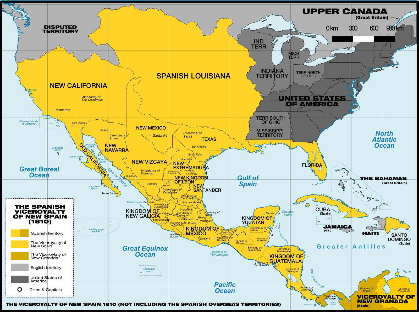
New Spain had built up by then to include the whole of what became Mexico, plus heading south into Guatemala, Belize, El Salvador, Honduras, Nicaragua, and Costa Rica. Northward, it extended way up into the US Southwest, covering California, Nevada, Utah, Arizona, New Mexico, Texas, and bits of Colorado, Wyoming, Kansas, Oklahoma, and Louisiana. Florida remained Spanish through 1819, even if they were losing their firm grip by that point.
It didn’t stop there—the Caribbean brought in Cuba, Puerto Rico, and the Dominican Republic. Across the Pacific, the Philippines, Guam, and Marianas were hooked in via trade paths, where ships hauled silver west and returned with Asian items.
| Region | Key Areas in 1810 |
|---|---|
| North America | Mexico, US Southwest from California to Texas, Florida |
| Central America | Guatemala to Costa Rica |
| Caribbean | Cuba, Puerto Rico, Dominican Republic |
| Pacific | Philippines, Guam, Marianas |
Things shifted quick after. In September, priest Miguel Hidalgo called together people from Dolores and got them riled up to challenge Spanish control, helped along by lousy harvests and Napoleon’s chaos in Europe that left the king weakened. Support poured in fast for him, though he ended up captured and executed in 1811. But the effort didn’t stop—others stepped in, and after drawn-out battles, Mexico went independent in 1821, followed by the other regions forming their own nations. From one big piece to around 20 countries.


