Historical MapsPolitical maps 
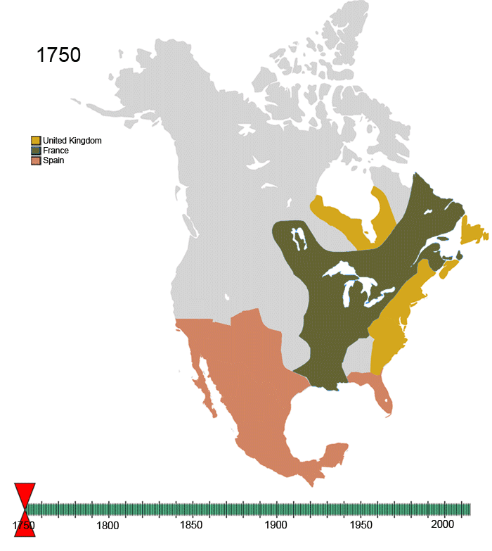
North American political boundaries (1750-2015) July 29, 2015 Alex Related Posts:Predominant ancestry in the U.S.The Rise and Fall of Civilizations: An Animated Map…The Oldest Cities in the U.S. MappedThe age of borders: when were the world's current…American Indian Population by County (1990 – 2022)Evolution of United States Standard Time Zone BoundariesThe countries & US states that offer the cheapest…River Basins as Countries: A New World Map