There are 50 states in the U.S., which means about fifty unique stories reveal how every state got its shape.
According to Mark Stein, author of the work “How the States Got Their Shapes,” there was six of the most significant influences that managed the shapes of the states:
The American Revolution
Natural geographic barriers
Longitude and latitude lines
The construction of railroads
The 1808 proposal for the Erie Canal
The political disagreements over the problem of slavery
The American Revolution helped determine the shapes of the first 13 colonies that became the New England states.
The shapes of the most initial states were frequently determined by natural geographic barriers, such as rivers and mountains. For example, New Hampshire and Vermont are divided by the Connecticut River, California and Arizona are divided by the Colorado River, Indiana and Kentucky are separated by the Ohio River.
Moreover, Congress used longitude and latitude lines to create western states similar in shape and size.
For instance, Washington, Oregon, Wyoming, Colorado, North Dakota, and South Dakota are all approximately 7 degrees longitude wide (~483 miles). Besides, Kansas, Nebraska, North Dakota, and South Dakota are all nearly 3 degrees of latitude tall (~207 miles).
With the development of national railroads, the shapes of U.S. states didn’t depend as much on the natural ways as rivers. Railways started to shape where one state ended and another began. The building of the Erie Canal also changed the shapes of states in the regions it crossed.
The problem of slavery also assisted in molding the states’ shapes in the territory added in the Louisiana Purchase of 1803. The Missouri Compromise of 1818 set basing state lines in the region where slavery was allowed. It permitted slavery in states with northern boundaries below 36 degrees, 30 minutes north latitude.
Finally, рnlike other states, California and Texas рфму determined their own borders.
What might the states’ shape have been if other influences, for example, cultural and economic relations, had been used to form state boundaries?
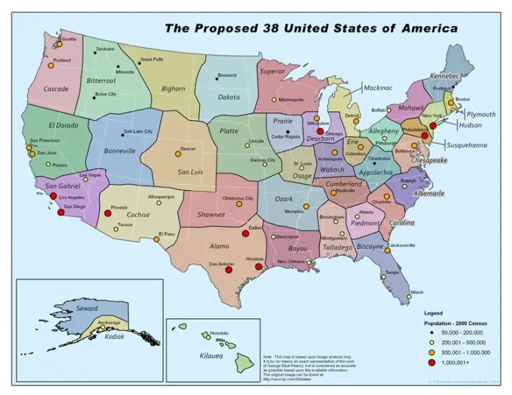
Below are the 38 States of America, proposed by George Etzel Pearcy in 1973, based on cultural and economic relations of existing regions.
Here a mapping experiment was created by Andrew Shears to visualize alternative results for various failed state partition proposals throughout U.S. history. This map was not created to propose redrawing states; instead, it is a creative work based very loosely on historical ideas and events.
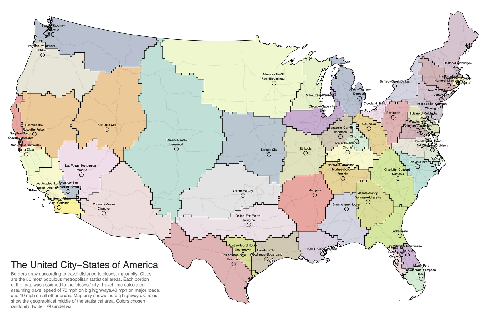
At present, it may be more rational to draw the boundaries between the states, taking into account the location of major cities and highways.
Reddit user desfirsit redrawn borders so that each part of the map is assigned to the nearest (in travel time) of the 50 U.S. largest metropolitan areas.
I’m writing a post of an alternative election of the Senate. The 50 city-states map is very inventive and provocative.
Could I use it there with a citation you specify?
Mr Right
1 year ago
You have too many states in the NE. One state called New England should include NY, RI, CT, MA, ME, NH, VT. They are all ideologically the same. what about having the east half of CA be part of NV? Otherwise its an interesting map.


")

?")

I’m writing a post of an alternative election of the Senate. The 50 city-states map is very inventive and provocative.
Could I use it there with a citation you specify?
You have too many states in the NE. One state called New England should include NY, RI, CT, MA, ME, NH, VT. They are all ideologically the same. what about having the east half of CA be part of NV? Otherwise its an interesting map.