If I had to guess how you got to work this morning, I’d bet money you drove. By yourself. Am I right?
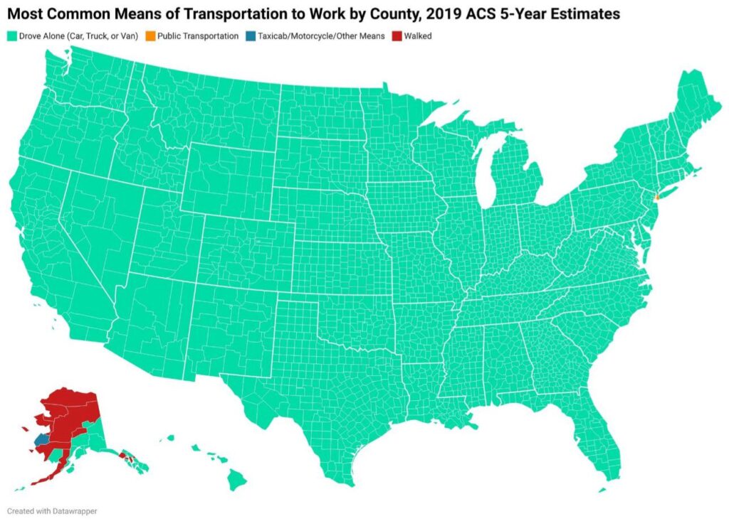
Looking at this first map from the 2019 American Community Survey, I can see I’d win that bet in almost every county across the US.
Sea of teal. Drive alone, drive alone, drive alone. The only real standout? New York City, glowing orange where people actually take the subway to work like civilized humans.
I dug into the numbers and found something pretty wild. Nationally, just 5% of workers use public transit. That’s it. Five measly percent. Meanwhile, my neighbors can’t figure out why traffic is so bad.
But that 5% is misleading as hell. Out in rural areas, good luck finding a bus route. In big cities though? Sometimes a quarter or even a third of people hop on trains and buses. The difference is night and day.
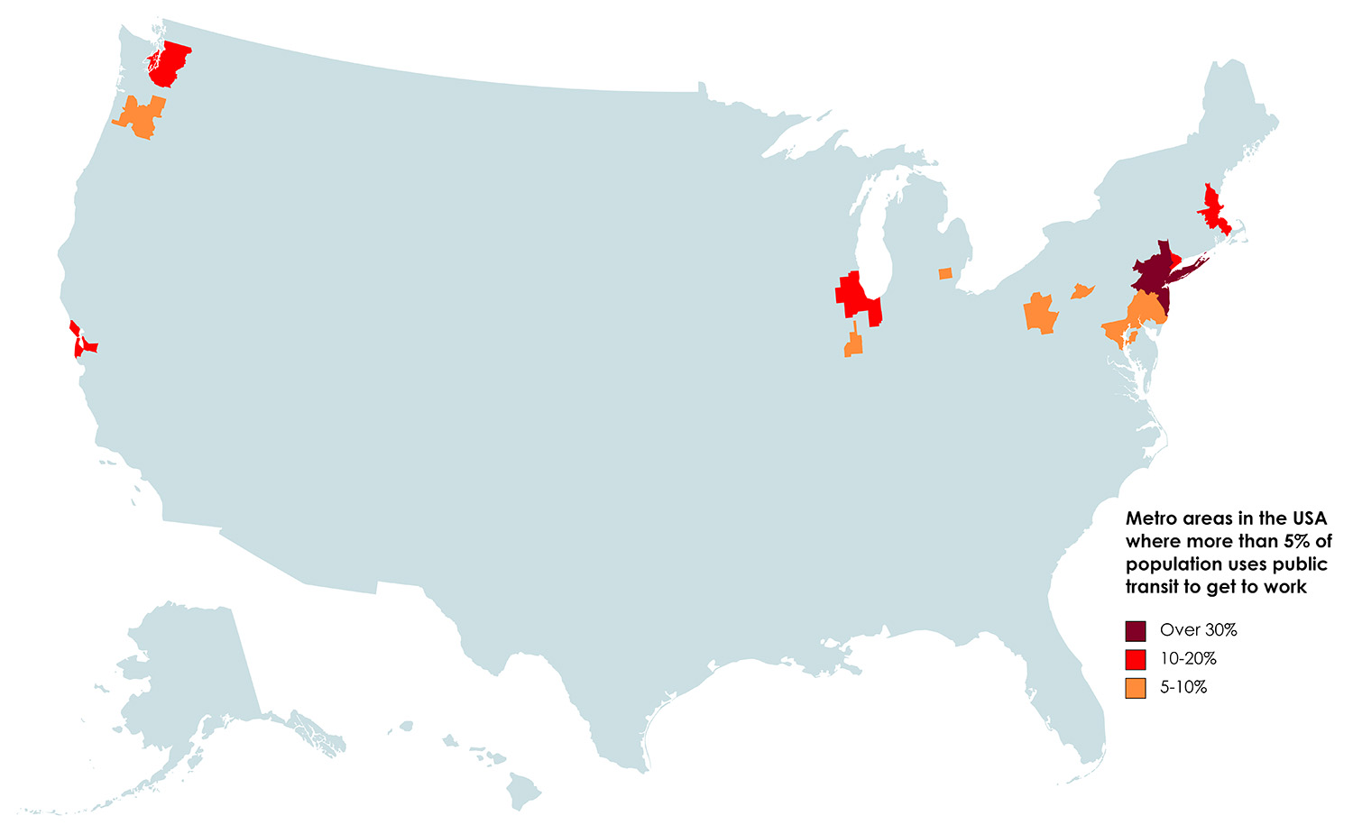
This second map shows where public transit actually matters – metros where at least 5% of folks use it to get to work.
The Cities That Actually Get It Right
New York crushes everyone else. Over 30% of workers there take the subway, buses, or commuter trains. In Manhattan? More like half.
San Francisco comes in second around 17%. BART gets you across the bay without dealing with bridge traffic. Smart.
DC hits 14%. Their Metro system spreads out into Virginia and Maryland suburbs.
Boston manages 12% on the T. From what I’ve read, it breaks down sometimes, but parking in Cambridge sounds like a nightmare.
Chicago’s at 11% with the L trains. Love how they loop around downtown. Makes way more sense than circling blocks looking for parking.
Philly rounds out the top spots at 9%. SEPTA‘s not fancy, but it works.
See what these places have in common? They built their train systems before everyone fell in love with cars. Dense neighborhoods where walking to the station actually makes sense. Most American cities went the opposite direction—built everything around highways and parking lots.
To learn more about the American transportation system, have a look at the following road atlases and map posters: