Rome reached its most significant territorial extent during the reign of Trajan (AD 117). At its climax, the Roman Empire extended from Britain in the Northwest to Egypt in the Southeast, embracing 5 million square kilometers (~1.9 sq. mi).
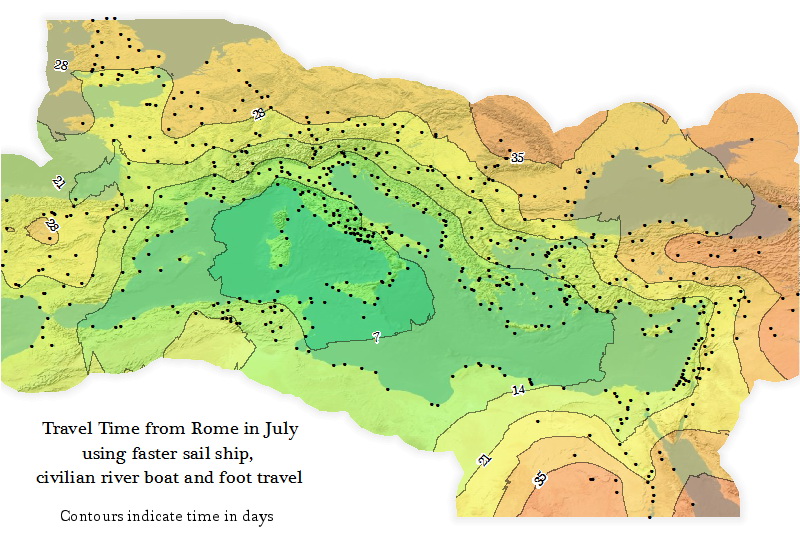
A well-developed road network was essential for the growth and maintenance of such a vast empire. The maps below illustrate the extent of road construction in this great empire.
The first major Roman road, ‘Appian Way,’ was built in 312 B.C. between republican Rome and its allies in Capua.
Appian Way
Ancient Roman roads overlaid on a modern road map of Italy
Tabula Peutingeriana: ancient road network map of the Roman Empire
Roman roads were used to move officials, civilians, armies, and trade. Ways of the Empire were of different kinds, varying from small provincial roads to broad, long-distance roadways built to unite large cities, chief towns, and military posts. These significant roads were surfaced with stone and metaled, cambered for drainage, and were flanked by walkways, bridle paths, and drainage trenches. They were set along ideally studied courses, and some were made through hills, canyons, and rivers.
At the zenith of the Roman Empire’s growth, about 29 large military roadways radiated from Rome, and 372 great roads interconnected the late Roman Empire’s 113 provinces. The whole covered more than 400 thousand km (250 thousand mi) of roads, of which above 80.5 thousand km (50 thousand mi) were stone-paved.
In Gaul only, no less than 21 thousand km (13 thousand mi) of highways have been improved, and in Britain, at least 4 thousand kilometers (2,500 mi). The system of roads in Iberia totaled some 10.5 thousand kilometers (6.5 thousand miles).