Maps of world
Map of all of the surface of Earth. Maps of continents, countries, regions, and cities.
Exploring the world of Connectography
This interactive map builds on the global infrastructure networks depicted in Parag Khanna’s 2016 book “Connectography – Mapping the Future
Read MoreThe World song map
https://www.wired.com/2016/11/every-single-name-entrancing-map-music-reference/ Via wired.com
Read More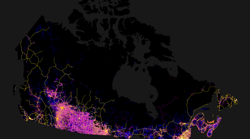
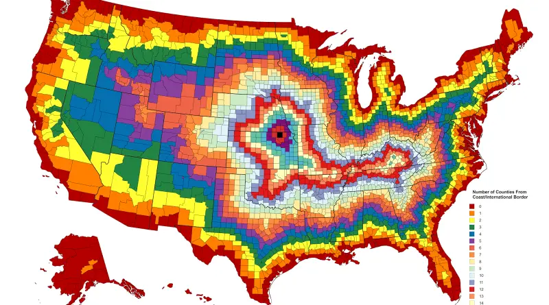
2,500 kilometer-long line that stretches halfway cross Canada without seeing virtually any signs of humanity
You could walk the entirety of this 2,500 kilometer-long line that stretches halfway cross Canada without seeing virtually any signs
Read More
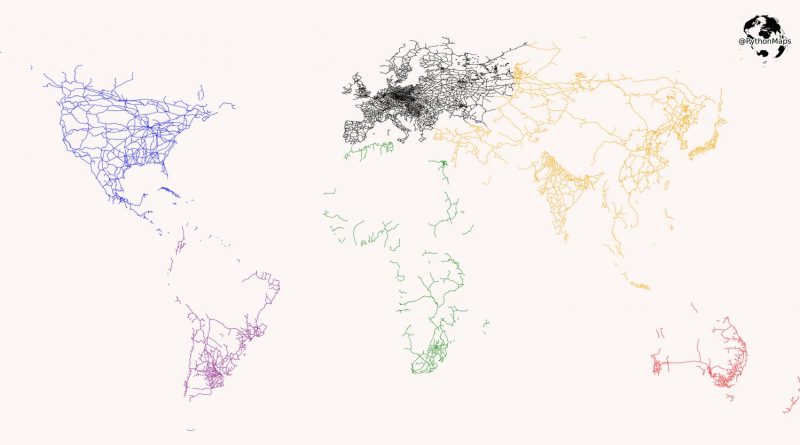
All the railroads in the world
Modern rail transport began with the British development of the steam train when Richard Trevithick ran a steam train between Penydarren Ironworks and Abercynon in 1802. Thus the railroad system in Great Britain is the oldest in the world. In the 20th century, railroad transport reached maturity. Nowadays, the United States has the world’s most extended railway network, followed by China, Russia, and India.
Read MoreTime zones in a Buckminster Fuller Dymaxion map
Dymaxion map of world time zones departs from the traditional linear, West-to-East representation to propose a view of the world
Read More