Tornadoes have always been the deadliest natural phenomena in the United States. The U.S. receives more than 1.2 thousand tornadoes yearly (4 times the amount seen in Europe). Damaging tornadoes rated EF4 or EF5 on the Enhanced Fujita Scale happen more frequently in the U.S. than in any other nation.
The Enhanced Fujita Scale ranks tornado strength from weakest – an EF0 tornado (wind speeds from 65–85 mph or 29–38 m/s [105–137 km/h])- to strongest – an EF5 tornado (wind speeds of greater than 200 mph o r89 m/s [320 km/h]) based on harm caused to property and infrastructure.
Over 80 deaths and 1,500 injuries in the U.S. are associated with tornadoes each year. In 2020, tornadoes resulted in about $2.53 billion worth of damage across the nation. The video below shows one of the most extended tracks and duration tornadoes in history formed in Arkansas and ran through 6 U.S. states on November 10, 2021, producing EF-4 damage in countless places along the way.
The map below shows the Tornado Risk Index, representing a community’s relative risk for Tornados compared to the rest of the U.S.
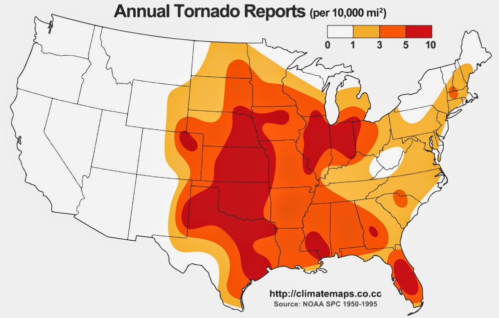
Most tornadoes in the U.S. happen east of the Rocky Mountains. The Great Plains, the Midwest, the Mississippi Valley, and the southern states are the most severely affected tornadoes. This area is also called “Tornado Alley.”
Tornado Alley
The term “Tornado Alley” was first utilized in 1952 as the study project heading to study extreme weather in Texas, Louisiana, Arkansas, Oklahoma, Kansas, South Dakota, Iowa, and Nebraska. Tornado climatologists indicate intense activity in particular areas, and storm hunters have long determined the Tornado Alley.
U.S. states of the Tornado Valey with the highest average number of tornadoes per 10,000 square miles (25,900 km square kilometers) per year:
Rank
State
Number of tornadoes per 10,000 mi2
1
Florida
12.2
2
Kansas
11.7
3
Maryland
9.9
4
Illinois
9.7
5
Mississippi
9.2
6
Iowa
9.1
7
Oklahoma
9
8
South Carolina
9
9
Alabama
8.6
10
Louisiana
8.5
11
Arkansas
7.5
12
Nebraska
7.4
13
Missouri
6.5
14
North Carolina
6.4
15
Tennessee
6.2
16
Indiana
6.1
17
Texas
5.9
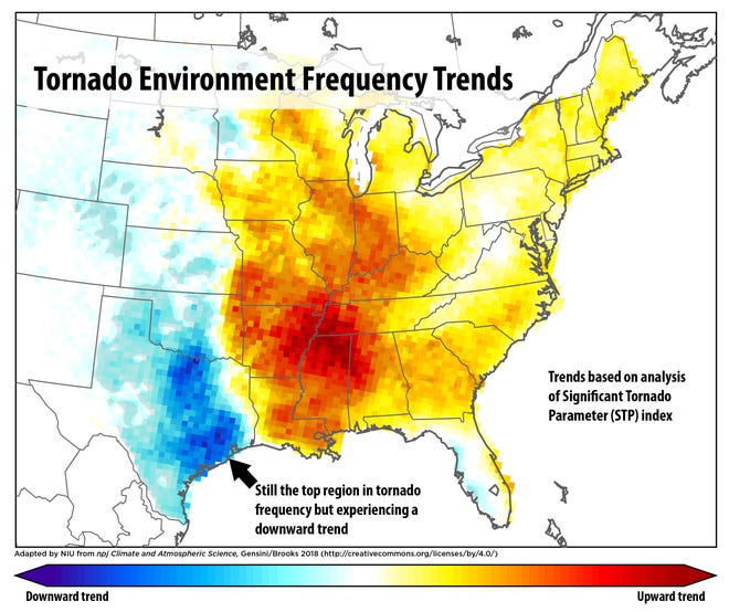
According to the publication in Nature, Tornado alley has been moving eastward over the past 40 years.
Track and Peak Intensity of U.S. Tornadoes
The map below created by Robert Rohde shows the approximate track and peak intensity of every tornado recorded in the United States from 1950 to 2017. The data is from the National Weather Service’s archive of Severe Weather Reports.
The map clearly shows the frequency of tornados varies enormously with geographic location across the United States, with the “Tornado alley” and parts of the Gulf Coast being particularly susceptible. However, tornadoes occur at least occasionally in every state shown.
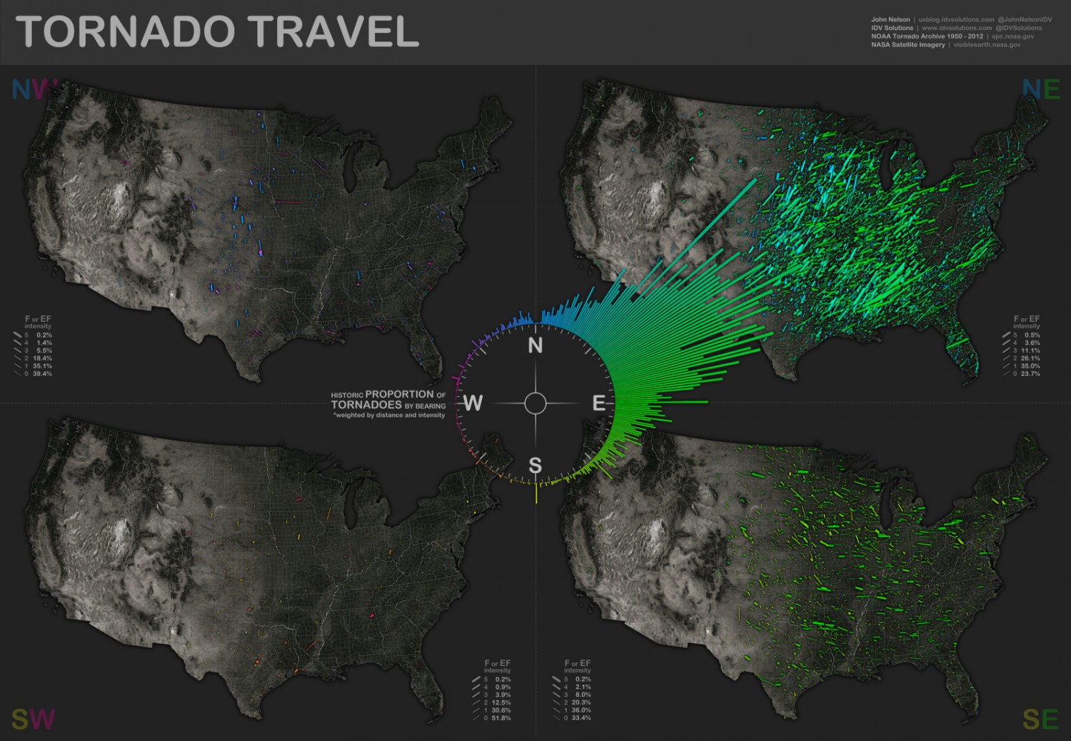
For the most part, tornados travel throughout the tornado valley in west-to-east paths or southwest-to-northeast.
The map below created by Reddit user AJgloe shows the relative frequency of tornadoes by the direction they traveled in the United States over 60 years.


 rated fast-food chains across the United States")


wow
Wow