Airports are conveniences to park and support aircraft and a control tower. An airport consists of a landing area, which contains an aerially open space including at least one operationally active surface such as a runway for a plane or a helipad, and often includes adjoining service structures. Larger airports have airport aprons, air traffic control centers, eateries, and lounges.
An airport only serving helicopters is called a heliport. An airport for use by seaplane aircraft is named a seaplane base. Such a base comprises a stretch of open water and seaplane docks.
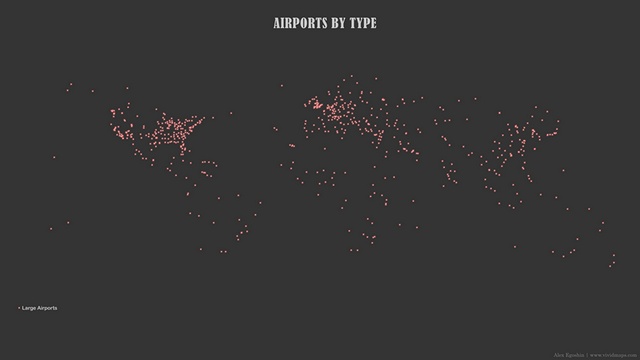
The map below shows almost 65 thousand existing airports.
Small airports account for more than half of all airports in the world (36,307). The total number of heliports in the world is 15,267. The number of medium and large airports is 4,513 and 653, respectively. In addition, there are 1,064 seaplane bases and 37 balloon ports worldwide.
College Park Airport, established in 1909 In Maryland (U.S.) by Wilbur Wright, is acknowledged as the world’s oldest continuously functioning airfield, although it operates only in general aviation traffic.
Hamburg Airport, which opened in January 1911, is the oldest commercial international airport worldwide, which is still in operation.
Atlanta International Airport was the world’s busiest airport by passenger traffic from 1998 to 2019 by serving about 110 million travelers every year, dropping its title in 2020 due to the effect of the coronavirus pandemic and being exceeded by Guangzhou Baiyun International Airport as a result.
Top 10 world’s busiest airports in 2020 by the total number of passengers
Guangzhou, China (CAN) – 43,767,558
Atlanta, United States (ATL) – 42,918,685
Chengdu, China (CTU) – 40,741,509
Dallas/Fort Worth, United States (DFW) – 39,364, 990
Shenzhen, China (SZX) – 37,916,054
Beijing, China (PEK) – 34,513,827
Denver CO, United States (DEN) – 33,741,129
Kunming, China (KMG) – 32,990,805
Shanghai, China (SHA) – 31,165,641
Xi’an, China (XIY) – 31,073,924
Airports by Altitude
For making a map of airports by altitude I used WorldClim elevation data.
The highest altitude airport is in India, at an altitude of 6.7 kilometers (4.2 miles). The highest heliport Siachen Glacier AFS is also in India, at 7.2 kilometers (4.5 miles). The airport with the lowest altitude is Bar Yehuda Airfield in Israel (-378 meters / -1240 feet).
Airports with the highest altitude
Type
Altitude, m
Name
Country
Airport Code
Heliport
6705
Siachen Glacier AFS Airport
India
IN-0001
Small Airport
5068
Daulat Beg Oldi Advanced Landing Ground
India
IN-0003
Medium Airport
4367
Daocheng Yading Airport
China
ZUDC
Large Airport
3282
Alejandro Velasco Astete International Airport
Peru
SPZO
Seaplane Base
1992
Yellowstone Seaplane Base
United States
US-1087
Balloonport
1713
Palisades Field
United States
59ID
Airports with the lowest altitude
Type
Altitude, m
Name
Country
Airport Code
Medium Airport
-378
Bar Yehuda Airfield
Israel
LLMZ
Small Airport
-66
Furnace Creek Airport
United States
KL06
Heliport
-37
Riverside County Sheriff Thermal Heliport
United States
US-1151
Seaplane Base
-19
Acushnet River Seaplane Base
United States
6MA8
Large Airport
-7
Heydar Aliyev International Airport
Azerbaijan
UBBB
Balloonport
2
Cudjoe Key South TARS Site
United States
US-2457
Airports by Average Temperature
According to Worldclim data, Jack F. Paulus Skiway airport in Antarctica is the coldest airport in the world. The average annual temperature in this airfield is -48.4°С (-55.12°F). On the other hand, Eritrean Assab International is the hottest airport globally, with an average yearly temperature of +30.9°С (+87.62°F).
Hottest airports by average annual temperature
Type
Average temperature, °С
Name
Country
Airport Code
Medium Airport
+30.9
Assab International Airport
Eritrea
HHSB
Small Airport
+30.7
Kaédi Airport
Mauritania
GQNK
Heliport
+30.6
Arafat General Hospital Heliport
Saudi Arabia
SA-0016
Large Airport
+29.7
Khartoum International Airport
Sudan
HSSS
Seaplane Base
+28.8
Niyama Private Islands Seaplane Base
Maldives
MV-0008
Balloonport
+25.0
Cudjoe Key South TARS Site
United States
US-2457
Coldest airports by average annual temperature
Type
Average temperature, °С
Name
Country
Airport Code
Medium Airport
-48.4
Jack F. Paulus Skiway
Antarctica
AQ-0005
Small Airport
-27.1
Summit Ice Landing Strip
Greenland
GL-0006
Heliport
-16.1
Station Nord Heliport
Greenland
BGNO
Seaplane Base
-13.9
Cambridge Bay Seaplane Base
Canada
CJD7
Large Airport
-5.1
Yellowknife International Airport
Canada
CYZF
Balloonport
+4.3
Palisades Field
United States
59ID
Airports by Wind Speed
Winds by themselves are seldom the cause of accidents, but the winds are one of the principal factors that affect an aircraft’s flight. The map below created using the mean wind speed data at the location for the ten years presented at the Technical University of Denmark website.
Windiest airports
Type
Wind speed, m/s
Name
Country
Airport Code
Heliport
14.68
Berthoud Pass Heliport
United States
CD37
Small Airport
11.22
Mont Llaret Pic d’Aude Airfield
France
FR-0296
Seaplane Base
9.24
Minstrel Island Seaplane Base
Canada
CAX7
Medium Airport
8.92
Matsu Nangan Airport
Taiwan
RCFG
Large Airport
6.81
Hato International Airport
Curaçao / Netherland
TNCC
Ballonport
5.30
Lydiard Park
Great Britain
GB-0682
The Most Dangerous Airports in the World
1. Tenzing-Hillary Airport (Nepal) at an altitude of almost 2,900 meters (9,500 ft), with the changeable Himalayan weather.
2. Princess Juliana International Airport (Sint Maarten) has just over 2,286 meters (7,500 ft) in length, which puts it right on the limit for larger jets coming.
3. Cristiano Ronaldo Madeira International Airport (Portugal) faces severe crosswinds due to its position in the Atlantic Ocean.
4. Ronald Reagan Washington National Airport (Washington DC) needs pilots to make a twisting visual way to bypass high-profile buildings, including The White House and The Pentagon.
5. Paro Airport (Bhutan) with an airstrip squeezed between the peaks of the Himalayas.


great info, thanks for sharing!