The 100th Meridian has shifted 140 miles east since 1980
In the context of the United States, the 100th meridian west holds particular significance due to its role in shaping settlement patterns, agriculture, and water management in the western part of the country.
John Wesley Powell, a geologist, explorer, and former Civil War officer, conducted pioneering studies of the American West. In the late 19th century, he proposed a classification system that divided the United States into distinct hydrological regions, known as “physiographic provinces.” He used the 100th meridian as a dividing line between the “humid” East and the “arid” West.
The concept of the 100th meridian as a boundary influenced westward settlement during the 19th century. As pioneers and settlers moved west, they encountered the challenges posed by the transition to drier conditions. The availability of water for irrigation became a crucial factor in determining the feasibility of agriculture beyond this point.
While the 100th meridian still serves as a useful reference point, changing climate patterns and shifts in precipitation have caused some areas to experience variations in their historical aridity. Increasing temperatures and shifts in weather patterns can influence water availability, affecting both agriculture and urban areas.
According to the online magazine Yale Environment 360, the North American climate boundary that visibly separates the humid eastern part of the American continent from the more arid western plains has shifted 140 miles east since 1980.

I created the animated map that shows how the 100th meridian will shift in 2050 and 2070, using the Köppen-Geiger climate classification.
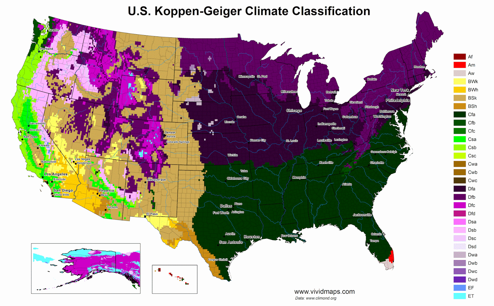
To learn more about the climate and geography of the United States have a look at the following maps:


")


Most climate models have been proven flawed and inaccurate. Climate models of the early 1970’s said we’d be in a mini ice age by now.
Most… so this means there is at least a climate model you would find suitable? If so, which would you recommend as being most accurate?
Total BS i live in south TX, goliad county, humid as hell all year 80-90% the dry line is not there at all. Maybe west of San Antonio but for sure not the south texas coast