Between 1846 and 1854, treaty negotiations changed everything for millions of families. The Treaty of Guadalupe Hidalgo and the Gadsden Purchase a few years later completely recast where the U.S. ended and Mexico began.
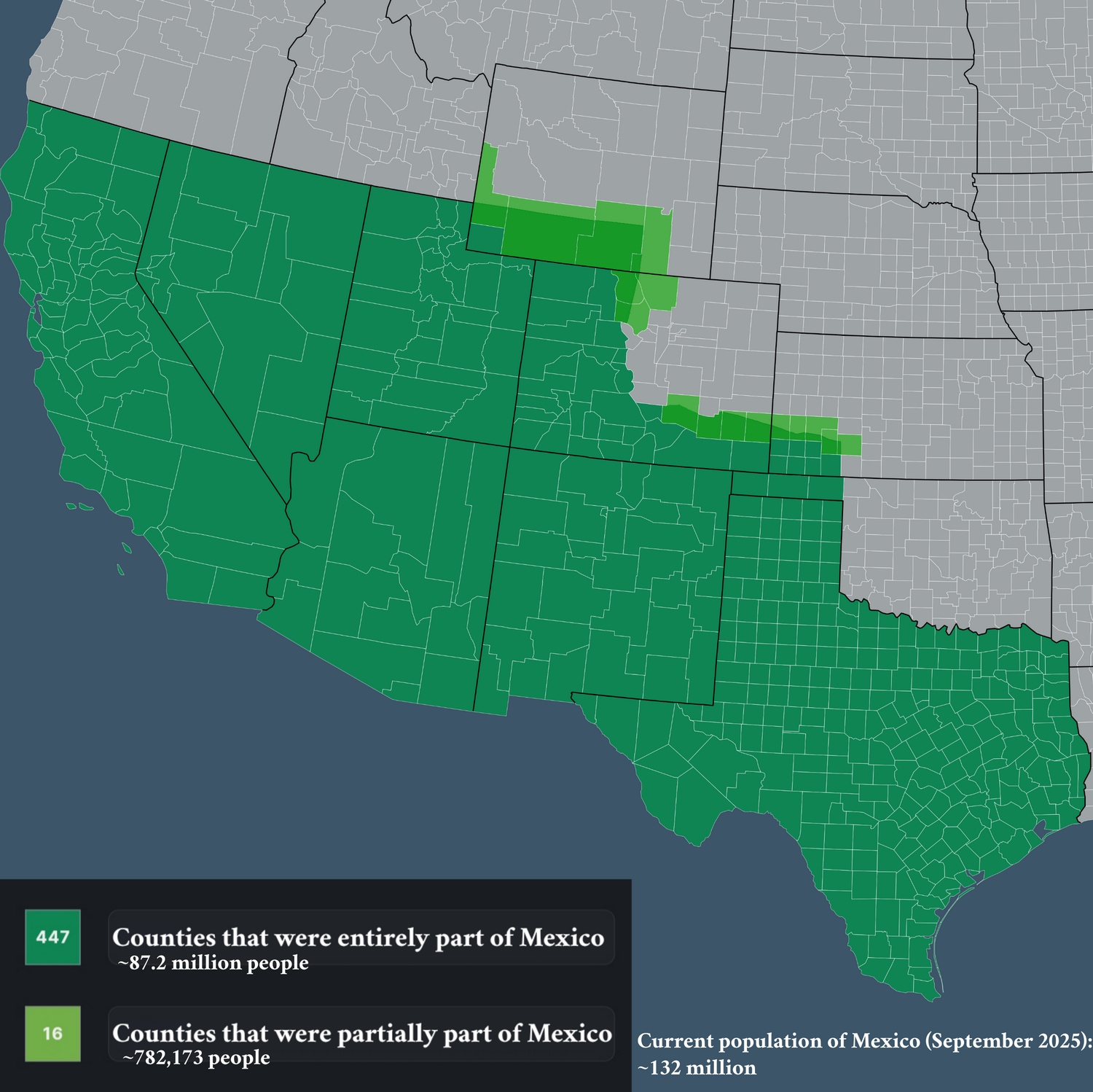
The map below, created by Reddit user Objective-Low7790, shows which U.S. counties used to be part of Mexico. You’d expect to see California, Texas, Arizona—but Colorado? Half the state was Mexican. Even pieces of Wyoming and Kansas were south of the border back then.
According to the map, 447 counties were completely Mexican territory (they’re home to about 87.2 million people today), plus 16 more counties that were partially Mexican (another 782,173 people).
You can still see those old boundaries in census data.
State
% Hispanic or Latino (2023)
% Spanish at home (2023)
New Mexico
48.6%
24.5%
California
40.4%
28.2%
Texas
39.8%
28.1%
Arizona
31.6%
19.2%
Nevada
29.9%
19.9%
Colorado
22.7%
11.0%
Utah
16.9%
10.7%
Kansas
13.7%
8.0%
Oklahoma
13.5%
7.9%
Wyoming
11.1%
4.7%
What if these lands had remained part of Mexico? Mexico has about 132 million people now (mid-2025 estimates). Add the 87+ million from these former Mexican counties and you get around 220 million—that’s before accounting for all the demographic shifts and migrations that would have unfolded differently. That would make this alternate Mexico one of the world’s most populous nations.