Old crow landscape hazard risk map of Yukon Communities
This map was produced for the purposes of landscape hazard assessment and climate change adaptation planning for the community of
Read More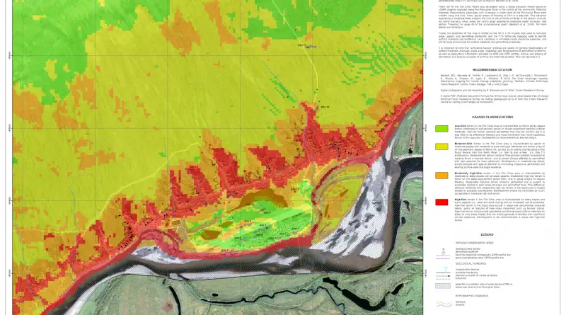
This map was produced for the purposes of landscape hazard assessment and climate change adaptation planning for the community of
Read MoreVia sciencenews.org Relates posts: – The Zika virus – Zika virus threatens US from abroad
Read MoreBorders are scaled to show a ratio of dissimilarity. The line thickness is a ratio calculated between adjacent countries. Countries
Read MoreTyphoons are amongst the most destructive natural hazards on our planet, with the most intense typhoons found over the northwestern
Read More