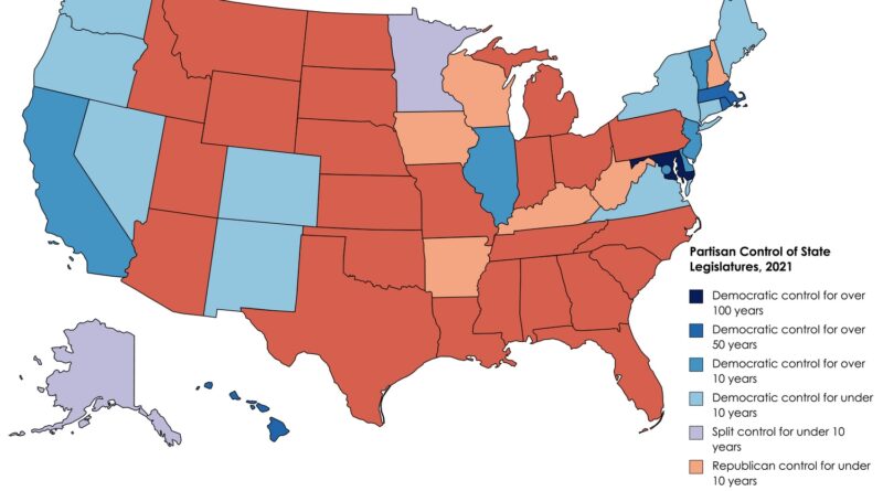
Political maps

Political Maps show governmental and administrative borders of countries, provinces, states, and counties, the location of major cities, and other political units.

Political maps

U.S. Presidential election 2016: dasymetric dot density

Most election maps mislead by shading entire counties red or blue, but what if we mapped every single vote exactly where people live? This dasymetric dot density map does just that—placing 130+ million dots based on urban, suburban, and rural population densities. The result? A clearer, more accurate picture of the 2016 election. See the real voting patterns emerge! 🔴🔵 Explore the map now.

Read More
Political maps

The Meaning Behind National Anthems

National anthems are more than just songs—they reflect a nation’s history, struggles, and values. A world map color-codes them by subject, while a European map examines their first words. But which country had the first anthem? Which anthem is the oldest? And how often do nations change their national songs? Let’s dive into the fascinating world of anthems.

Read More