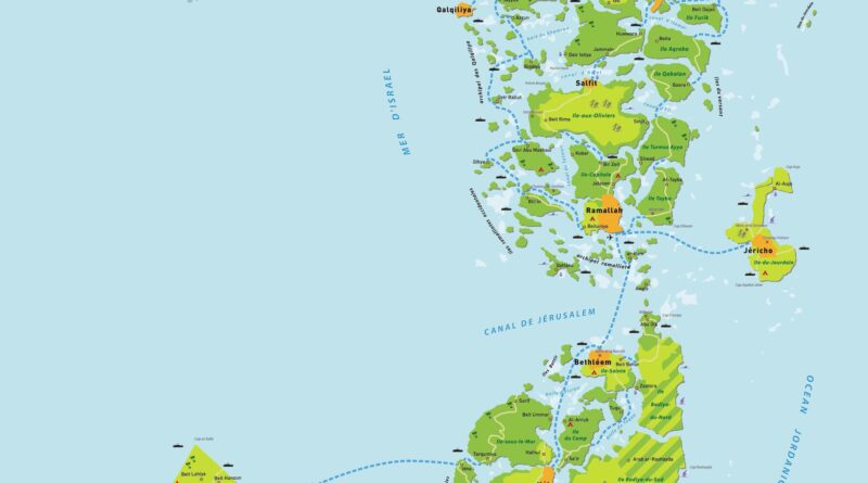
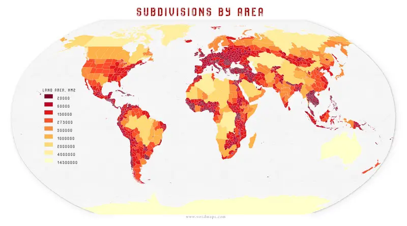
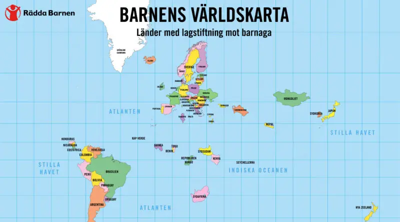
Political maps

Political Maps show governmental and administrative borders of countries, provinces, states, and counties, the location of major cities, and other political units.

Political maps

Palestine Archipelago

The State of Palestine, with a population slightly large of 5 million, theoretically includes the West Bank (a territory that sits between modern-day Israel and Jordan) and the Gaza Strip (which borders modern-day Israel and Egypt). Palestine has been acknowledged by 138 of the 193 United Nations members.

Read More
Political maps

15 maps that explain China

China is the world’s most populous nation and the world’s 4th-largest country in the world. The nation has the world’s largest army and the 2nd-largest military budget. In 2010 China’s economy became the the 2nd-wealthiest nation worldwide by nominal GDP and developed to the largest by purchasing power parity in 2014. Today the nation has been described as a potential superpower.

Read More
Political maps

Largest Subdivisions Mapped

A first-level subdivision or subnational entity is an officially outlined geographical division within a sovereign country. Such a division is designed to improve the responsiveness of a national government to sub-national activities. As such, a division is given some degree of administrative independence, which is considered as a form of limited self-government in some nations.

Read More
NewsPolitical mapsVivid maps

2020 U.S. Election Mapped: TrumpLand vs Biden Archipelago – A Tale of Two Americas

The 2020 U.S. presidential election revealed stark contrasts in how Americans vote based on where they live. These original maps show Biden’s urban archipelagos – centers of economic power generating 70% of U.S. GDP – scattered across Trump’s expansive heartland. From county-level analysis to population-weighted visualizations, these maps tell the story of two Americas: one concentrated in high-density cities, another spread across the rural landscape. Building on my viral 2016 electoral maps, this new series offers fresh insights into our nation’s deepening political geography.

Read More