End of the recognition of the Republic of China
There has been countries that restablished recognition of the Republic of China and ended it later. In this map, the
Read MorePolitical Maps show governmental and administrative borders of countries, provinces, states, and counties, the location of major cities, and other political units.
There has been countries that restablished recognition of the Republic of China and ended it later. In this map, the
Read MoreA Washington Post-SurveyMonkey poll of all 50 states indicates the 2016 campaign could flip several red and blue states from
Read MoreTerritorial disputes in the South China Sea present an array of potential flashpoints between countries with overlapping claims. In recent
Read MoreVia www.nittygrittyguide.com/eu-referendum-nitty-gritty-fact-guide
Read More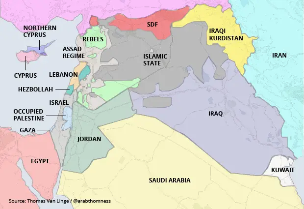
– The Syrian central government (in light grey), based in Damascus, controls a coastal strip of territory in a patchwork
Read More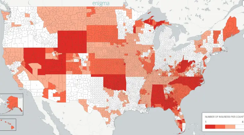
The average United States county would have access to 3.3 insurers in 2017, 18% less than the 4.0 average in
Read More
Netafilter has been built on top of MyNeta’s database which contains data of the educational qualifications, net assests owned and
Read More
Related posts: – World’s major cultural spheres – Live cultural map over time 1981 to 2015
Read MoreRelated post: – Number of presidents born in each US State
Read More